File:Rombergpark-100330-11330-Quelle.jpg
Jump to navigation
Jump to search
Size of this preview: 800 × 536 pixels. Other resolutions: 320 × 214 pixels | 640 × 428 pixels | 1,024 × 685 pixels | 1,280 × 857 pixels | 2,560 × 1,714 pixels | 3,872 × 2,592 pixels.
Original file (3,872 × 2,592 pixels, file size: 8.23 MB, MIME type: image/jpeg)
Captions
Captions
Add a one-line explanation of what this file represents
| Description |
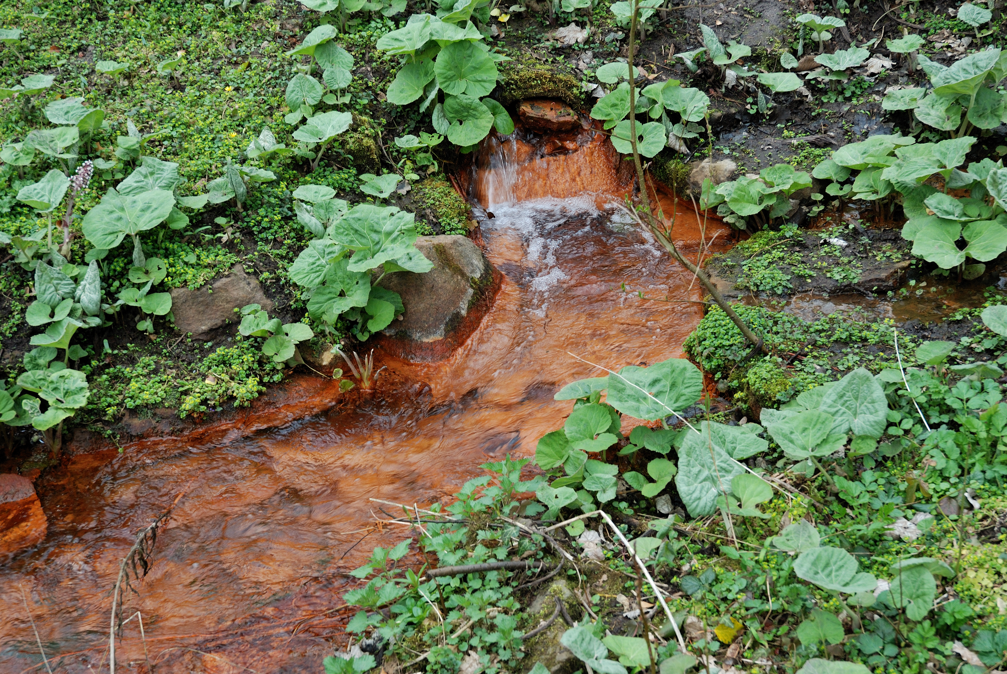
Deutsch: Bachlauf mit Gewöhnlicher Pestwurz (Petasites hybridus) westlich des Hauptweges, Quelle. Im Rombergpark fördern mehrere Quellen Eisenocker, der aus dem Eisenstein zwischen den Kohleflözen gelöst wird. Das Wasser am östlichen Berghang hat eine Temperatur von 9° und stammt daher aus geringer Tiefe, die Quellen westlich des Hauptweges (wie diese) führen Grubenwasser der ehemaligen Zeche Glückaufsegen und sind das ganze Jahr 13-15° warm und stammen daher aus größerer Tiefe. |
| Date | |
| Source | Own work |
| Author | Mbdortmund |
| Camera location | | View this and other nearby images on: OpenStreetMap |
|---|

|
Permission is granted to copy, distribute and/or modify this document under the terms of the GNU Free Documentation License, Version 1.2 only as published by the Free Software Foundation; with no Invariant Sections, no Front-Cover Texts, and no Back-Cover Texts. A copy of the license is included in the section entitled GNU Free Documentation License. | 1.2 only |
File history
Click on a date/time to view the file as it appeared at that time.
| Date/Time | Thumbnail | Dimensions | User | Comment | |
|---|---|---|---|---|---|
| current | 22:46, 30 March 2010 | | 3,872 × 2,592 (8.23 MB) | Mbdortmund (talk | contribs) | {{Information |Description={{de|Bachlauf westlich des Hauptweges, Quelle}} |Source={{own}} |Date=2010-03 |Author= Mbdortmund |Permission= |other_versions= }} {{location|51|28|42.35|N|7|27|54.83|E|region:DE}} {{GFDL 1.2}} [[Category |
You cannot overwrite this file.
File usage on Commons
There are no pages that use this file.