File:Romania Vaslui Location maps.GIF
Jump to navigation
Jump to search
No higher resolution available.
Romania_Vaslui_Location_maps.GIF (400 × 527 pixels, file size: 463 KB, MIME type: image/gif, looped, 3 frames, 12 s)
Captions
Captions
Add a one-line explanation of what this file represents
Summary
[edit]
| Description |
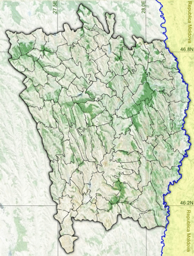
Română: Romania UAT Vaslui Location |
| Date | |
| Source |
|
| Author | Asybaris01 |
Licensing
[edit]
| This image is in the public domain because it is a screenshot from NASA’s globe software World Wind using a public domain layer, such as Blue Marble, MODIS, Landsat, SRTM, USGS or GLOBE.
|
 |
File history
Click on a date/time to view the file as it appeared at that time.
| Date/Time | Thumbnail | Dimensions | User | Comment | |
|---|---|---|---|---|---|
| current | 18:57, 15 February 2015 | | 400 × 527 (463 KB) | Asybaris01 (talk | contribs) | User created page with UploadWizard |
You cannot overwrite this file.
File usage on Commons
There are no pages that use this file.
File usage on other wikis
The following other wikis use this file:
- Usage on ro.wikipedia.org
- Vaslui
- Bârlad
- Huși
- Negrești
- Albița, Vaslui
- Armășeni (Băcești), Vaslui
- Averești, Vaslui
- Bahnari, Vaslui
- Banca, Vaslui
- Băbușa, Vaslui
- Băile Drânceni, Vaslui
- Bogdănești, Vaslui
- Borodești, Vaslui
- Brodoc, Vaslui
- Căzănești, Vaslui
- Cârja, Vaslui
- Cârțibași, Vaslui
- Cepești, Vaslui
- Chilieni, Vaslui
- Cioatele, Vaslui
- Coroiești (Bogdănița), Vaslui
- Coroieștii de Sus, Vaslui
- Cujba, Vaslui
- Dodești, Vaslui
- Dumasca, Vaslui
- Epureni (Duda-Epureni), Vaslui
- Fălciu, Vaslui
- Floreni, Vaslui
- Focșeasca, Vaslui
- Fundătura (Arsura), Vaslui
- Gârceni, Vaslui
- Ghergheleu, Vaslui
- Ghermănești (Drânceni), Vaslui
- Glodeni, Vaslui
- Hreasca, Vaslui
- Hurdugi, Vaslui
- Igești, Vaslui
- Lățești, Vaslui
- Lipovăț, Vaslui
- Mihail Kogălniceanu, Vaslui
- Mircești, Vaslui
- Mireni, Vaslui
- Moara Grecilor, Vaslui
- Movileni, Vaslui
- Murgeni
- Parpanița, Vaslui
- Păcurărești, Vaslui
- Păltiniș, Vaslui
- Pâhnești, Vaslui
- Poiana, Vaslui
View more global usage of this file.