File:Roineval (Ròineabhal) - geograph.org.uk - 3265760.jpg
Jump to navigation
Jump to search

Size of this preview: 800 × 600 pixels. Other resolutions: 320 × 240 pixels | 640 × 480 pixels | 1,024 × 768 pixels | 1,280 × 960 pixels | 1,600 × 1,200 pixels.
Original file (1,600 × 1,200 pixels, file size: 1.28 MB, MIME type: image/jpeg)
Captions
Captions
Add a one-line explanation of what this file represents
Summary
[edit]_-_geograph.org.uk_-_3265760.jpg&action=edit§ion=1)
| Description |
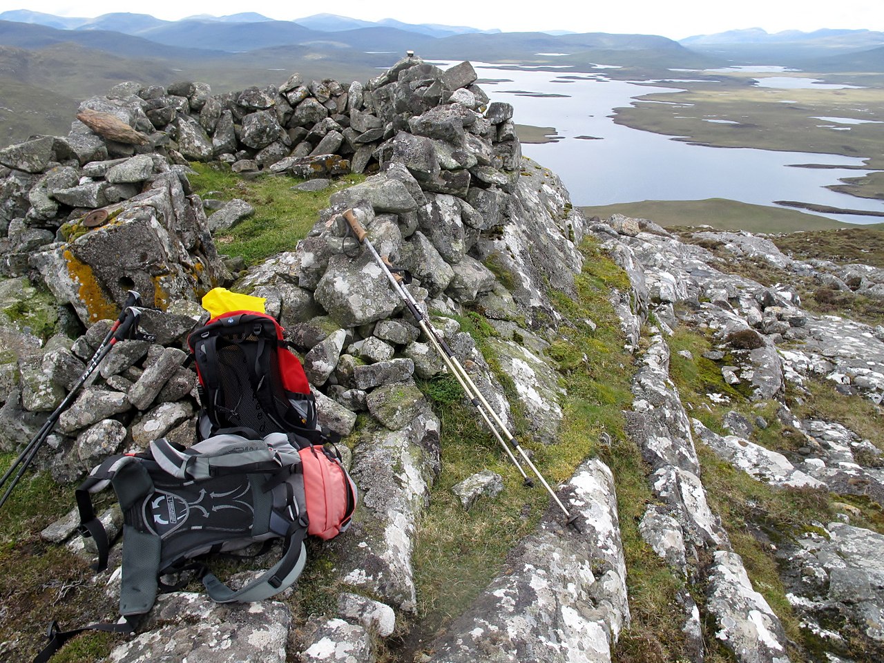
English: Roineval [Ròineabhal]
Via A859 and Slèiteachal Mhòr with Jonathan de Ferranti, Jim Bloomer and Mat Webster. A conspicuous and locally steep summit plus no paths at all. Summit shelter contains remains of trig point. Name: Roineval [Ròineabhal] Hill number: 1576 Height: 281m / 922ft Area: 24A: Lewis and Nearby Islands Class: Ma Grid ref: NB 23300 21211 Summit feature: shelter on rock Drop: 203m Col: 78m NB230200 |
| Date | |
| Source | From geograph.org.uk |
| Author | Rude Health |
| Permission (Reusing this file) |
Creative Commons Attribution Share-alike license 2.0 |
| Attribution (required by the license) | Rude Health / Roineval [Ròineabhal] / |
| Camera location | | View this and other nearby images on: OpenStreetMap |
|---|
_-_geograph.org.uk_-_3265760.jpg¶ms=058.095100_N_-006.697827_E_globe:Earth_type:camera_source:geograph-osgb36(NB23282143)_heading:247.00&language=en)
| Object location | | View this and other nearby images on: OpenStreetMap |
|---|
_-_geograph.org.uk_-_3265760.jpg¶ms=058.095090_N_-006.698170_E_globe:Earth_class:object_type:object_source:geograph-osgb36(NB23262143)_heading:247.00&language=en)
Licensing
[edit]_-_geograph.org.uk_-_3265760.jpg&action=edit§ion=2)

|
This image was taken from the Geograph project collection. See this photograph's page on the Geograph website for the photographer's contact details. The copyright on this image is owned by Rude Health and is licensed for reuse under the Creative Commons Attribution-ShareAlike 2.0 license.
|
This file is licensed under the Creative Commons Attribution-Share Alike 2.0 Generic license.
Attribution: Rude Health
- You are free:
- to share – to copy, distribute and transmit the work
- to remix – to adapt the work
- Under the following conditions:
- attribution – You must give appropriate credit, provide a link to the license, and indicate if changes were made. You may do so in any reasonable manner, but not in any way that suggests the licensor endorses you or your use.
- share alike – If you remix, transform, or build upon the material, you must distribute your contributions under the same or compatible license as the original.
File history
Click on a date/time to view the file as it appeared at that time.
| Date/Time | Thumbnail | Dimensions | User | Comment | |
|---|---|---|---|---|---|
| current | 16:01, 1 July 2019 | | 1,600 × 1,200 (1.28 MB) | Salen9 (talk | contribs) | == {{int:filedesc}} == {{Information |Description={{en|1=Roineval [Ròineabhal] Via A859 and Slèiteachal Mhòr with Jonathan de Ferranti, Jim Bloomer and Mat Webster. A conspicuous and locally steep summit plus no paths at all. Summit shelter contains remains of trig point. Name: Roineval [Ròineabhal] Hill number: 1576 Height: 281m / 922ft Area: 24A: Lewis and Nearby Islands Class: Ma Grid ref: NB 23300 21211 Summit feature: shelter on rock Drop: 203m Col: 78m NB230200}} |Source=From... |
You cannot overwrite this file.
File usage on Commons
There are no pages that use this file.
_-_geograph.org.uk_-_3265760.jpg&oldid=934694953)