File:Rockfish Gap Viewpoint, Interstate 64, Virginia (2854228002).jpg
Original file (1,280 × 960 pixels, file size: 92 KB, MIME type: image/jpeg)
Captions
Captions
Summary
[edit].jpg&action=edit§ion=1)
| Description |
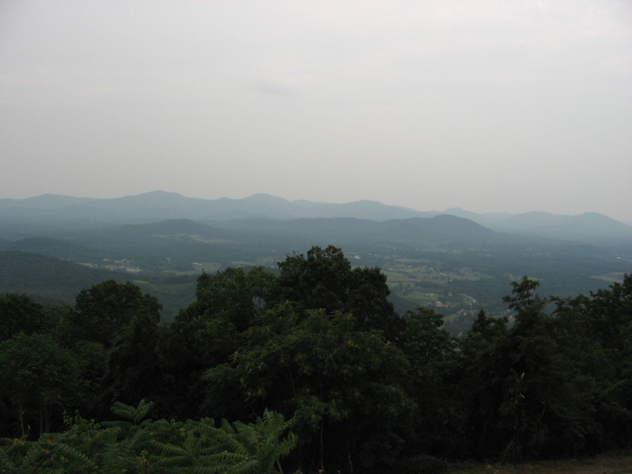
Rockfish Gap is a wind gap located in the Blue Ridge Mountains between Charlottesville and Waynesboro, Virginia, United States, through Afton Mountain, which is frequently used to refer to the gap. Joining the Shenandoah Valley to the Piedmont region of the state, it is the site of the mountain crossing of Interstate 64, U.S. Highway 250, and the former Blue Ridge Railroad which later became part of the Chesapeake and Ohio Railway and is currently part of the CSX line. With an elevation of about 1,900 feet (580 m), it is one of the lowest gaps between Manassas Gap and the James River. Rockfish Gap lies along a drainage divide between southeast-flowing streams that drain to the James River and northwest-flowing streams in the Shenandoah River system. The scenic Skyline Drive, which runs north through Shenandoah National Park to Front Royal, and the Blue Ridge Parkway, which runs south to a point near Cherokee, North Carolina, each generally following the mountain ridgetops, meet a short distance north of Rockfish Gap (such that the roadway on the bridge over the gap is actually part of the Blue Ridge Parkway). The Appalachian Trail also passes through the gap. In the 18th century, early trails used by Native Americans were gradually expanded to accommodate the westward expansion of Virginia colonists. The Three Chopt or Three Notch'd Road had been established in the Colony of Virginia between Richmond and the Shenandoah Valley by the 1740s. Most likely, the road followed an ancient Monacan trail from the village of Orapax (east of Richmond) to the western Shenandoah Valley. This well-planned route required only one major river crossing, the Rivanna at Charlottesville, with inns or taverns spaced about 10 miles apart. By 1782, carriages could cross the Blue Ridge at Rockfish Gap. In 1818, President of the United States James Monroe, former presidents Thomas Jefferson and James Madison, and Chief Justice of the United States Supreme Court John Marshall joined 24 other dignitaries at a meeting held in the Mountain Top Tavern at Rockfish Gap. Under Jefferson's leadership, they selected nearby Charlottesville as the site of the new University of Virginia. en.wikipedia.org/wiki/Rockfish_Gap en.wikipedia.org/wiki/Wikipedia:Text_of_Creative_Commons_... |
| Date | |
| Source | Rockfish Gap Viewpoint, Interstate 64, Virginia |
| Author | Ken Lund from Reno, Nevada, USA |
| Camera location | | View this and other nearby images on: OpenStreetMap |
|---|
.jpg¶ms=038.044407_N_-078.792561_E_globe:Earth_type:camera_source:Flickr_&language=en)
Licensing
[edit].jpg&action=edit§ion=2)
- You are free:
- to share – to copy, distribute and transmit the work
- to remix – to adapt the work
- Under the following conditions:
- attribution – You must give appropriate credit, provide a link to the license, and indicate if changes were made. You may do so in any reasonable manner, but not in any way that suggests the licensor endorses you or your use.
- share alike – If you remix, transform, or build upon the material, you must distribute your contributions under the same or compatible license as the original.
| This image was originally posted to Flickr by Ken Lund at https://flickr.com/photos/75683070@N00/2854228002. It was reviewed on 3 November 2016 by FlickreviewR and was confirmed to be licensed under the terms of the cc-by-sa-2.0. |
File history
Click on a date/time to view the file as it appeared at that time.
| Date/Time | Thumbnail | Dimensions | User | Comment | |
|---|---|---|---|---|---|
| current | 16:44, 3 November 2016 | | 1,280 × 960 (92 KB) | Ser Amantio di Nicolao (talk | contribs) | Transferred from Flickr via Flickr2Commons |
You cannot overwrite this file.
File usage on Commons
There are no pages that use this file.
.jpg&oldid=892616316)