File:Road into Llanymawddwy - geograph.org.uk - 507603.jpg
Jump to navigation
Jump to search
No higher resolution available.
Road_into_Llanymawddwy_-_geograph.org.uk_-_507603.jpg (640 × 480 pixels, file size: 154 KB, MIME type: image/jpeg)
Captions
Captions
Add a one-line explanation of what this file represents
Summary
[edit]
| Description |
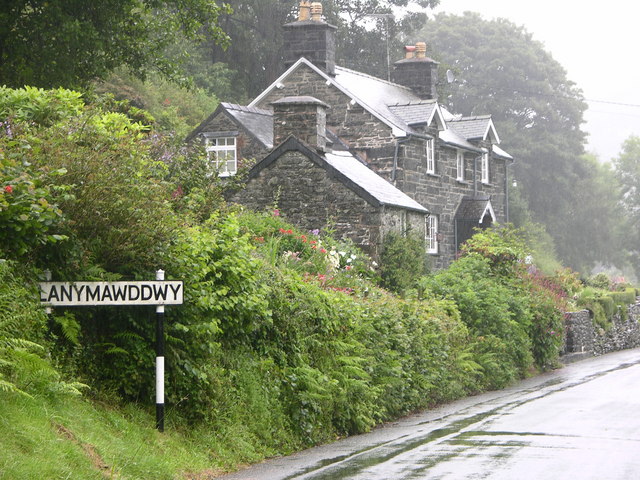
English: Road into Llanymawddwy This was a drovers' road used for driving cattle and other stock to markets in England.
This was the way to Bwlch-y-Groes and the road to Bala. It was a very spiritual place because drovers and pilgrims needed somewhere to pray before tackling the pass. They also needed somewhere to rest and at one time there were 7 public houses in the village with names linked to droving. |
| Date | |
| Source | From geograph.org.uk |
| Author | liz dawson |
| Attribution (required by the license) | liz dawson / Road into Llanymawddwy / |
| Camera location | | View this and other nearby images on: OpenStreetMap |
|---|
_heading:45.00&language=en)
| Object location | | View this and other nearby images on: OpenStreetMap |
|---|
_heading:45.00&language=en)
Licensing
[edit]

|
This image was taken from the Geograph project collection. See this photograph's page on the Geograph website for the photographer's contact details. The copyright on this image is owned by liz dawson and is licensed for reuse under the Creative Commons Attribution-ShareAlike 2.0 license.
|
This file is licensed under the Creative Commons Attribution-Share Alike 2.0 Generic license.
Attribution: liz dawson
- You are free:
- to share – to copy, distribute and transmit the work
- to remix – to adapt the work
- Under the following conditions:
- attribution – You must give appropriate credit, provide a link to the license, and indicate if changes were made. You may do so in any reasonable manner, but not in any way that suggests the licensor endorses you or your use.
- share alike – If you remix, transform, or build upon the material, you must distribute your contributions under the same or compatible license as the original.
File history
Click on a date/time to view the file as it appeared at that time.
| Date/Time | Thumbnail | Dimensions | User | Comment | |
|---|---|---|---|---|---|
| current | 09:55, 5 February 2011 | | 640 × 480 (154 KB) | GeographBot (talk | contribs) | == {{int:filedesc}} == {{Information |description={{en|1=Road into Llanymawddwy This was a drovers' road used for driving cattle and other stock to markets in England. This was the way to Bwlch-y-Groes and the road to Bala. It was a very spiritual place |
You cannot overwrite this file.
File usage on Commons
There are no pages that use this file.