File:Road Map Upper Peninsula Michigan 1919.jpg
Jump to navigation
Jump to search
Size of this preview: 800 × 460 pixels. Other resolutions: 320 × 184 pixels | 640 × 368 pixels | 1,024 × 589 pixels | 1,280 × 736 pixels | 2,560 × 1,473 pixels | 4,713 × 2,711 pixels.
Original file (4,713 × 2,711 pixels, file size: 3.15 MB, MIME type: image/jpeg)
Captions
Captions
Add a one-line explanation of what this file represents
Summary
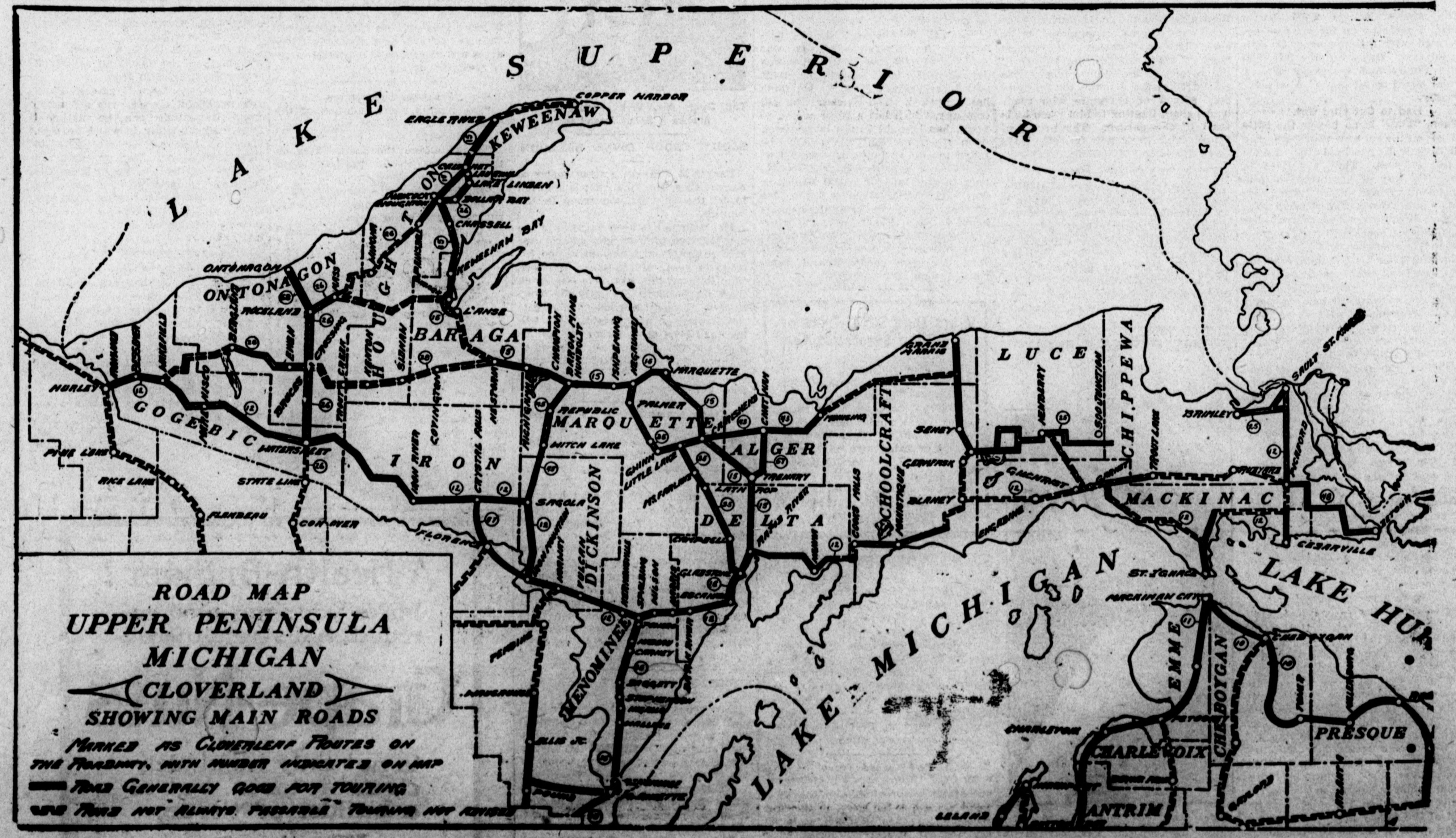
[edit]| Description | Road_Map_Upper_Peninsula_Michigan_1919 | ||||||
| Date | |||||||
| Source | The L'Anse sentinel., August 08, 1919, Image 1 | ||||||
| Author | The L'Anse sentinel | ||||||
| Permission (Reusing this file) |
|


File history
Click on a date/time to view the file as it appeared at that time.
| Date/Time | Thumbnail | Dimensions | User | Comment | |
|---|---|---|---|---|---|
| current | 23:28, 8 August 2019 | | 4,713 × 2,711 (3.15 MB) | Thats Just Great (talk | contribs) | {{Information |description=Road_Map_Upper_Peninsula_Michigan_1919 |date= August 08, 1919 |source=[https://chroniclingamerica.loc.gov/lccn/sn96077142/1919-08-08/ed-1/seq-1/#date1=08%2F08%2F1919&index=17&rows=20&sequence=1&date2=08%2F08%2F1919&words=&dateFilterType=range&page=8 The L'Anse sentinel., August 08, 1919, Image 1] |author=The L'Anse sentinel |permission={{PD-US}} |other versions= }} Category:Road maps of Michigan Category:1919 maps of Michigan |
You cannot overwrite this file.
File usage on Commons
The following 3 pages use this file: