File:River is dying.jpg
Jump to navigation
Jump to search

Size of this preview: 800 × 599 pixels. Other resolutions: 320 × 240 pixels | 640 × 479 pixels | 1,024 × 767 pixels | 1,280 × 958 pixels | 2,560 × 1,917 pixels | 4,808 × 3,600 pixels.
Original file (4,808 × 3,600 pixels, file size: 21.66 MB, MIME type: image/jpeg)
Captions
Captions
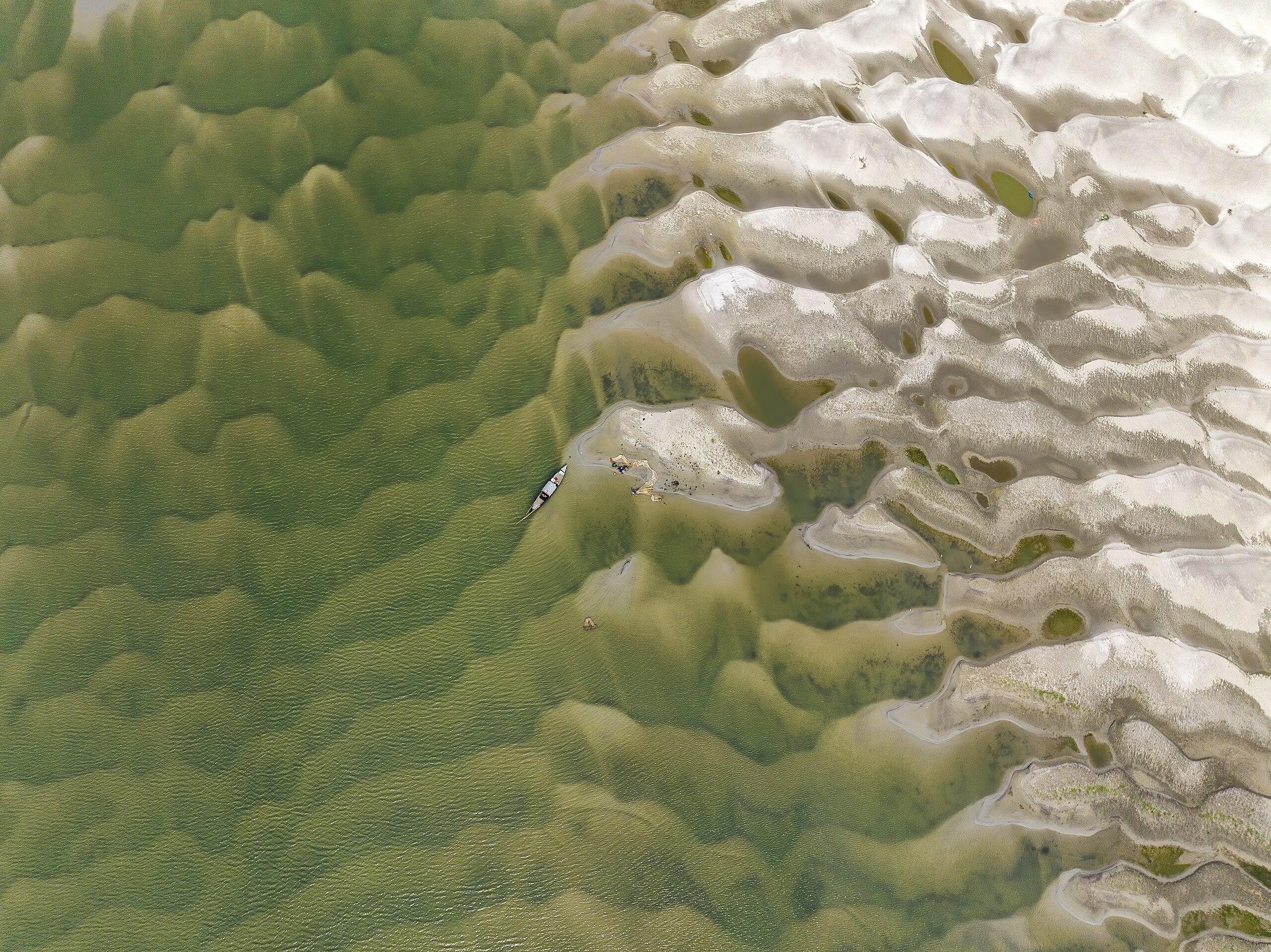
A fishermen team was catching fish using big net in the char area of River Padma in the district of Rajshahi, Bangladesh. But as the river drying up they barely abled to catch adequate fish for last few years.
Summary
[edit]
| Description |
English: Climate Change, Deforestation, Upstream Dams and Diversion, Urbanization, Population Pressure are the most acute reason behind the dying situation of a mighty river like Padma. Changes in weather patterns and shifting precipitation regimes have led to reduced rainfall and altered river flow. These changes disrupt the natural balance of water in the river. Unregulated deforestation along the river basin has resulted in soil erosion, siltation, and reduced groundwater recharge. This, in turn, impacts the river's ability to maintain a healthy water flow. Construction of dams and diversion of water for various purposes upstream significantly reduces the water reaching downstream areas, including the Padma River.
The gradual drying of the Padma River carries several grave consequences like Ecological Impact, Environmental Degradation, Agricultural Disruption, Water Scarcity, Economic Fallout and many others. Reduced water flow disrupts the river's ecosystems, affecting aquatic life, wetlands, and biodiversity. Farmers who rely on the river for irrigation face challenges, leading to decreased agricultural productivity. As the river's water levels drop, it directly impacts the availability of drinking water for communities living along its banks. The drying of the river can lead to increased pollution, sedimentation, and loss of natural habitats. |
| Date | |
| Source | Own work |
| Author | Asker Ibne Firoz |
| Camera location | | View this and other nearby images on: OpenStreetMap |
|---|
Licensing
[edit]
I, the copyright holder of this work, hereby publish it under the following license:
This file is licensed under the Creative Commons Attribution-Share Alike 4.0 International license.
- You are free:
- to share – to copy, distribute and transmit the work
- to remix – to adapt the work
- Under the following conditions:
- attribution – You must give appropriate credit, provide a link to the license, and indicate if changes were made. You may do so in any reasonable manner, but not in any way that suggests the licensor endorses you or your use.
- share alike – If you remix, transform, or build upon the material, you must distribute your contributions under the same or compatible license as the original.
This image was uploaded as part of Wiki Loves Earth 2024.
|
 |
File history
Click on a date/time to view the file as it appeared at that time.
| Date/Time | Thumbnail | Dimensions | User | Comment | |
|---|---|---|---|---|---|
| current | 10:02, 20 May 2024 | | 4,808 × 3,600 (21.66 MB) | Asker Ibne Firoz (talk | contribs) | Uploaded own work with UploadWizard |
You cannot overwrite this file.
File usage on Commons
There are no pages that use this file.