File:River Ythan near Ardlogie - geograph.org.uk - 1293191.jpg
Jump to navigation
Jump to search
No higher resolution available.
River_Ythan_near_Ardlogie_-_geograph.org.uk_-_1293191.jpg (640 × 427 pixels, file size: 257 KB, MIME type: image/jpeg)
Captions
Captions
Add a one-line explanation of what this file represents
Summary
[edit]
| Description |
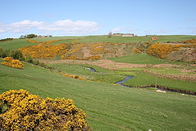
English: River Ythan near Ardlogie A small river meandering through a wide strath, far too big to have been eroded by its present flow, tells us that this is a glacial meltwater channel dating from the end of the last Ice Age 10,000-odd years ago. East Mains of Ardlogie, on the skyline, is in the next square. Ardlogie Farm is among the trees on the skyline at left. |
| Date | |
| Source | From geograph.org.uk |
| Author | Anne Burgess |
| Attribution (required by the license) | Anne Burgess / River Ythan near Ardlogie / |
| Camera location | | View this and other nearby images on: OpenStreetMap |
|---|
_heading:0.00&language=en)
| Object location | | View this and other nearby images on: OpenStreetMap |
|---|
_heading:0.00&language=en)
Licensing
[edit]

|
This image was taken from the Geograph project collection. See this photograph's page on the Geograph website for the photographer's contact details. The copyright on this image is owned by Anne Burgess and is licensed for reuse under the Creative Commons Attribution-ShareAlike 2.0 license.
|
This file is licensed under the Creative Commons Attribution-Share Alike 2.0 Generic license.
Attribution: Anne Burgess
- You are free:
- to share – to copy, distribute and transmit the work
- to remix – to adapt the work
- Under the following conditions:
- attribution – You must give appropriate credit, provide a link to the license, and indicate if changes were made. You may do so in any reasonable manner, but not in any way that suggests the licensor endorses you or your use.
- share alike – If you remix, transform, or build upon the material, you must distribute your contributions under the same or compatible license as the original.
File history
Click on a date/time to view the file as it appeared at that time.
| Date/Time | Thumbnail | Dimensions | User | Comment | |
|---|---|---|---|---|---|
| current | 10:40, 27 February 2011 | | 640 × 427 (257 KB) | GeographBot (talk | contribs) | == {{int:filedesc}} == {{Information |description={{en|1=River Ythan near Ardlogie A small river meandering through a wide strath, far too big to have been eroded by its present flow, tells us that this is a glacial meltwater channel dating from the end o |
You cannot overwrite this file.
File usage on Commons
There are no pages that use this file.