File:River Hull at Sculcoates, Kingston upon Hull, 2021-03-14.jpg
Jump to navigation
Jump to search
Size of this preview: 800 × 584 pixels. Other resolutions: 320 × 234 pixels | 640 × 468 pixels | 1,024 × 748 pixels.
Original file (1,024 × 748 pixels, file size: 1.02 MB, MIME type: image/jpeg)
Captions
Captions
Add a one-line explanation of what this file represents
Summary
[edit]
| Description |
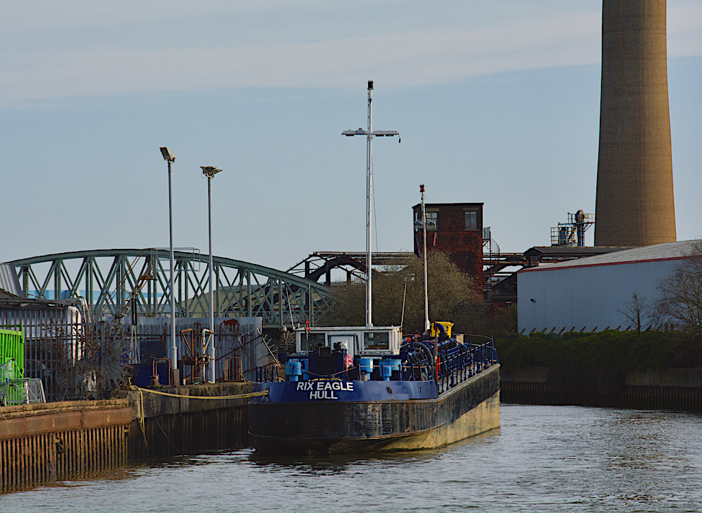
English: River Hull at Sculcoates. Looking upriver from Wincolmlee. To the right of the image is the base of the 463ft-high 'Reckitt's Chimney', the tallest in Hull, built to discharge sulphur dioxide into the atmosphere but now disused. To the left is the blue painted 'Hull Bridge' carrying the rail freight line to the docks over the river. Moored on the western bank is the Rix Eagle oil tanker, operated by local company Rix Shipping. |
| Date | Taken on 14 March 2021 |
| Source | From geograph.org.uk |
| Author | Paul Harrop |
| Attribution (required by the license) | Paul Harrop / Bus stop Knapton Green / |
| Camera location | | View this and other nearby images on: OpenStreetMap |
|---|
| Object location | | View this and other nearby images on: OpenStreetMap |
|---|
Licensing
[edit]

|
This image was taken from the Geograph project collection. See this photograph's page on the Geograph website for the photographer's contact details. The copyright on this image is owned by Paul Harrop and is licensed for reuse under the Creative Commons Attribution-ShareAlike 2.0 license.
|
This file is licensed under the Creative Commons Attribution-Share Alike 2.0 Generic license.
Attribution: Paul Harrop
- You are free:
- to share – to copy, distribute and transmit the work
- to remix – to adapt the work
- Under the following conditions:
- attribution – You must give appropriate credit, provide a link to the license, and indicate if changes were made. You may do so in any reasonable manner, but not in any way that suggests the licensor endorses you or your use.
- share alike – If you remix, transform, or build upon the material, you must distribute your contributions under the same or compatible license as the original.
File history
Click on a date/time to view the file as it appeared at that time.
| Date/Time | Thumbnail | Dimensions | User | Comment | |
|---|---|---|---|---|---|
| current | 16:45, 14 March 2021 | | 1,024 × 748 (1.02 MB) | Kolforn (talk | contribs) | {{Information |description={{en|1= River Hull at Sculcoates. Looking upriver from Wincolmlee. To the right of the image is the base of the 463ft-high 'Reckitt's Chimney', the tallest in Hull, built to discharge sulphur dioxide into the atmosphere but now disused. To the left is the blue painted 'Hull Bridge' carrying the rail freight line to the docks over the river. Moored on the western bank is the Rix Eagle oil tanker, operated by local company Rix Shipping. |Date={{Taken on|2021-03-14|loc... |
You cannot overwrite this file.
File usage on Commons
There are no pages that use this file.