File:Rita 2005-09-19 1315Z.png
Jump to navigation
Jump to search
Size of this preview: 800 × 500 pixels. Other resolutions: 320 × 200 pixels | 640 × 400 pixels | 1,024 × 640 pixels | 1,280 × 800 pixels | 1,920 × 1,200 pixels.
Original file (1,920 × 1,200 pixels, file size: 3.6 MB, MIME type: image/png)
Captions
Captions
Add a one-line explanation of what this file represents
Summary
[edit]
| Description |
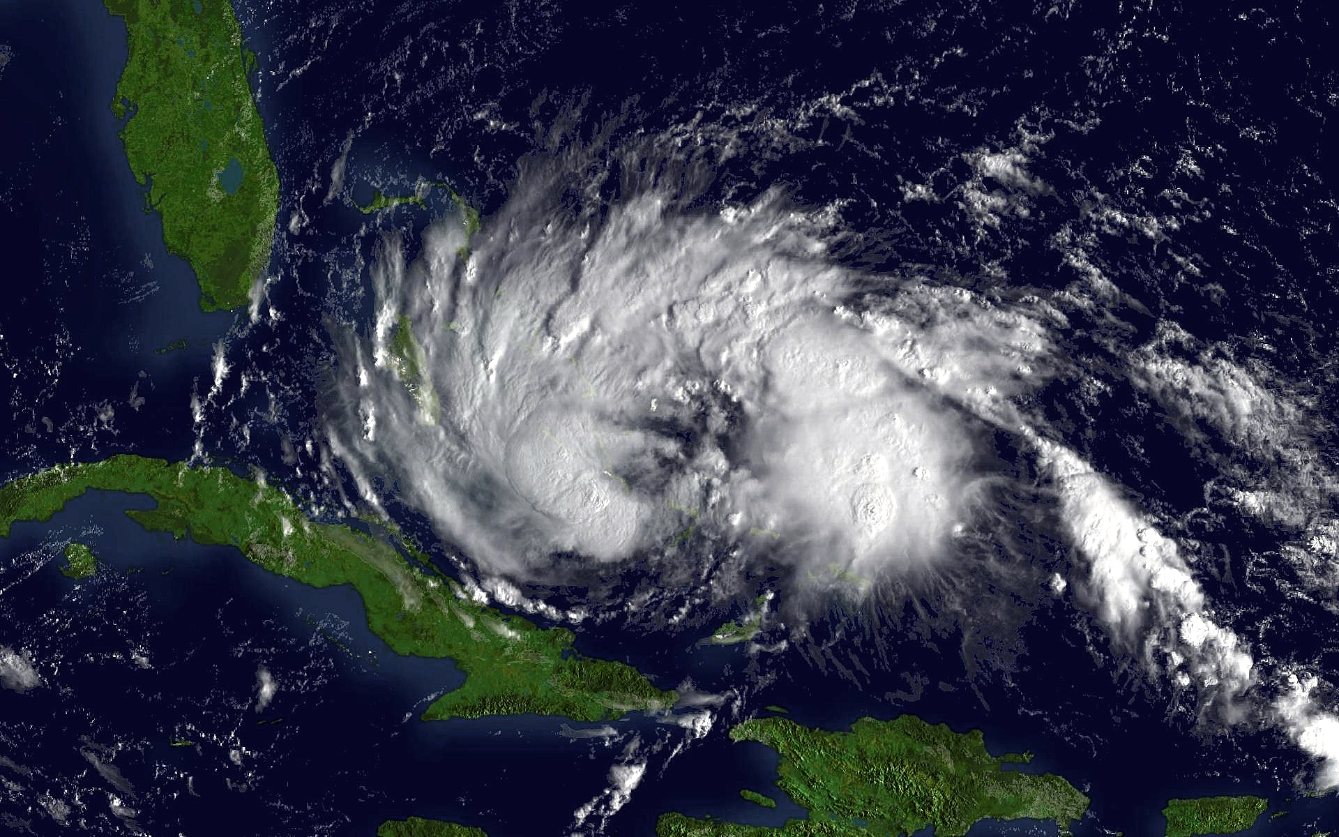
Source: http://www.nnvl.noaa.gov/cgi-bin/index.cgi?page=items&ser=109765 Description: Tropical Storm Rita regional imagery, 2005.09.19 at 1315Z. Centerpoint Latitude: 24:23:43N Longitude: 75:02:10W. |
| Date | |
| Source | NOAA |
| Author | NOAA |
Licensing
[edit]
This image is in the public domain because it contains materials that originally came from the U.S. National Oceanic and Atmospheric Administration, taken or made as part of an employee's official duties.
|
Original upload log
[edit]
The original description page was here. All following user names refer to en.wikipedia.
- 2006-05-25 20:36 Timl2k4 188×154×8 (58344 bytes) Source: http://www.nnvl.noaa.gov/cgi-bin/index.cgi?page=items&ser=109765 Description: Tropical Storm Rita regional imagery, 2005.09.19 at 1315Z. Centerpoint Latitude: 24:23:43N Longitude: 75:02:10W. == Licensing == {{PD-USGov-DOC-NOAA}}
File history
Click on a date/time to view the file as it appeared at that time.
| Date/Time | Thumbnail | Dimensions | User | Comment | |
|---|---|---|---|---|---|
| current | 12:52, 29 July 2010 | | 1,920 × 1,200 (3.6 MB) | Supportstorm (talk | contribs) | Higher Resolution |
| 21:27, 27 March 2007 |  | 188 × 154 (57 KB) | BigrTex (talk | contribs) | {{Information |Description=Source: http://www.nnvl.noaa.gov/cgi-bin/index.cgi?page=items&ser=109765 Description: Tropical Storm Rita regional imagery, 2005.09.19 at 1315Z. Centerpoint Latitude: 24:23:43N Longitude: 75:02:10W. |Source=Originally from [htt |
You cannot overwrite this file.
File usage on Commons
The following page uses this file:
- File:Rita-19-1315z-T35-discussion1500z.png (file redirect)