File:RioGrandedoNorte Municipalities.svg
From Wikimedia Commons, the free media repository
Jump to navigation
Jump to search

Size of this PNG preview of this SVG file: 800 × 497 pixels. Other resolutions: 320 × 199 pixels | 640 × 397 pixels | 1,024 × 636 pixels | 1,280 × 795 pixels | 2,560 × 1,590 pixels | 1,594 × 990 pixels.
Original file (SVG file, nominally 1,594 × 990 pixels, file size: 135 KB)
File information
Structured data
Captions
Captions
Add a one-line explanation of what this file represents
| DescriptionRioGrandedoNorte Municipalities.svg |
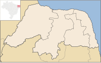
Português: Mapa do Rio Grande dividido em municípios excluindo as micro e mesorregiões. |
| Date | |
| Source | File:RioGrandedoNorte MesoMicroMunicip.svg by Raphael Lorenzeto de Abreu |
| Author | Marcos Elias de Oliveira Júnior |
| Permission (Reusing this file) |
This file is licensed under the Creative Commons Attribution 2.5 Generic license.
|
| Other versions |
 |
File history
Click on a date/time to view the file as it appeared at that time.
| Date/Time | Thumbnail | Dimensions | User | Comment | |
|---|---|---|---|---|---|
| current | 00:34, 3 August 2011 |  | 1,594 × 990 (135 KB) | Marquinhos (talk | contribs) | Small change. |
| 17:28, 28 June 2011 |  | 1,594 × 990 (129 KB) | Marquinhos (talk | contribs) | Small revision | |
| 16:16, 17 June 2011 |  | 1,594 × 990 (129 KB) | Marquinhos (talk | contribs) | Cleaned SVG | |
| 16:20, 16 June 2011 |  | 1,594 × 990 (131 KB) | Marquinhos (talk | contribs) | Removed municipalities in red and fixed version. | |
| 16:15, 16 June 2011 |  | 1,594 × 990 (192 KB) | Marquinhos (talk | contribs) | {{Information |Description ={{pt|1=Mapa do Rio Grande dividido em municípios excluindo as micro e mesorregiões.}} |Source =File:RioGrandedoNorte MesoMicroMunicip.svg by Raphael Lorenzeto de Abreu |Author |
You cannot overwrite this file.
File usage on Commons
There are no pages that use this file.
File usage on other wikis
The following other wikis use this file:
- Usage on pt.wikipedia.org
Hidden category:
