File:Rimogne And Its Region.jpg
Jump to navigation
Jump to search

Size of this preview: 799 × 600 pixels. Other resolutions: 320 × 240 pixels | 639 × 480 pixels | 1,023 × 768 pixels | 1,276 × 958 pixels.
Original file (1,276 × 958 pixels, file size: 445 KB, MIME type: image/jpeg)
Captions
Captions
Add a one-line explanation of what this file represents
Summary
[edit]
| Description |
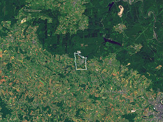
English: Aerial photograph of Rimogne and its region, in the Ardennes, France.
Français : Photographie aérienne de la région de Rimogne, Ardennes, France. |
| Date | 2007-12-02, the photographs were taken between 2000 and 2004. |
| Source | Nasa World Wind |
| Author | Sémhur ·✉·✍· |
| Camera location | | View this and other nearby images on: OpenStreetMap |
|---|
Licensing
[edit]
| This image is in the public domain because it is a screenshot from NASA’s globe software World Wind using a public domain layer, such as Blue Marble, MODIS, Landsat, SRTM, USGS or GLOBE.
|
 |
File history
Click on a date/time to view the file as it appeared at that time.
| Date/Time | Thumbnail | Dimensions | User | Comment | |
|---|---|---|---|---|---|
| current | 12:47, 10 December 2007 | | 1,276 × 958 (445 KB) | Sémhur (talk | contribs) | Mise en évidence des limites de la commune. |
| 19:47, 2 December 2007 |  | 1,276 × 958 (445 KB) | Sémhur (talk | contribs) | == Description == {{Information |Description= {{en}}Aerial photograph of en:Rimogne and its region, in the Ardennes, France. {{fr}}Photographie aérienne de la région de fr:Rimogne, Ardennes, France. |Source=[http://worldwind.arc.nasa.gov Nasa |
You cannot overwrite this file.
File usage on Commons
There are no pages that use this file.
File usage on other wikis
The following other wikis use this file:
- Usage on fr.wikipedia.org