File:Ries WorldWind SW.jpg
Jump to navigation
Jump to search
Size of this preview: 795 × 599 pixels. Other resolutions: 318 × 240 pixels | 637 × 480 pixels | 992 × 748 pixels.
Original file (992 × 748 pixels, file size: 315 KB, MIME type: image/jpeg)
Captions
Captions
Add a one-line explanation of what this file represents
| Description |
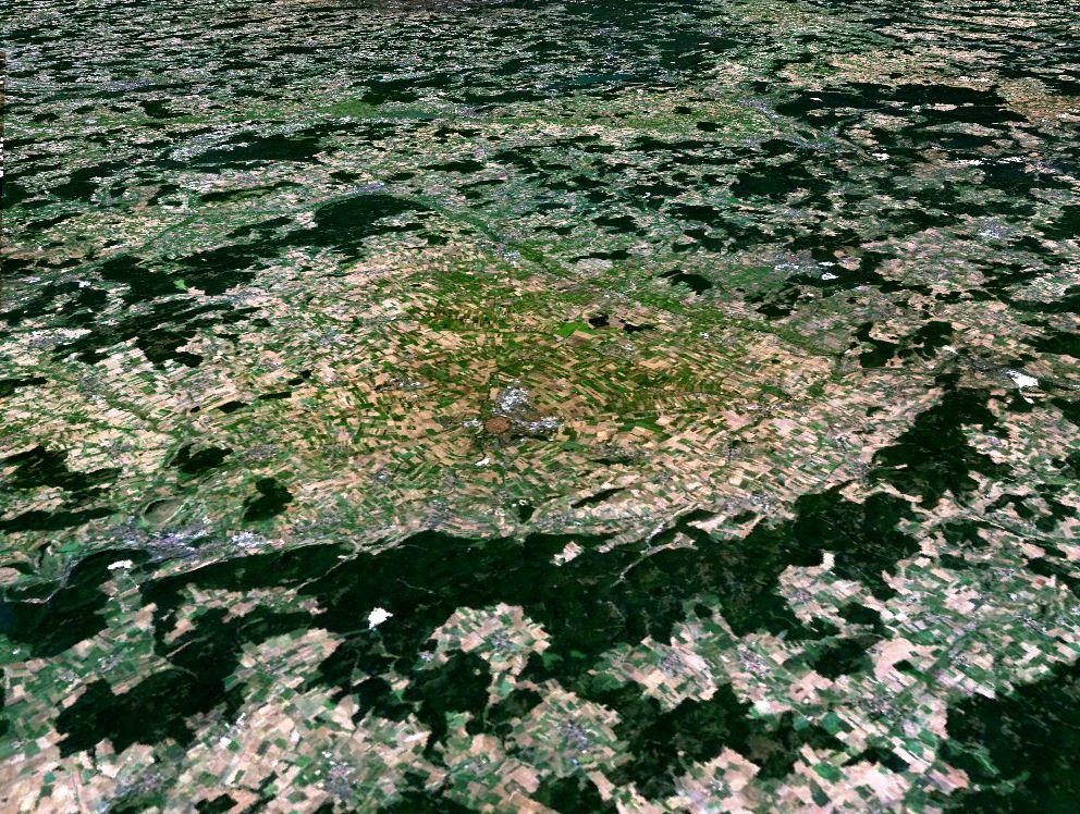
English: Nördlinger Ries, view from southwest. Within the Ries crater, the city of Nördlingen stands out.
Deutsch: Nördlinger Ries, aus dem Südwesten gesehen. Innerhalb des Rieskraters ist die Stadt Nördlingen erkennbar. |
| Source | Created with NASA WorldWind by User:Vesta using Landsat 7 (Visible Color) satellite image. |
| Author | User:Vesta |
48°53′18″N 10°32′09″E / 48.88833°N 10.53583°E
| This image is in the public domain because it is a screenshot from NASA’s globe software World Wind using a public domain layer, such as Blue Marble, MODIS, Landsat, SRTM, USGS or GLOBE.
|
 |
File history
Click on a date/time to view the file as it appeared at that time.
| Date/Time | Thumbnail | Dimensions | User | Comment | |
|---|---|---|---|---|---|
| current | 09:40, 5 January 2006 | | 992 × 748 (315 KB) | Vesta~commonswiki (talk | contribs) |
You cannot overwrite this file.
File usage on Commons
The following 3 pages use this file:
File usage on other wikis
The following other wikis use this file:
- Usage on als.wikipedia.org
- Usage on de.wikipedia.org
- Nördlinger Ries
- Portal:Astronomie/Lesenswerte Artikel
- Wikipedia Diskussion:Hauptseite/Artikel des Tages/Archiv/Vorschläge/2009
- Wikipedia Diskussion:Hauptseite/Artikel des Tages/Archiv/Vorschläge/2009/Q3
- Wikipedia Diskussion:Hauptseite/Artikel des Tages/Archiv/Vorschläge/2020/Q4
- Wikipedia:Hauptseite/Archiv/22. November 2020
- Usage on es.wikipedia.org
- Usage on fi.wikipedia.org
- Usage on fr.wikipedia.org
- Usage on ja.wikipedia.org
- Usage on la.wikipedia.org
- Usage on nl.wikipedia.org
- Usage on pl.wikipedia.org
- Usage on ru.wikipedia.org
- Usage on uk.wikipedia.org
- Usage on zh.wikipedia.org