File:Richard Ware, A map of the sacred geography taken from the Old and New Testament. Containing most of ye then known parts of the world and by whom peopled (FL200037438 2369137).jpg
Jump to navigation
Jump to search

Size of this preview: 714 × 600 pixels. Other resolutions: 286 × 240 pixels | 571 × 480 pixels | 914 × 768 pixels | 1,219 × 1,024 pixels | 2,438 × 2,048 pixels | 5,656 × 4,752 pixels.
Original file (5,656 × 4,752 pixels, file size: 39.89 MB, MIME type: image/jpeg)
Captions
Captions
Add a one-line explanation of what this file represents
Summary
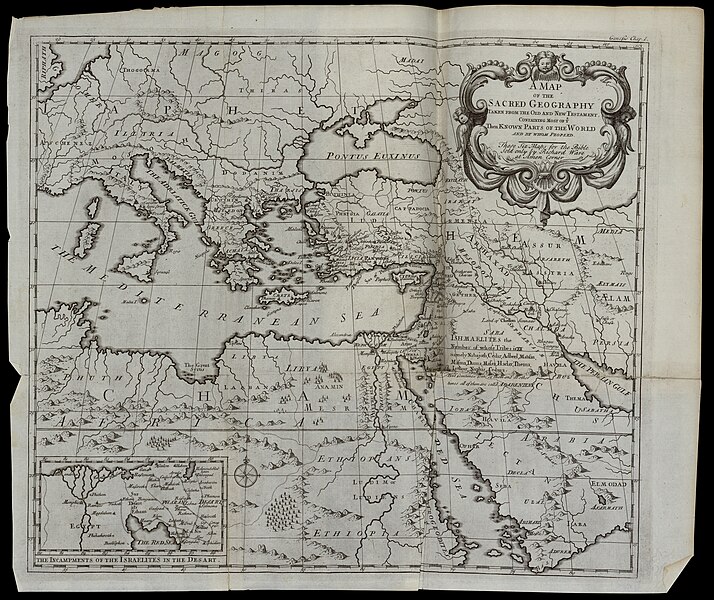
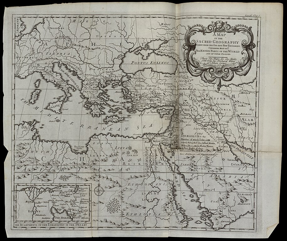
[edit]| Richard Ware: A map of the sacred geography taken from the Old and New Testament. Containing most of ye then known parts of the world and by whom peopled
( |
||||||||||||||||||||||||
|---|---|---|---|---|---|---|---|---|---|---|---|---|---|---|---|---|---|---|---|---|---|---|---|---|
| Artist |
|
|||||||||||||||||||||||
| Title |
A map of the sacred geography taken from the Old and New Testament. Containing most of ye then known parts of the world and by whom peopled |
|||||||||||||||||||||||
| Description |
A map of the sacred geography taken from the Old and New Testament. Containing most of ye then known parts of the world and by whom peopled.... Sold only by Richard Ware. |
|||||||||||||||||||||||
| Language | English | |||||||||||||||||||||||
| Publication date | 1725 | |||||||||||||||||||||||
| Dimensions | height: 358 mm (14.09 in); width: 420 mm (16.53 in) | |||||||||||||||||||||||
| Collection |
|
|||||||||||||||||||||||
| Current location |
|
|||||||||||||||||||||||
| Place of publication | London | |||||||||||||||||||||||
| search Merhav catalog | London | |||||||||||||||||||||||
| Notes | Copperplate; From: Sacred Geography, contained in six maps. London, 1725. Added to: The Holy Bible, Oxford, John Baskett, 1723. Genesis Chap.I. Atl. C7 77 B 333. | |||||||||||||||||||||||
| IE PID | IE200037436 | |||||||||||||||||||||||
| Rosetta filename | FL200037438 | |||||||||||||||||||||||
| NNL item ID (P3959) | 990023691370205171 | |||||||||||||||||||||||
| search Merhav catalog | English, Richard Ware | |||||||||||||||||||||||
| Source/Photographer |
|
|||||||||||||||||||||||
| Other versions | ||||||||||||||||||||||||
| Jpg / Tif version |
|
|||||||||||||||||||||||

.jpg)

.jpg&action=edit§ion=1)
Licensing
[edit].jpg&action=edit§ion=2)
The copyright situation of this work is theoretically uncertain, because in the country of origin copyright lasts 70 years after the death of the author, and the date of the author's death is unknown. However, the date of creation of the work was over 120 years ago, and it is thus a reasonable assumption that the copyright has expired (see here for the community discussion). Do not use this template if the date of death of the author is known.
| |
| This file has been identified as being free of known restrictions under copyright law, including all related and neighboring rights. | |
File history
Click on a date/time to view the file as it appeared at that time.
| Date/Time | Thumbnail | Dimensions | User | Comment | |
|---|---|---|---|---|---|
| current | 02:35, 29 July 2023 | | 5,656 × 4,752 (39.89 MB) | Geagea (talk | contribs) | pattypan 22.03 |
You cannot overwrite this file.
File usage on Commons
The following page uses this file:
.jpg&oldid=787803517)