File:Rhodos-Cyprus-Southern Turkish Coast-satellite map.jpg
Jump to navigation
Jump to search
Size of this preview: 800 × 468 pixels. Other resolutions: 320 × 187 pixels | 640 × 374 pixels | 1,024 × 598 pixels | 1,682 × 983 pixels.
Original file (1,682 × 983 pixels, file size: 713 KB, MIME type: image/jpeg)
Captions
Captions
Add a one-line explanation of what this file represents
Summary
[edit]
| Description |
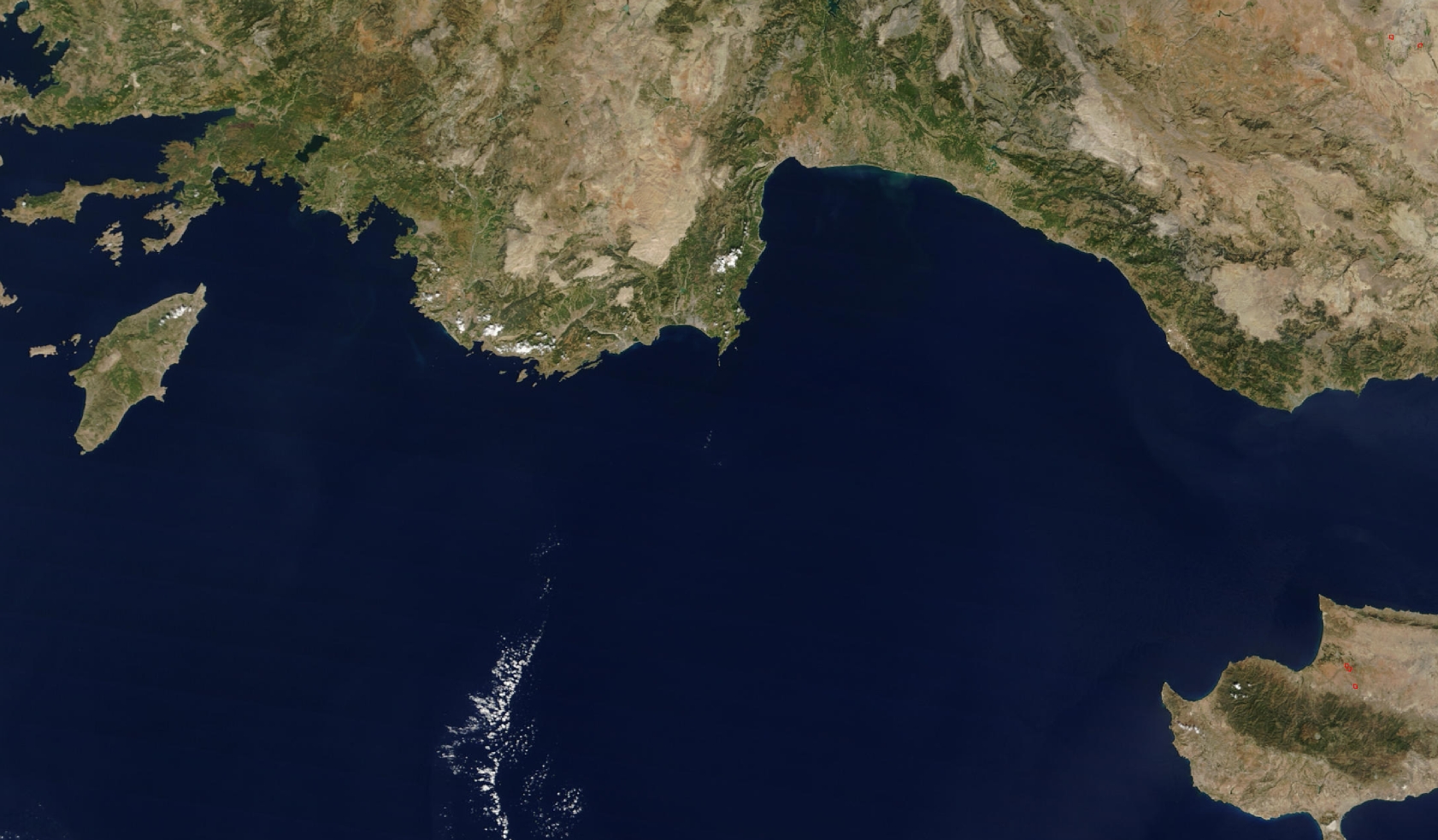
Ελληνικά: Δορυφορική εικόνα της θαλάσσιας περιοχής μεταξύ Ρόδου και Κύπρου English: Satellite map of the Mediterranean Sea between Rhodos and Cyprus, and the southern coast of Turkey |
| Date | |
| Source | https://visibleearth.nasa.gov/view.php?id=62350 |
| Author | NASA |
Licensing
[edit]
| This file is in the public domain in the United States because it was solely created by NASA. NASA copyright policy states that "NASA material is not protected by copyright unless noted". (See Template:PD-USGov, NASA copyright policy page or JPL Image Use Policy.) | ||
 |
Warnings:
|
Original upload log
[edit]
The original description page was here. All following user names refer to el.wikipedia.
| Date/Time | Dimensions | User | Comment |
|---|---|---|---|
| 2017-12-24 14:35 | 1682×983× (729920 bytes) | Τακλαμακαν | {{Πληροφορίες εικόνας |Περιγραφή=Δορυφορική εικόνα του Λυκίου Πελάγους |Πηγή=https://visibleearth.nasa.gov/view.php?id=62350 |Ημερομηνία=24/12/2017 |Δημιουργός=NASA |Ά... |
File history
Click on a date/time to view the file as it appeared at that time.
| Date/Time | Thumbnail | Dimensions | User | Comment | |
|---|---|---|---|---|---|
| current | 13:22, 25 December 2017 | | 1,682 × 983 (713 KB) | MARKELLOS (talk | contribs) | Transferred from el.wikipedia |
You cannot overwrite this file.
File usage on Commons
The following page uses this file:
- File:Lycian sea2.jpg (file redirect)
File usage on other wikis
The following other wikis use this file:
- Usage on ja.wikipedia.org