File:Rete autostradale italiana con superstrade.svg
Jump to navigation
Jump to search

Size of this PNG preview of this SVG file: 425 × 500 pixels. Other resolutions: 204 × 240 pixels | 408 × 480 pixels | 653 × 768 pixels | 870 × 1,024 pixels | 1,741 × 2,048 pixels.
Original file (SVG file, nominally 425 × 500 pixels, file size: 169 KB)
Captions
Captions
Add a one-line explanation of what this file represents
| Description |
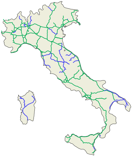
English: Italian motorway network (motorways, distributions, connections, orbitals, RA and freeways).
Español: Red de autopistas et carretteras italianas (carreteras, distribuciones, conexiones, circunvalaciónes, RA et carretteras majores).
Italiano: Rete autostradale (autostrade, diramazioni autostradali , raccordi autostradali, tangenziali autostradali, RA) e superstradale (sono segnalate solo le strade classificate tecnicamente come strade extraurbane principali/cat.B > 30 km e le strade extraurbane secondarie/cat. C a due carreggiate > 30 km). È segnalata inoltre la superstrada SS11 Torino-Chivasso e la SS114 Augusta-Siracusa |
| Date | |
| Source |
English: Own work.
Español: Mi propio trabajo.
Italiano: Fatta da me. |
| Author | Gigillo83, original of ColdShine |
| Permission (Reusing this file) |
This file is licensed under the Creative Commons Attribution-Share Alike 3.0 Unported license.
|
| Other versions | Derivative works of this file: Rete autostradale italiana-labeled.svg |
This W3C-unspecified vector image was created with Inkscape .
| Annotations | This image is annotated: View the annotations at Commons |
File history
Click on a date/time to view the file as it appeared at that time.
| Date/Time | Thumbnail | Dimensions | User | Comment | |
|---|---|---|---|---|---|
| current | 18:49, 11 March 2014 | | 425 × 500 (169 KB) | Fulvio314 (talk | contribs) | RA17 -> A34 |
| 13:52, 23 October 2010 |  | 425 × 500 (170 KB) | Gigillo83 (talk | contribs) | Finishing A28 | |
| 10:14, 23 June 2010 |  | 425 × 500 (164 KB) | Gigillo83 (talk | contribs) | Modified Sicilia | |
| 10:12, 23 June 2010 |  | 425 × 500 (163 KB) | Gigillo83 (talk | contribs) | Modified Puglia | |
| 09:51, 23 June 2010 |  | 425 × 500 (163 KB) | Gigillo83 (talk | contribs) | {{Information |other_versions={{DerivativeVersions|Rete autostradale italiana-labeled.svg}} | |Description= {{en|Italian motorway network (motorways, distributions, connections, orbitals, RA and freeways).}} {{es|Red de autopistas et carretteras italianas |
You cannot overwrite this file.
File usage on Commons
The following 2 pages use this file:
File usage on other wikis
The following other wikis use this file:
- Usage on ar.wikipedia.org
- Usage on en.wikipedia.org
- Usage on fr.wikipedia.org
- Usage on he.wikivoyage.org
- Usage on it.wikipedia.org