File:República Socialista Asturiana mapa.svg
Jump to navigation
Jump to search

Size of this PNG preview of this SVG file: 690 × 522 pixels. Other resolutions: 317 × 240 pixels | 635 × 480 pixels | 1,015 × 768 pixels | 1,280 × 968 pixels | 2,560 × 1,937 pixels.
Original file (SVG file, nominally 690 × 522 pixels, file size: 412 KB)
Captions
Captions
Add a one-line explanation of what this file represents
| Description |
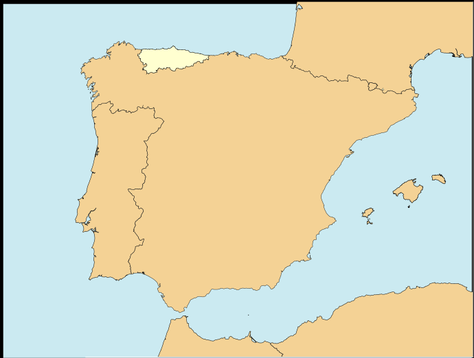
Asturianu: Allugamientu de la República Socialista Asturiana na Península Ibérica
English: Map of the Socialist Republic of Asturias in the Iberian Peninsula. Español: Localización de la República Socialista Asturiana en la Península Ibérica. |
| Date | (UTC) |
| Source | |
| Author |
| This is a retouched picture, which means that it has been digitally altered from its original version. The original can be viewed here: Localización de Asturias.svg:
|
I, the copyright holder of this work, hereby publish it under the following licenses:
This file is licensed under the Creative Commons Attribution-Share Alike 3.0 Unported, 2.5 Generic, 2.0 Generic and 1.0 Generic license.
- You are free:
- to share – to copy, distribute and transmit the work
- to remix – to adapt the work
- Under the following conditions:
- attribution – You must give appropriate credit, provide a link to the license, and indicate if changes were made. You may do so in any reasonable manner, but not in any way that suggests the licensor endorses you or your use.
- share alike – If you remix, transform, or build upon the material, you must distribute your contributions under the same or compatible license as the original.

|
Permission is granted to copy, distribute and/or modify this document under the terms of the GNU Free Documentation License, Version 1.2 or any later version published by the Free Software Foundation; with no Invariant Sections, no Front-Cover Texts, and no Back-Cover Texts. A copy of the license is included in the section entitled GNU Free Documentation License. |
You may select the license of your choice.
Original upload log
[edit]
This image is a derivative work of the following images:
- File:Localización_de_Asturias.svg licensed with Cc-by-sa-3.0,2.5,2.0,1.0, GFDL
- 2009-07-06T10:30:19Z Rastrojo 690x522 (574377 Bytes) nueva versión
- 2008-04-02T18:31:49Z Paintman 578x374 (417169 Bytes) Color verde y por comunidades autónomas.
- 2008-01-07T19:05:07Z Rastrojo 578x374 (622397 Bytes) {{Information |Description= Localización de [[w:es:Asturias|Asturias]] respecto a España |Source= [[:Image:Provincias de España centrado.svg]] |Date= |Author= [[w:es:User:Rastrojo|Rastrojo]] |Permission= |other_versions= }
Uploaded with derivativeFX
File history
Click on a date/time to view the file as it appeared at that time.
| Date/Time | Thumbnail | Dimensions | User | Comment | |
|---|---|---|---|---|---|
| current | 21:26, 5 June 2010 | | 690 × 522 (412 KB) | Saguzar1 (talk | contribs) | {{Information |Description={{ast|Allugamientu de la República Socialista Asturiana na Península Ibérica}} {{en|Map of the Socialist Republic of Asturias in the Iberian Peninsula.}}{{es|Localización de la [[w:e |
You cannot overwrite this file.
File usage on Commons
There are no pages that use this file.