File:Removal of office buildings IMG 3970 -1.jpg
From Wikimedia Commons, the free media repository
Jump to navigation
Jump to search
Size of this preview: 800 × 589 pixels. Other resolutions: 320 × 236 pixels | 640 × 471 pixels | 1,024 × 754 pixels | 1,280 × 943 pixels | 2,000 × 1,473 pixels.
Original file (2,000 × 1,473 pixels, file size: 291 KB, MIME type: image/jpeg)
File information
Structured data
Captions
Summary
[edit]DescriptionRemoval of office buildings IMG 3970 -1.jpg |
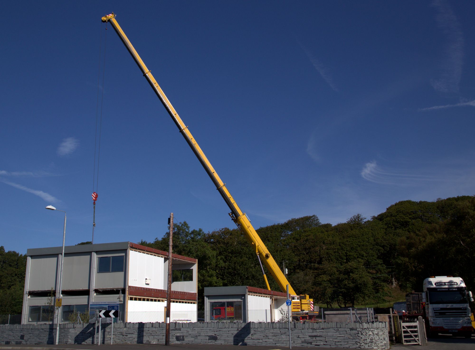
English: The temporary office building used by the contractor, HOCHTIEF being removed from site following completion of the project. |
Date | |
Source | Own work |
Author | Talsarnau Times |
Camera location | 52° 55′ 44.37″ N, 4° 03′ 41.26″ W | View this and other nearby images on: OpenStreetMap | 52.928993; -4.061462 |
---|
Licensing
[edit]I, the copyright holder of this work, hereby publish it under the following license:
This file is licensed under the Creative Commons Attribution-Share Alike 4.0 International license.
- You are free:
- to share – to copy, distribute and transmit the work
- to remix – to adapt the work
- Under the following conditions:
- attribution – You must give appropriate credit, provide a link to the license, and indicate if changes were made. You may do so in any reasonable manner, but not in any way that suggests the licensor endorses you or your use.
- share alike – If you remix, transform, or build upon the material, you must distribute your contributions under the same or compatible license as the original.
File history
Click on a date/time to view the file as it appeared at that time.
Date/Time | Thumbnail | Dimensions | User | Comment | |
---|---|---|---|---|---|
current | 10:27, 18 August 2015 | 2,000 × 1,473 (291 KB) | Talsarnau Times (talk | contribs) | User created page with UploadWizard |
You cannot overwrite this file.
File usage on Commons
The following page uses this file:
Metadata
This file contains additional information such as Exif metadata which may have been added by the digital camera, scanner, or software program used to create or digitize it. If the file has been modified from its original state, some details such as the timestamp may not fully reflect those of the original file. The timestamp is only as accurate as the clock in the camera, and it may be completely wrong.
Camera manufacturer | Canon |
---|---|
Camera model | Canon EOS 6D |
Author | Archie Harris |
Copyright holder | archie.harris13@gmail.com |
Date and time of data generation | 09:44, 18 August 2015 |
Exposure time | 1/500 sec (0.002) |
F-number | f/16 |
ISO speed rating | 400 |
Lens focal length | 32 mm |
Latitude | 52° 55′ 44.38″ N |
Longitude | 4° 3′ 41.26″ W |
Altitude | 11.2 meters above sea level |
Width | 5,472 px |
Height | 3,648 px |
Compression scheme | JPEG (old) |
Horizontal resolution | 72 dpi |
Vertical resolution | 72 dpi |
Orientation | Normal |
File change date and time | 09:44, 18 August 2015 |
Software used | PaintShop Pro 16.00 |
Exif version | 2.3 |
Supported Flashpix version | 1 |
Color space | sRGB |
Meaning of each component |
|
Date and time of digitizing | 09:44, 18 August 2015 |
DateTime subseconds | 00 |
DateTimeOriginal subseconds | 00 |
DateTimeDigitized subseconds | 00 |
Exposure Program | Normal program |
APEX shutter speed | 9 |
APEX aperture | 8 |
APEX exposure bias | 0 |
Metering mode | Pattern |
Flash | Flash did not fire, compulsory flash suppression |
Focal plane X resolution | 3,810.5849582173 |
Focal plane Y resolution | 3,815.89958159 |
Focal plane resolution unit | inches |
Custom image processing | Normal process |
Exposure mode | Auto exposure |
White balance | Auto white balance |
Scene capture type | Standard |
GPS time (atomic clock) | 08:41:44.993 |
Satellites used for measurement | 12 |
Receiver status | Measurement in progress |
Measurement mode | 3-dimensional measurement |
Measurement precision | Poor (50) |
Geodetic survey data used | WGS-84 |
GPS date | 18 August 2015 |
GPS tag version | 0.0.3.2 |