File:Remnants of beaver pond in New York's Adirondack Park.jpg
Jump to navigation
Jump to search
Size of this preview: 800 × 450 pixels. Other resolutions: 320 × 180 pixels | 640 × 360 pixels | 1,334 × 750 pixels.
Original file (1,334 × 750 pixels, file size: 423 KB, MIME type: image/jpeg)
Captions
Captions
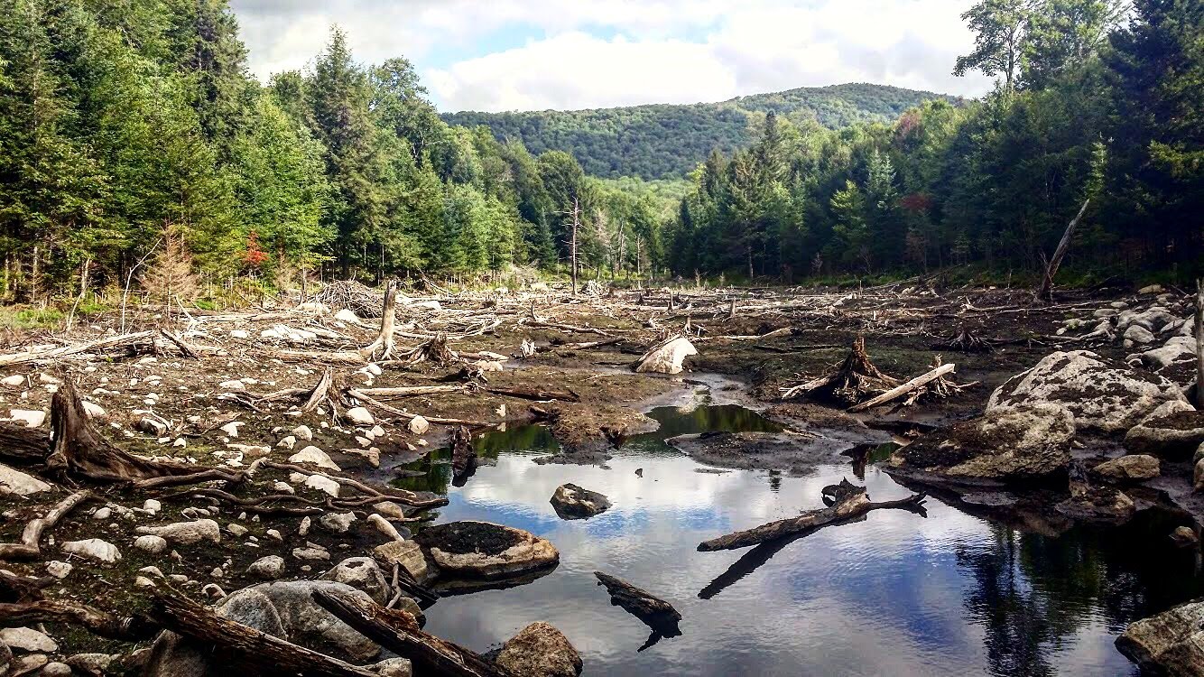
Remnants of a beaver pond following a dam breakage along an impoundment in New York's Adirondack State Park.
Summary
[edit]
| Description |
English: Beaver (Castorum canadensis) are known for building large dam structures along streams, producing large impoundments of water upstream which they use for movement and foraging. Should the dam not be properly maintained, these impoundments may release, breaking the dam and leaving behind a heavily disturbed area where the beaver pond had been. This photo shows one such remnant following a dam breakage in New York's Adirondack State Park. |
| Date | |
| Source | Own work |
| Author | Second Sender |
| Camera location | | View this and other nearby images on: OpenStreetMap |
|---|
Licensing
[edit]
I, the copyright holder of this work, hereby publish it under the following license:
This file is licensed under the Creative Commons Attribution 4.0 International license.
- You are free:
- to share – to copy, distribute and transmit the work
- to remix – to adapt the work
- Under the following conditions:
- attribution – You must give appropriate credit, provide a link to the license, and indicate if changes were made. You may do so in any reasonable manner, but not in any way that suggests the licensor endorses you or your use.
| This file was uploaded as part of Wiki Science Competition 2021. |
File history
Click on a date/time to view the file as it appeared at that time.
| Date/Time | Thumbnail | Dimensions | User | Comment | |
|---|---|---|---|---|---|
| current | 01:57, 24 December 2021 | | 1,334 × 750 (423 KB) | Second Sender (talk | contribs) | Uploaded own work with UploadWizard |
You cannot overwrite this file.
File usage on Commons
There are no pages that use this file.
File usage on other wikis
The following other wikis use this file:
- Usage on en.wikipedia.org
- Usage on ja.wikipedia.org