File:Remains of subway at Arthington station (geograph 4094138).jpg
Jump to navigation
Jump to search
Size of this preview: 401 × 599 pixels. Other resolutions: 160 × 240 pixels | 321 × 480 pixels | 514 × 768 pixels | 1,152 × 1,721 pixels.
Original file (1,152 × 1,721 pixels, file size: 1.31 MB, MIME type: image/jpeg)
Captions
Captions
Add a one-line explanation of what this file represents
Summary
[edit].jpg&action=edit§ion=1)
| Description |
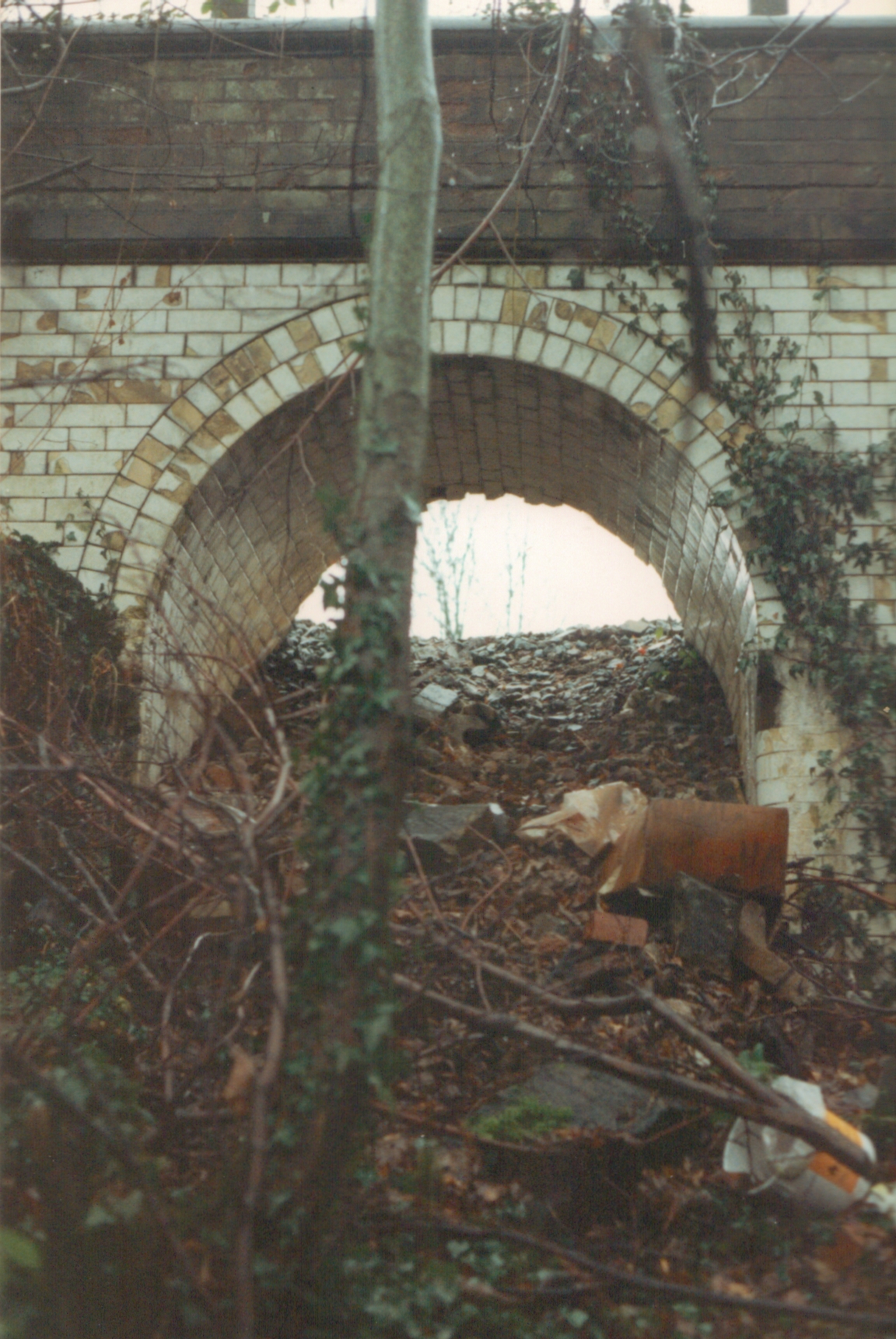
English: Remains of subway at Arthington station At first sight, the station site at Arthington didn't appear to have much left in the way of tangible reminders of the railway. For the most part, the platforms had been demolished and the trackbed had been converted to a road. But upon exploring through the undergrowth at the edge of the site (and, I regret to say, trespassing across an active railway line, which was a very stupid thing to do), I found this. It's the remains of the passenger subway which led from the platform for trains to Leeds beneath the tracks to the rest of the station. |
| Date | |
| Source | From geograph.org.uk |
| Author | John Winder |
| Permission (Reusing this file) |
Creative Commons Attribution Share-alike license 2.0 |
| Attribution (required by the license) | John Winder / Remains of subway at Arthington station / |
| Camera location | | View this and other nearby images on: OpenStreetMap |
|---|
.jpg¶ms=053.894332_N_-001.609807_E_globe:Earth_type:camera_source:geograph-osgb36(SE25744431)_heading:180.00&language=en)
| Object location | | View this and other nearby images on: OpenStreetMap |
|---|
.jpg¶ms=053.894330_N_-001.609810_E_globe:Earth_class:object_type:object_source:geograph-osgb36(SE25744431)_heading:180.00&language=en)
Licensing
[edit].jpg&action=edit§ion=2)

|
This image was taken from the Geograph project collection. See this photograph's page on the Geograph website for the photographer's contact details. The copyright on this image is owned by John Winder and is licensed for reuse under the Creative Commons Attribution-ShareAlike 2.0 license.
|
This file is licensed under the Creative Commons Attribution-Share Alike 2.0 Generic license.
Attribution: John Winder
- You are free:
- to share – to copy, distribute and transmit the work
- to remix – to adapt the work
- Under the following conditions:
- attribution – You must give appropriate credit, provide a link to the license, and indicate if changes were made. You may do so in any reasonable manner, but not in any way that suggests the licensor endorses you or your use.
- share alike – If you remix, transform, or build upon the material, you must distribute your contributions under the same or compatible license as the original.
File history
Click on a date/time to view the file as it appeared at that time.
| Date/Time | Thumbnail | Dimensions | User | Comment | |
|---|---|---|---|---|---|
| current | 21:27, 15 January 2021 | | 1,152 × 1,721 (1.31 MB) | Lamberhurst (talk | contribs) | Transferred from geograph.co.uk using [https://tools.wmflabs.org/geograph2commons/ geograph2commons] |
You cannot overwrite this file.
File usage on Commons
The following page uses this file:
.jpg&oldid=664285096)