File:Reliefkarte Kirgisistan.png
Jump to navigation
Jump to search

Size of this preview: 800 × 415 pixels. Other resolutions: 320 × 166 pixels | 640 × 332 pixels | 1,024 × 532 pixels | 1,280 × 665 pixels | 2,898 × 1,505 pixels.
Original file (2,898 × 1,505 pixels, file size: 6.1 MB, MIME type: image/png)
Captions
Captions
Add a one-line explanation of what this file represents
Summary
[edit]| Description |
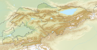
Deutsch: Reliefkarte Kirgisistan
Topographischer Hintergrund: NASA Shuttle Radar Topography Mission (public domain). SRTM3 v.2. |
||||||||
| Date | |||||||||
| Source | Own work | ||||||||
| Author | Tschubby | ||||||||
| Permission (Reusing this file) |
I, the copyright holder of this work, hereby publish it under the following licenses:
This file is licensed under the Creative Commons Attribution-Share Alike 2.5 Generic, 2.0 Generic and 1.0 Generic license.
You may select the license of your choice. |

File history
Click on a date/time to view the file as it appeared at that time.
| Date/Time | Thumbnail | Dimensions | User | Comment | |
|---|---|---|---|---|---|
| current | 09:51, 28 May 2018 | | 2,898 × 1,505 (6.1 MB) | Tschubby (talk | contribs) | == {{int:filedesc}} == {{Information |Description= {{de| Reliefkarte Kirgisistan}} Topographischer Hintergrund: [http://www2.jpl.nasa.gov/srtm NASA Shuttle Radar Topography Mission] (public domain). SRTM3 v.2.<br /> Grenzen: Kyrgyzstan location map.svg |Source={{own}} |Date= 2018-05-28 |Author= Tschubby |Permission= {{self|GFDL|Cc-by-sa-3.0-migrated|Cc-by-sa-2.5,2.0,1.0}} |other_versions= }} Category:Location maps of Kyrgyzstan |
You cannot overwrite this file.
File usage on Commons
There are no pages that use this file.
File usage on other wikis
The following other wikis use this file:
- Usage on arz.wikipedia.org
- Usage on bg.wikipedia.org
- Кант
- Бишкек
- Ферганска котловина
- Ош (Киргизстан)
- Джалал Абад
- Талас
- Карадаря
- Узген
- Нарин (река)
- Исък Кул
- Баткен
- Шаблон:ПК Киргизстан
- Каракол (град)
- Каракул (Киргизстан)
- Нарин
- Казарман
- Сонгкул
- Чатър Кул
- Баласагун
- Майлуу Суу
- Таласка долина
- Токмок
- Чуйска долина
- Чаткал
- Суяб
- Баликчи
- Дженгиш Чокусу
- Хан Тенгри
- Инилчек
- Какшаал Тоо
- Пскемски хребет
- Чаткалски хребет
- Курамински хребет
- Таласки Алатау
- Сусамиртау
- Киргизки хребет
- Джумгалтау
- Фергански хребет
- Молдотау
- Джамантау
- Атбаши
- Наринтау
- Джетим
- Акшийрак
- Борколдой
- Сариджаз (хребет)
View more global usage of this file.