File:Reliefkarte Deutschland.png
Jump to navigation
Jump to search

Size of this preview: 469 × 599 pixels. Other resolutions: 188 × 240 pixels | 376 × 480 pixels | 601 × 768 pixels | 802 × 1,024 pixels | 1,603 × 2,048 pixels | 3,638 × 4,647 pixels.
Original file (3,638 × 4,647 pixels, file size: 23.88 MB, MIME type: image/png)
Captions
Captions
Add a one-line explanation of what this file represents
Summary
[edit]| Description |
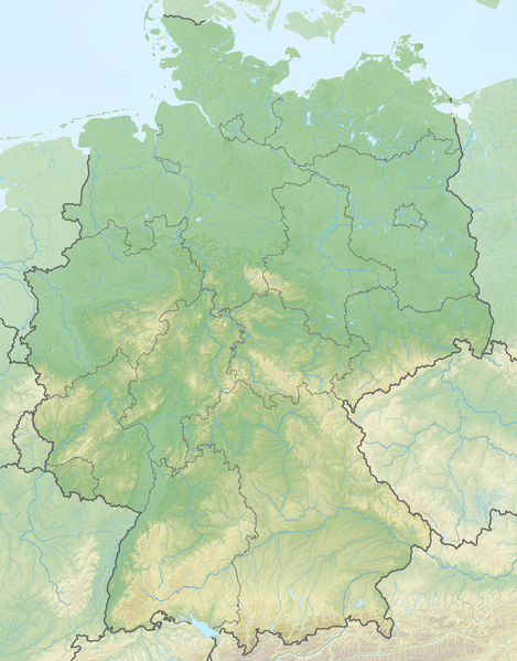
Deutsch: Reliefkarte Deutschland
Topographischer Hintergrund: NASA Shuttle Radar Topography Mission (public domain). SRTM3 v.2. |
||||||||
| Date | |||||||||
| Source | Own work | ||||||||
| Author | Tschubby | ||||||||
| Permission (Reusing this file) |
I, the copyright holder of this work, hereby publish it under the following licenses:
This file is licensed under the Creative Commons Attribution-Share Alike 2.5 Generic, 2.0 Generic and 1.0 Generic license.
You may select the license of your choice. |

File history
Click on a date/time to view the file as it appeared at that time.
| Date/Time | Thumbnail | Dimensions | User | Comment | |
|---|---|---|---|---|---|
| current | 17:24, 10 April 2020 | | 3,638 × 4,647 (23.88 MB) | Tschubby (talk | contribs) | {{Information |description= |date= |source= |author= |permission= |other versions= }} |
| 20:51, 16 May 2018 |  | 3,636 × 4,644 (22.52 MB) | Tschubby (talk | contribs) | {{Information |description= |source= |date= |author= |permission= |other versions= }} | |
| 16:29, 16 May 2018 |  | 3,636 × 4,644 (22.52 MB) | Tschubby (talk | contribs) | == {{int:filedesc}} == {{Information |Description= {{de| Reliefkarte Deutschland}} Topographischer Hintergrund: [http://www2.jpl.nasa.gov/srtm NASA Shuttle Radar Topography Mission] (public domain). SRTM3 v.2.<br /> Grenzverläufe: File:Germany adm location map.svg |Source={{own}} |Date= 2018-05-16 |Author= Tschubby |Permission= {{self|GFDL|Cc-by-sa-3.0-migrated|Cc-by-sa-2.5,2.0,1.0}} |other_versions= }} |
You cannot overwrite this file.
File usage on Commons
There are no pages that use this file.
File usage on other wikis
The following other wikis use this file:
- Usage on bg.wikipedia.org
- Берлин
- Аахен
- Кайзерслаутерн
- Кьолн
- Калв
- Байройт
- Зиген
- Мюнхен
- Нюрнберг
- Рюген
- Гарц
- Бремен
- Зигбург
- Хановер
- Франкфурт на Майн
- Потсдам
- Магдебург
- Хамбург
- Марбург
- Марктъл
- Дармщат
- Инголщат
- Бинген ам Рейн
- Карлсруе
- Лайпциг
- Дрезден
- Кемниц
- Ерфурт
- Щутгарт
- Шверин
- Кил (град)
- Майнц
- Саарбрюкен
- Дюселдорф
- Висбаден
- Хале (Зале)
- Ваймар
- Росток
- Цвикау
- Кобург
- Фрайзинг
- Айзенах
- Айзлебен
- Касел
- Ханау
- Гьотинген
- Шлайфе
View more global usage of this file.