File:Relief Map of North Caucasian Federal District.jpg
Jump to navigation
Jump to search
Size of this preview: 676 × 599 pixels. Other resolutions: 271 × 240 pixels | 541 × 480 pixels | 866 × 768 pixels | 1,200 × 1,064 pixels.
Original file (1,200 × 1,064 pixels, file size: 300 KB, MIME type: image/jpeg)
Captions
Captions
Add a one-line explanation of what this file represents
Summary
[edit]| Description |
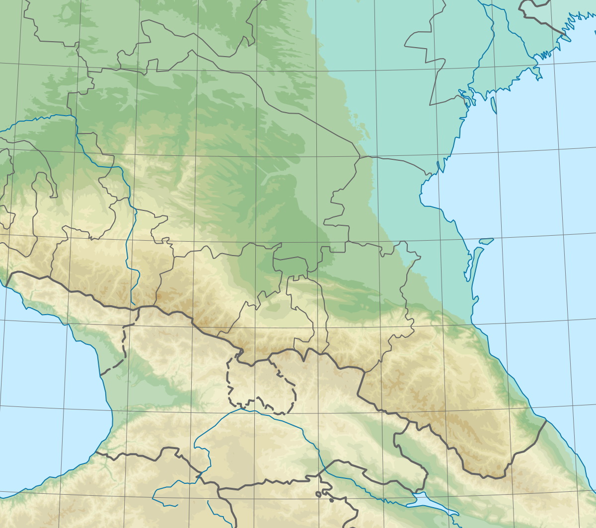
English: Physical map of the North Caucasian Federal District in Russia.
    x = sin({{{3}}}/82.558-0.539)*(1485.08-14.3651*{{{2}}})+48.06
    y = cos({{{3}}}/82.558-0.539)*(1675.19-16.2041*{{{2}}})-916.31
Equidistant conic projection, central meridian: E 44° 30′, basic parallels: N 43° 9′ and N 44° 45′.Русский: Физическая карта Северо-Кавказского федерального округа Российской Федерации.
Проекция коническая равнопромежуточная. Центральный меридиан: 44° 30′ в.д., базовые параллели: 43° 9′ с.ш. и 44° 45′ с.ш. |
||||||||
| Date | |||||||||
| Source | Own work, based on Natural Earth data | ||||||||
| Author | Hellerick | ||||||||
| Other versions |
[]
|


Licensing
[edit]
I, the copyright holder of this work, hereby publish it under the following license:
This file is licensed under the Creative Commons Attribution-Share Alike 3.0 Unported license.
- You are free:
- to share – to copy, distribute and transmit the work
- to remix – to adapt the work
- Under the following conditions:
- attribution – You must give appropriate credit, provide a link to the license, and indicate if changes were made. You may do so in any reasonable manner, but not in any way that suggests the licensor endorses you or your use.
- share alike – If you remix, transform, or build upon the material, you must distribute your contributions under the same or compatible license as the original.
File history
Click on a date/time to view the file as it appeared at that time.
| Date/Time | Thumbnail | Dimensions | User | Comment | |
|---|---|---|---|---|---|
| current | 07:32, 11 February 2020 | | 1,200 × 1,064 (300 KB) | Takhirgeran Umar (talk | contribs) | Reverted to version as of 12:39, 7 September 2013 (UTC) |
| 09:36, 29 January 2020 |  | 2,000 × 1,773 (1.38 MB) | Takhirgeran Umar (talk | contribs) | об | |
| 12:39, 7 September 2013 |  | 1,200 × 1,064 (300 KB) | Hellerick (talk | contribs) | User created page with UploadWizard |
You cannot overwrite this file.
File usage on Commons
The following 19 pages use this file:
- User:Hellerick
- File:Outline Map of Central Russia.svg
- File:Outline Map of Far Eastern Federal District.svg
- File:Outline Map of North Caucasian Federal District.svg
- File:Outline Map of Northwestern Federal District.svg
- File:Outline Map of Southern Federal District.svg
- File:Outline Map of Volga Federal District.svg
- File:Outline map of Urals Federal District.svg
- File:Relief Map of Central Russia.png
- File:Relief Map of Far Eastern Federal District.jpg
- File:Relief Map of North Caucasian Federal District.jpg
- File:Relief Map of North Caucasian Federal District.svg
- File:Relief Map of Northwestern Federal District.jpg
- File:Relief Map of Southern Federal District.jpg
- File:Relief Map of Southern Federal District.svg
- File:Relief Map of Volga Federal District.jpg
- File:Relief map of Urals Federal District.jpg
- File:Relief map of Urals Federal District.svg
- Template:Other versions/Federal Districts of Russia
File usage on other wikis
The following other wikis use this file:
- Usage on az.wikipedia.org
- Usage on ba.wikipedia.org
- Usage on ce.wikipedia.org
- Usage on da.wikipedia.org
- Usage on en.wikipedia.org
- Usage on eo.wikipedia.org
- Usage on fr.wikipedia.org
- Usage on hr.wikipedia.org
- Usage on inh.wikipedia.org
- Usage on it.wikipedia.org
- Usage on ja.wikipedia.org
- Usage on ko.wikipedia.org
- Usage on os.wikipedia.org
- Usage on ru.wikipedia.org
- Терек
- Ставропольская возвышенность
- Северо-Кавказский федеральный округ
- Кума (река, впадает в Каспийское море)
- Тамбукан (озеро)
- Тебулосмта
- Ногайская степь
- Егорлык
- Сунженский хребет
- Кизлярский залив
- Большой Ставропольский канал
- Терский хребет
- Шаблон:ПозКарта Россия Северо-Кавказский ФО
- Участник:Hellerick/Песочница/ПозКарта
- Западная ильменно-бугровая равнина
- Проект:Графическая мастерская/Заявки/Архив/2015/12
View more global usage of this file.