File:Relief Map of New Siberian Islands.png
Jump to navigation
Jump to search
No higher resolution available.
Relief_Map_of_New_Siberian_Islands.png (675 × 546 pixels, file size: 304 KB, MIME type: image/png)
Captions
Captions
Add a one-line explanation of what this file represents
Summary
[edit]| Description |
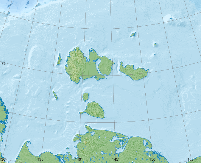
Русский: Новосибирские острова, физическая карта.
|
| Date | |
| Source |
|
| Author | Nzeemin |
| Other versions |
|

Licensing
[edit]
I, the copyright holder of this work, hereby publish it under the following license:
This file is licensed under the Creative Commons Attribution-Share Alike 3.0 Unported license.
- You are free:
- to share – to copy, distribute and transmit the work
- to remix – to adapt the work
- Under the following conditions:
- attribution – You must give appropriate credit, provide a link to the license, and indicate if changes were made. You may do so in any reasonable manner, but not in any way that suggests the licensor endorses you or your use.
- share alike – If you remix, transform, or build upon the material, you must distribute your contributions under the same or compatible license as the original.
Source Code
[edit]
set PATH=C:\programs\GMT5\bin;%PATH%
set GSBIN=C:\PROGRA~1\gs\gs9.04/bin

set COORDS=129.8/70.8/163.2/77.5
rem width = xmaxsvg / 150.0 * 2.54
set PAPERX=11.43
rem height = ymaxsvg / 150.0 * 2.54
set PAPERY=9.25
set PROJNCOORDS=-JA143/74.5/4.5i -R%COORDS%r

grdraster 34 -R122/164/70/79 -Gh.grd
grdgradient h.grd -Ne0.3 -A315 -M -Ghi.grd
if not errorlevel 0 goto End

pscoast.exe %PROJNCOORDS% -Gc -Df -P --PAPER_MEDIA=Custom_%PAPERX%cx%PAPERY%c -X0 -Y0 -K > map.eps
grdimage h.grd -Ihi.grd -Cmount.cpt -P %PROJNCOORDS% --PAPER_MEDIA=Custom_%PAPERX%cx%PAPERY%c -X0 -Y0 -O -K >> map.eps
if not errorlevel 0 goto End
pscoast.exe %PROJNCOORDS% -Q -Df -P --PAPER_MEDIA=Custom_%PAPERX%cx%PAPERY%c -X0 -Y0 -O -K >> map.eps

rem grdimage h_cor_cut.grd -Ihi.grd -Cwiki-water-verlauf2.cpt -P %COORDSCUT% --PAPER_MEDIA=Custom_%PAPERX%cx%PAPERY%c -X0 -Y0 -K -O >> map.eps
if not errorlevel 0 goto End

grdcut.exe ETOPO1_Bed_g_gmt4.grd -R122/164/70/79 -Gh_cor_cut.grd
grdgradient h_cor_cut.grd -Ne0.3 -A315 -M -Ghi.grd
if not errorlevel 0 goto End

pscoast %PROJNCOORDS% -Sc -Df -P --PAPER_MEDIA=Custom_%PAPERX%cx%PAPERY%c -X0 -Y0 -O -K >> map.eps
if not errorlevel 0 goto End
grdimage h_cor_cut.grd -Ihi.grd -Cwiki-water-verlauf2.cpt -P %PROJNCOORDS% --PAPER_MEDIA=Custom_%PAPERX%cx%PAPERY%c -X0 -Y0 -K -O >> map.eps
if not errorlevel 0 goto End
rem grdcontour h_cor_cut.grd -C250 -Wc0.2p,#0978AB -P %PROJNCOORDS% --PAPER_MEDIA=Custom_%PAPERX%cx%PAPERY%c -X0 -Y0 -K -O >> map.eps
if not errorlevel 0 goto End
pscoast %PROJNCOORDS% -Q -Df -P --PAPER_MEDIA=Custom_%PAPERX%cx%PAPERY%c -X0 -Y0 -O -K >> map.eps
if not errorlevel 0 goto End

pscoast.exe %PROJNCOORDS% -W0.25,#0978AB -Df -P --PAPER_MEDIA=Custom_%PAPERX%cx%PAPERY%c -X0 -Y0 -O -K >> map.eps

psbasemap %PROJNCOORDS% -Ba5S --PLOT_DEGREE_FORMAT=ddd:mm --ANNOT_FONT_SIZE_PRIMARY=6p -P --MAP_ANNOT_OFFSET_PRIMARY=0 --PAPER_MEDIA=Custom_%PAPERX%cx%PAPERY%c --OBLIQUE_ANNOTATION=6 --BASEMAP_FRAME_RGB=+9/120/171 --FRAME_PEN=0p,0_100:0p --TICK_PEN=0p,0_100:0p --TICK_LENGTH=-0.3c -X0 -Y0 -O -K >> map.eps
if not errorlevel 0 goto End
psbasemap %PROJNCOORDS% -Ba5W --PLOT_DEGREE_FORMAT=ddd:mm --ANNOT_FONT_SIZE_PRIMARY=6p -P --MAP_ANNOT_OFFSET_PRIMARY=0 --PAPER_MEDIA=Custom_%PAPERX%cx%PAPERY%c --OBLIQUE_ANNOTATION=6 --BASEMAP_FRAME_RGB=+9/120/171 --FRAME_PEN=0p,0_100:0p --TICK_PEN=0p,0_100:0p --TICK_LENGTH=-0.4c -X0 -Y0 -O -K >> map.eps
if not errorlevel 0 goto End

gmtset GRID_PEN_PRIMARY = 0.08p,#606060
psbasemap %PROJNCOORDS% -Bg5/g2+1 --FRAME_PEN=0p,0_100:0p -P --PAPER_MEDIA=Custom_%PAPERX%cx%PAPERY%c -X0 -Y0 -O >> map.eps
if not errorlevel 0 goto End

%GSBIN%\gswin32c.exe -dSAFER -dBATCH -dNOPAUSE -dGraphicsAlphaBits=4 -sDEVICE=pngalpha -dEPSCrop -r150 -sOutputFile=Oblast_phys_1.png map.eps
if not errorlevel 0 goto End

del h.grd
del hi.grd

:End
File history
Click on a date/time to view the file as it appeared at that time.
| Date/Time | Thumbnail | Dimensions | User | Comment | |
|---|---|---|---|---|---|
| current | 19:11, 31 May 2015 | | 675 × 546 (304 KB) | Cmdrjameson (talk | contribs) | Compressed with pngout. Reduced by 142kB (31% decrease). |
| 08:34, 7 April 2012 |  | 675 × 546 (447 KB) | Nzeemin (talk | contribs) | frame removed | |
| 19:42, 4 April 2012 |  | 675 × 546 (444 KB) | Nzeemin (talk | contribs) |
You cannot overwrite this file.
File usage on Commons
The following page uses this file:
File usage on other wikis
The following other wikis use this file:
- Usage on az.wikipedia.org
- Usage on ba.wikipedia.org
- Usage on be.wikipedia.org
- Usage on ceb.wikipedia.org
- Usage on de.wikipedia.org
- Usage on es.wikipedia.org
- Usage on et.wikipedia.org
- Usage on fr.wikipedia.org
- Usage on he.wikipedia.org
- Usage on hr.wikipedia.org
- Usage on hy.wikipedia.org
- Usage on ja.wikipedia.org
- Usage on os.wikipedia.org
- Usage on pl.wikipedia.org
- Usage on ru.wikipedia.org
View more global usage of this file.