File:Regattastrecke dove elbe ausbau vergleich 1880.jpg
Jump to navigation
Jump to search
Size of this preview: 800 × 491 pixels. Other resolutions: 320 × 197 pixels | 640 × 393 pixels | 1,024 × 629 pixels | 1,280 × 786 pixels | 1,804 × 1,108 pixels.
Original file (1,804 × 1,108 pixels, file size: 1.08 MB, MIME type: image/jpeg)
Captions
Captions
Add a one-line explanation of what this file represents
Summary
[edit]
| Description |
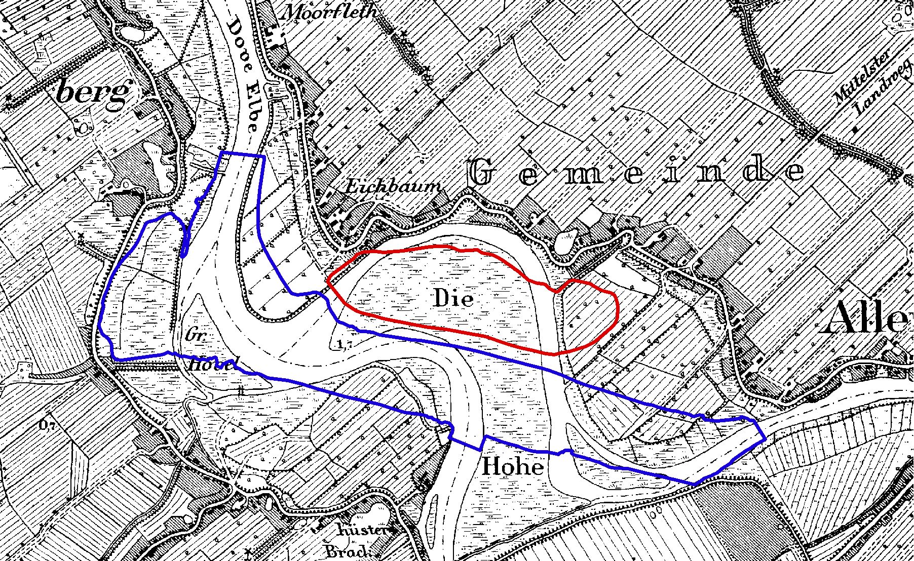
English: Map shows the original course of the "Dove Elbe" and "Gose Elbe" in the year 1880. Blue line shows the actual water's edge of the Dove Elbe, originated by the construction of the regatta area, red line shows the actual water's edge of the "Eichbaumsee"
Deutsch: Karte zeigt ursprünglichen Verlauf von Dove und Gose Elbe aus dem Jahr 1880. Blau gekennzeichnet ist der heutige Gewässeruferverlauf, entstanden durch den Ausbau der Regattastrecke. Rot gekennzeichnet ist der heutige Eichbaumsee. |
| Date | |
| Source |
Preußische Landesaufnahme 1880 Archiv Dinse |
| Author | Preußische Landesaufnahme |
Die gekennzeichneten Grenzen wurden mittels ARCGIS in die alte Karte digitalisiert.
Licensing
[edit]
I, the copyright holder of this work, hereby publish it under the following license:
| This file is made available under the Creative Commons CC0 1.0 Universal Public Domain Dedication. | |
| The person who associated a work with this deed has dedicated the work to the public domain by waiving all of their rights to the work worldwide under copyright law, including all related and neighboring rights, to the extent allowed by law. You can copy, modify, distribute and perform the work, even for commercial purposes, all without asking permission.
|
File history
Click on a date/time to view the file as it appeared at that time.
| Date/Time | Thumbnail | Dimensions | User | Comment | |
|---|---|---|---|---|---|
| current | 12:03, 6 February 2011 | | 1,804 × 1,108 (1.08 MB) | Volker Dinse (talk | contribs) | {{Information |Description ={{en|1=Map shows the original course of the "Dove Elbe" and "Gose Elbe" in the year 1880. Blue line shows the actual water's edge of the Dove Elbe, originated by the construction of the regatta area, red line shows the actua |
You cannot overwrite this file.
File usage on Commons
The following page uses this file:
File usage on other wikis
The following other wikis use this file:
- Usage on de.wikipedia.org