File:Red Rock Canyon NCA (9422129357).jpg
Original file (2,027 × 2,876 pixels, file size: 4.56 MB, MIME type: image/jpeg)
Captions
Captions
Summary
[edit].jpg&action=edit§ion=1)
| Description |
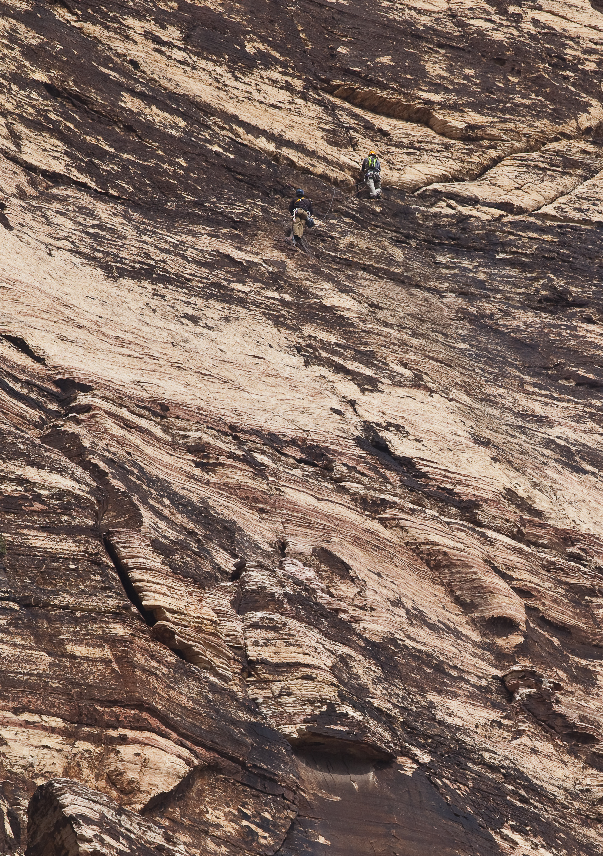
Red Rock Canyon was designated as Nevada's first National Conservation Area. Red Rock Canyon is located 17 miles west of the Las Vegas Strip on Charleston Boulevard/State Route 159. The area is 195,819 acres and is visited by more than one million people each year. In marked contrast to a town geared to entertainment and gaming, Red Rock offers enticements of a different nature including a 13-mile scenic drive, more than 30 miles of hiking trails, rock climbing, horseback riding, mountain biking, road biking, picnic areas, nature observing and visitor center with exhibit rooms and a book store. The unique geologic features, plants and animals of Red Rock represent some of the best examples of the Mojave Desert. In 1990, special legislation supported by the Nevada congressional delegation, changed the status of the Red Rock Recreation Lands to a National Conservation Area (NCA), the seventh to be designated nationally. This legislation provides the funding to protect and improve the area. Red Rock Canyon National Conservation Area is enjoyed by the local population as well as visitors from the United States and many foreign countries. One million visitors each year enjoy the spectacular desert landscape, climbing and hiking opportunities, and interpretive programs sponsored by the BLM. Learn more about the NCA: www.blm.gov/nv/st/en/fo/lvfo/blm_programs/blm_special_are... |
| Date | |
| Source | Red Rock Canyon NCA |
| Author | Bureau of Land Management |
Licensing
[edit].jpg&action=edit§ion=2)
- You are free:
- to share – to copy, distribute and transmit the work
- to remix – to adapt the work
- Under the following conditions:
- attribution – You must give appropriate credit, provide a link to the license, and indicate if changes were made. You may do so in any reasonable manner, but not in any way that suggests the licensor endorses you or your use.
| This image was originally posted to Flickr by mypubliclands at https://flickr.com/photos/91981596@N06/9422129357. It was reviewed on 5 August 2015 by FlickreviewR and was confirmed to be licensed under the terms of the cc-by-2.0. |
| This image is a work of a Bureau of Land Management* employee, taken or made as part of that person's official duties. As a work of the U.S. federal government, the image is in the public domain in the United States. *or predecessor organization |
File history
Click on a date/time to view the file as it appeared at that time.
| Date/Time | Thumbnail | Dimensions | User | Comment | |
|---|---|---|---|---|---|
| current | 20:18, 4 August 2015 | | 2,027 × 2,876 (4.56 MB) | Wilfredor (talk | contribs) | Transferred from Flickr via Flickr2Commons |
You cannot overwrite this file.
File usage on Commons
There are no pages that use this file.
.jpg&oldid=888332341)