File:Reconstructed Weinbrenner Citymap of Karlsruhe 1823.svg
Jump to navigation
Jump to search

Size of this PNG preview of this SVG file: 799 × 599 pixels. Other resolutions: 320 × 240 pixels | 640 × 480 pixels | 1,024 × 768 pixels | 1,280 × 960 pixels | 2,560 × 1,920 pixels | 3,634 × 2,726 pixels.
Original file (SVG file, nominally 3,634 × 2,726 pixels, file size: 2.06 MB)
Captions
Captions
Add a one-line explanation of what this file represents
Summary
[edit]| Description |
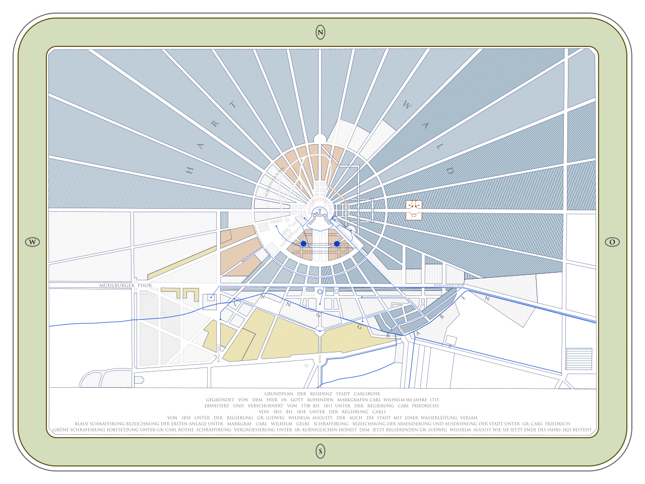
Deutsch: 2D Rekonstruktion des Weinbrenner Stadtplans von Karlsruhe aus der Karlsruher Pyramide. Entworfen von Friedrich Weinbrenner, 1823.
English: 2D reconstruction of the Weinbrenner citymap of Karlsruhe stored inside Karlsruhe's pyramid. The original was designed by Friedrich Weinbrenner. |
|||||||||||||||||||||||
| Date | ||||||||||||||||||||||||
| Source | Own work | |||||||||||||||||||||||
| Author |
2D reconstruction by Dr. Schorsch (talk) Original:
|
|||||||||||||||||||||||

| Object location | | View this and other nearby images on: OpenStreetMap |
|---|
Licensing
[edit]
I, the copyright holder of this work, hereby publish it under the following license:
This file is licensed under the Creative Commons Attribution-Share Alike 4.0 International license.
- You are free:
- to share – to copy, distribute and transmit the work
- to remix – to adapt the work
- Under the following conditions:
- attribution – You must give appropriate credit, provide a link to the license, and indicate if changes were made. You may do so in any reasonable manner, but not in any way that suggests the licensor endorses you or your use.
- share alike – If you remix, transform, or build upon the material, you must distribute your contributions under the same or compatible license as the original.
File history
Click on a date/time to view the file as it appeared at that time.
| Date/Time | Thumbnail | Dimensions | User | Comment | |
|---|---|---|---|---|---|
| current | 10:28, 1 February 2021 | | 3,634 × 2,726 (2.06 MB) | Xorx (talk | contribs) | New version with outer background rectangle filled in white to produce better thumbnail views. |
| 08:20, 28 January 2021 |  | 3,634 × 2,726 (2.06 MB) | Xorx (talk | contribs) | Uploaded own work with UploadWizard |
You cannot overwrite this file.
File usage on Commons
The following 3 pages use this file:
File usage on other wikis
The following other wikis use this file:
- Usage on de.wikipedia.org
- Usage on www.wikidata.org