File:Ready for Development - geograph.org.uk - 1073597.jpg
Jump to navigation
Jump to search
No higher resolution available.
Ready_for_Development_-_geograph.org.uk_-_1073597.jpg (640 × 479 pixels, file size: 80 KB, MIME type: image/jpeg)
Captions
Captions
Add a one-line explanation of what this file represents
Summary
[edit]
| Description |
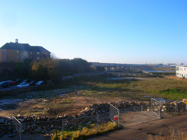
English: Ready for Development Taken from the embankment of the former Shoreham-Horsham line the small industrial unit that once occupied this spot has been demolished and is awaiting redevelopment. The railway and its bridge over the Adur is to the left with the northern edge of the Ropetackle development beyond it. A similar riverfront project may well be planned for this part. |
| Date | |
| Source | From geograph.org.uk |
| Author | Simon Carey |
| Attribution (required by the license) | Simon Carey / Ready for Development / |
| Camera location | | View this and other nearby images on: OpenStreetMap |
|---|
_heading:202.00&language=en)
| Object location | | View this and other nearby images on: OpenStreetMap |
|---|
_heading:202.00&language=en)
Licensing
[edit]

|
This image was taken from the Geograph project collection. See this photograph's page on the Geograph website for the photographer's contact details. The copyright on this image is owned by Simon Carey and is licensed for reuse under the Creative Commons Attribution-ShareAlike 2.0 license.
|
This file is licensed under the Creative Commons Attribution-Share Alike 2.0 Generic license.
Attribution: Simon Carey
- You are free:
- to share – to copy, distribute and transmit the work
- to remix – to adapt the work
- Under the following conditions:
- attribution – You must give appropriate credit, provide a link to the license, and indicate if changes were made. You may do so in any reasonable manner, but not in any way that suggests the licensor endorses you or your use.
- share alike – If you remix, transform, or build upon the material, you must distribute your contributions under the same or compatible license as the original.
File history
Click on a date/time to view the file as it appeared at that time.
| Date/Time | Thumbnail | Dimensions | User | Comment | |
|---|---|---|---|---|---|
| current | 08:10, 24 February 2011 | | 640 × 479 (80 KB) | GeographBot (talk | contribs) | == {{int:filedesc}} == {{Information |description={{en|1=Ready for Development Taken from the embankment of the former Shoreham-Horsham line the small industrial unit that once occupied this spot has been demolished and is awaiting redevelopment. The rail |
You cannot overwrite this file.
File usage on Commons
There are no pages that use this file.