File:Raydon-7Sep1946.png
From Wikimedia Commons, the free media repository
Jump to navigation
Jump to search

Size of this preview: 437 × 599 pixels. Other resolutions: 175 × 240 pixels | 350 × 480 pixels | 700 × 959 pixels.
Original file (700 × 959 pixels, file size: 782 KB, MIME type: image/png)
File information
Structured data
Captions
Captions
Add a one-line explanation of what this file represents
| DescriptionRaydon-7Sep1946.png |
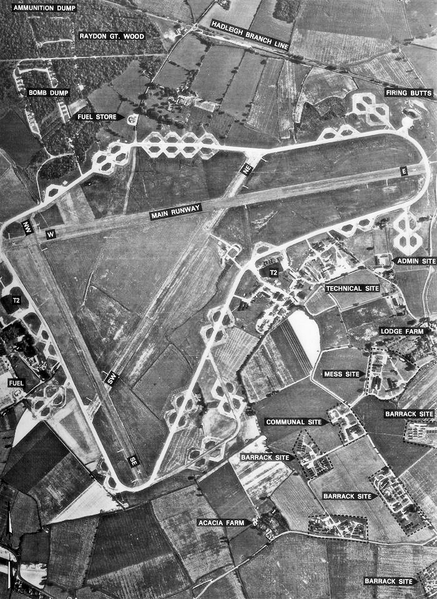
English: Aerial mapping photograph of RAF Raydon, England. |
||||
| Date | |||||
| Source | British Royal Ordiance Survey | ||||
| Author | British Government | ||||
| Permission (Reusing this file) |
|
Original upload log
[edit]The original description page was here. All following user names refer to en.wikipedia.
| Upload date | User | Bytes | Dimensions | Comment |
|---|---|---|---|---|
| 2006-03-19 18:14:45 | Bwmoll3 | 200606 | 700×959 | Aerial mapping photograph of RAF Raydon, taken 7 September 1946 Source: British Royal Ordiance Survey |
File history
Click on a date/time to view the file as it appeared at that time.
| Date/Time | Thumbnail | Dimensions | User | Comment | |
|---|---|---|---|---|---|
| current | 14:34, 19 February 2010 |  | 700 × 959 (782 KB) | Bwmoll3 (talk | contribs) | {{BotMoveToCommons|en.wikipedia|year={{subst:CURRENTYEAR}}|month={{subst:CURRENTMONTHNAME}}|day={{subst:CURRENTDAY}}}} == Summary == Aerial mapping photograph of RAF Raydon, taken 7 September 1946 Source: British Royal Ordiance Survey == Licensing == {{ |
You cannot overwrite this file.
File usage on Commons
The following page uses this file:
File usage on other wikis
The following other wikis use this file:
- Usage on en.wikipedia.org
- Usage on www.wikidata.org
