File:Rathbun Lake-Sunset Boat.jpg
Rathbun_Lake-Sunset_Boat.jpg (640 × 427 pixels, file size: 216 KB, MIME type: image/jpeg)
Captions
Summary
[edit]DescriptionRathbun Lake-Sunset Boat.jpg |
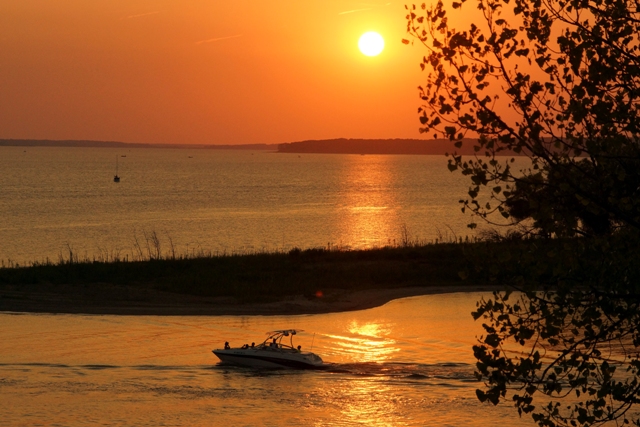
English: Boaters enjoying a sunset cruise on Rathbun Lake near Centerville, Iowa. |
Date | |
Source | http://www.nwk.usace.army.mil/Media/Images.aspx?mgqs=3Rathbun&page=1&stype=0 U.S. Army Corps of Engineers website. |
Author | Unknown employee of the United States Army Corps of Engineer. |
Camera location | 40° 50′ 08.31″ N, 92° 52′ 34.06″ W | View this and other nearby images on: OpenStreetMap | 40.835642; -92.876128 |
---|
This image was created by an employee of the U.S. Federal government.
Licensing
[edit]Public domainPublic domainfalsefalse |
This file is a work of a U.S. Army soldier or employee, taken or made as part of that person's official duties. As a work of the U.S. federal government, it is in the public domain in the United States.
العربية ∙ বাংলা ∙ català ∙ čeština ∙ Deutsch ∙ English ∙ español ∙ eesti ∙ فارسی ∙ suomi ∙ français ∙ hrvatski ∙ magyar ∙ Bahasa Indonesia ∙ italiano ∙ 日本語 ∙ 한국어 ∙ lietuvių ∙ македонски ∙ മലയാളം ∙ မြန်မာဘာသာ ∙ Nederlands ∙ polski ∙ português ∙ русский ∙ sicilianu ∙ српски / srpski ∙ Türkçe ∙ українська ∙ Tiếng Việt ∙ 中文(简体) ∙ 中文(繁體) ∙ +/− |
File history
Click on a date/time to view the file as it appeared at that time.
Date/Time | Thumbnail | Dimensions | User | Comment | |
---|---|---|---|---|---|
current | 01:37, 12 October 2012 | 640 × 427 (216 KB) | Sector001 (talk | contribs) | User created page with UploadWizard |
You cannot overwrite this file.
File usage on Commons
The following page uses this file:
File usage on other wikis
The following other wikis use this file:
- Usage on de.wikipedia.org
- Usage on en.wikipedia.org
Metadata
This file contains additional information such as Exif metadata which may have been added by the digital camera, scanner, or software program used to create or digitize it. If the file has been modified from its original state, some details such as the timestamp may not fully reflect those of the original file. The timestamp is only as accurate as the clock in the camera, and it may be completely wrong.
Image title |
|
---|---|
Camera manufacturer | SONY |
Camera model | SLT-A65V |
Exposure time | 1/1,250 sec (0.0008) |
F-number | f/9 |
ISO speed rating | 800 |
Date and time of data generation | 20:08, 3 August 2012 |
Lens focal length | 85 mm |
Latitude | 40° 50′ 8.31″ N |
Longitude | 92° 52′ 34.06″ W |
Altitude | 278.21 meters above sea level |
Short title |
|
Orientation | Normal |
Software used | Adobe Photoshop CS2 Windows |
File change date and time | 11:55, 4 October 2012 |
Y and C positioning | Co-sited |
Exposure Program | Normal program |
Exif version | 2.3 |
Date and time of digitizing | 20:08, 3 August 2012 |
Meaning of each component |
|
Image compression mode | 2 |
APEX brightness | 8.62265625 |
APEX exposure bias | 0 |
Maximum land aperture | 4.96875 APEX (f/5.6) |
Metering mode | Pattern |
Light source | Unknown |
Flash | Flash did not fire, compulsory flash suppression |
DateTimeOriginal subseconds | 00 |
DateTimeDigitized subseconds | 00 |
Supported Flashpix version | 1 |
Color space | sRGB |
File source | Digital still camera |
Scene type | A directly photographed image |
Custom image processing | Normal process |
Exposure mode | Auto exposure |
White balance | Auto white balance |
Focal length in 35 mm film | 127 mm |
Scene capture type | Standard |
Contrast | Normal |
Saturation | Normal |
Sharpness | Normal |
GPS time (atomic clock) | 01:08 |
Receiver status | Measurement in progress |
Measurement mode | 3-dimensional measurement |
Measurement precision | Poor (2.1983) |
Speed unit | Kilometers per hour |
Speed of GPS receiver | 1.729 |
Reference for direction of movement | True direction |
Direction of movement | 197.54 |
Geodetic survey data used | WGS-84 |
GPS date | 4 August 2012 |
GPS differential correction | 0 |
GPS tag version | 2.3.0.0 |
Keywords | Recreation |