File:Rathbun Lake, Iowa (11004128035).jpg

Original file (4,000 × 3,000 pixels, file size: 2.55 MB, MIME type: image/jpeg)
Captions
Captions
Summary
[edit].jpg&action=edit§ion=1)
| Description |
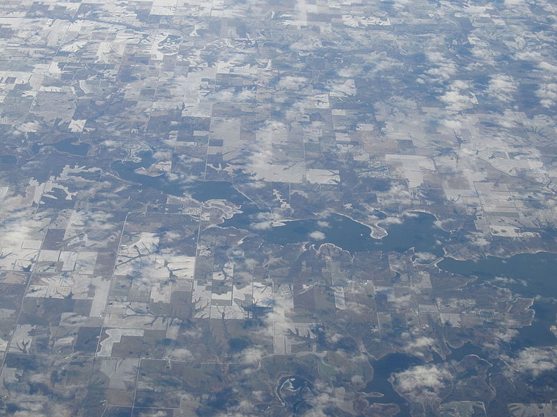
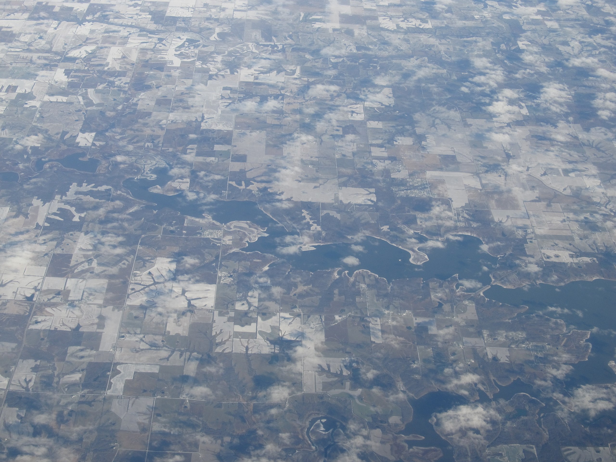
Rathbun Lake was constructed and is operated by the U.S. Army Corps of Engineers. Located at Chariton River mile marker 142, approximately 7 miles north of Centerville, Iowa, in Appanoose County, it is one of the largest lakes in Iowa. The lake was constructed to control flooding, provide recreation opportunities, abate stream pollution, fish and wildlife enhancement, and maintain minimum stream flow on the Chariton, Missouri, and Mississippi Rivers. The Chariton and South Fork of the Chariton River are the major sources of water flowing into Rathbun Lake. Camping, sightseeing, fishing, boating, picnicking and hunting are favorite activities on and near Rathbun Lake. The lake’s fish and wildlife resources provide sightseers, fisherman, and hunters ample opportunities for their sports. Bald eagles, white-tailed deer, Canada geese, wild turkey, crappie, walleye, channel catfish and other wildlife can be found at Rathbun Lake. The size of the lake combined with the prevailing winds make Rathbun Lake one of the best sailing lakes in Iowa. Two marina concession areas provide a full line of marina services. Rathbun Lake is home to the Rathbun Yacht Club. Boaters enjoying a sunset cruise on Rathbun Lake. Eight parks have been developed for public recreation. Six are managed by the Corps of Engineers, and one state park is managed by the Iowa Department of Natural Resources. Recreation facilities include boat ramps, courtesy docks, campgrounds, picnic areas and playgrounds. Honey Creek State Park Resort opened in 2008 and is Iowa's first-ever state-run resort with more than a hundred guest rooms, an 18-hole golf course, and an indoor water park. Rathbun Lake supplies the water treatment plant of Rathbun Regional Water Association (RRWA) which provides quality water to nearly 16,000 rural families, farms and communities in Iowa and Missouri. Average production at the plant during 2001 was 4.37 million gallons per day; however, the annual usage of the RRWA water system is equal to only 4 inches of Rathbun Lake water surface. en.wikipedia.org/wiki/Rathbun_lake en.wikipedia.org/wiki/Wikipedia:Text_of_Creative_Commons_... |
| Date | |
| Source | Rathbun Lake, Iowa |
| Author | Ken Lund from Reno, Nevada, USA |
| Camera location | | View this and other nearby images on: OpenStreetMap |
|---|
.jpg¶ms=040.878737_N_-093.066966_E_globe:Earth_type:camera_source:Flickr_&language=en)
Licensing
[edit].jpg&action=edit§ion=2)
- You are free:
- to share – to copy, distribute and transmit the work
- to remix – to adapt the work
- Under the following conditions:
- attribution – You must give appropriate credit, provide a link to the license, and indicate if changes were made. You may do so in any reasonable manner, but not in any way that suggests the licensor endorses you or your use.
- share alike – If you remix, transform, or build upon the material, you must distribute your contributions under the same or compatible license as the original.
| This image was originally posted to Flickr by Ken Lund at https://flickr.com/photos/75683070@N00/11004128035. It was reviewed on 4 December 2015 by FlickreviewR and was confirmed to be licensed under the terms of the cc-by-sa-2.0. |
File history
Click on a date/time to view the file as it appeared at that time.
| Date/Time | Thumbnail | Dimensions | User | Comment | |
|---|---|---|---|---|---|
| current | 00:57, 4 December 2015 | | 4,000 × 3,000 (2.55 MB) | INeverCry (talk | contribs) | Transferred from Flickr via Flickr2Commons |
You cannot overwrite this file.
File usage on Commons
There are no pages that use this file.
.jpg&oldid=893261540)