File:Rare cloudless image of the Faroe Islands.jpg

Original file (4,401 × 4,461 pixels, file size: 3.8 MB, MIME type: image/jpeg)
Captions
Captions
Summary
[edit]
| Description |
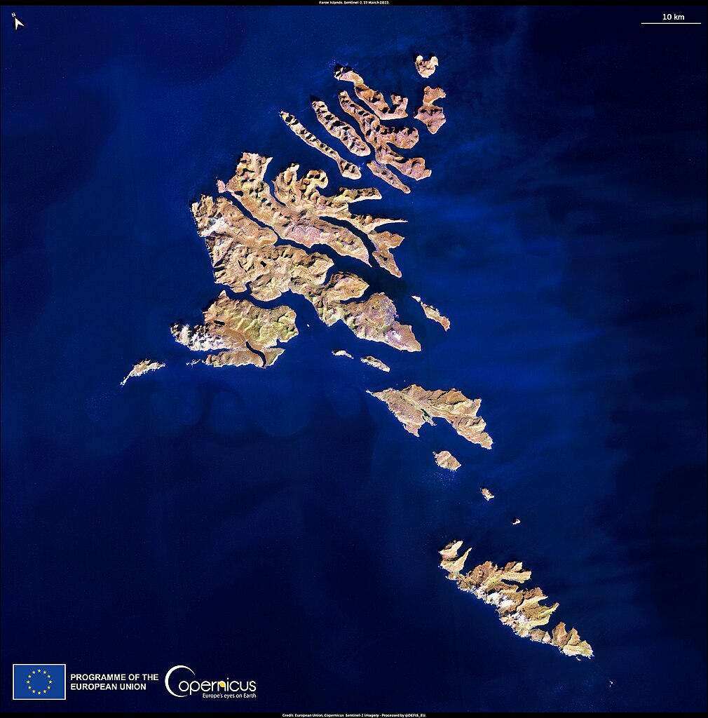
English: The Faroe Islands are an archipelago situated halfway between Iceland and Norway. Their remote location attracts high numbers of birds migrating over the North Atlantic Ocean: it is estimated that approximately 110 different species of birds can be found in the archipelago. The Atlantic Puffin is the second most numerous bird species in the Faroe Islands, and even though their population had started to diminish in recent years because of a reduction in fish stock close to the coast, it has now started to recover thanks to the new regulations put in place to preserve it. The Faroe Islands’ climate is influenced by cold currents coming from the Arctic Circle and mild currents coming from the Atlantic Ocean, resulting in a nearly constant presence of clouds. However, on 27 March 2022, one of the Copernicus Sentinel-2 satellites captured this rare cloudless image, thanks to the extended high-pressure area that has characterised northern Europe and part of the Atlantic Ocean during the month of March 2022. |
| Date | Taken on 27 March 2022 |
| Source | Rare cloudless image of the Faroe Islands |
| Author | European Union, Copernicus Sentinel-2 imagery |
Licensing
[edit]

|
This image contains data from a satellite in the Copernicus Programme, such as Sentinel-1, Sentinel-2 or Sentinel-3. Attribution is required when using this image.
Attribution: Contains modified Copernicus Sentinel data 2022
The use of Copernicus Sentinel Data is regulated under EU law (Commission Delegated Regulation (EU) No 1159/2013 and Regulation (EU) No 377/2014). Relevant excerpts:
Free access shall be given to GMES dedicated data [...] made available through GMES dissemination platforms [...].
Access to GMES dedicated data [...] shall be given for the purpose of the following use in so far as it is lawful:
GMES dedicated data [...] may be used worldwide without limitations in time.
GMES dedicated data and GMES service information are provided to users without any express or implied warranty, including as regards quality and suitability for any purpose. |
File history
Click on a date/time to view the file as it appeared at that time.
| Date/Time | Thumbnail | Dimensions | User | Comment | |
|---|---|---|---|---|---|
| current | 06:59, 30 August 2023 | | 4,401 × 4,461 (3.8 MB) | OptimusPrimeBot (talk | contribs) | #Spacemedia - Upload of https://www.copernicus.eu/system/files/2022-03/image_day/20220331_FaroeIslands.jpg via Commons:Spacemedia |
You cannot overwrite this file.
File usage on Commons
There are no pages that use this file.