File:Range walk on West Creech Hill - geograph.org.uk - 221658.jpg
Jump to navigation
Jump to search
No higher resolution available.
Range_walk_on_West_Creech_Hill_-_geograph.org.uk_-_221658.jpg (640 × 480 pixels, file size: 158 KB, MIME type: image/jpeg)
Captions
Captions
Add a one-line explanation of what this file represents
Summary
[edit]
| Description |
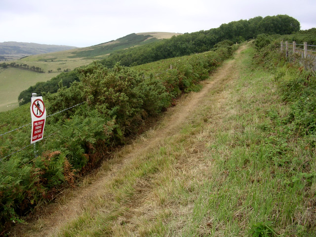
English: Range walk on West Creech Hill. This grid square is within the MoD's Lulworth ranges and public access to this grid square is limited to the road (to the right), this path, and the lane that branches off to the ruined village of Tyneham. These routes are only open when the range is not firing (most weekends and holidays) and they are checked by the MoD to ensure that they are free from unexploded shells and debris. |
| Date | |
| Source | From geograph.org.uk |
| Author | Jim Champion |
| Attribution (required by the license) | Jim Champion / Range walk on West Creech Hill / |
| Object location | | View this and other nearby images on: OpenStreetMap |
|---|
_heading:247.00&language=en)
Licensing
[edit]

|
This image was taken from the Geograph project collection. See this photograph's page on the Geograph website for the photographer's contact details. The copyright on this image is owned by Jim Champion and is licensed for reuse under the Creative Commons Attribution-ShareAlike 2.0 license.
|
This file is licensed under the Creative Commons Attribution-Share Alike 2.0 Generic license.
Attribution: Jim Champion
- You are free:
- to share – to copy, distribute and transmit the work
- to remix – to adapt the work
- Under the following conditions:
- attribution – You must give appropriate credit, provide a link to the license, and indicate if changes were made. You may do so in any reasonable manner, but not in any way that suggests the licensor endorses you or your use.
- share alike – If you remix, transform, or build upon the material, you must distribute your contributions under the same or compatible license as the original.
File history
Click on a date/time to view the file as it appeared at that time.
| Date/Time | Thumbnail | Dimensions | User | Comment | |
|---|---|---|---|---|---|
| current | 00:16, 1 February 2010 | | 640 × 480 (158 KB) | GeographBot (talk | contribs) | == {{int:filedesc}} == {{Information |description={{en|1=Range walk on West Creech Hill. This grid square is within the MoD's Lulworth ranges and public access to this grid square is limited to the road (to the right), this path, and the lane that branche |
You cannot overwrite this file.
File usage on Commons
There are no pages that use this file.