File:Rail, road and foot - geograph.org.uk - 388350.jpg
Jump to navigation
Jump to search
No higher resolution available.
Rail,_road_and_foot_-_geograph.org.uk_-_388350.jpg (640 × 406 pixels, file size: 128 KB, MIME type: image/jpeg)
Captions
Captions
Add a one-line explanation of what this file represents
Summary
[edit]
| Description |
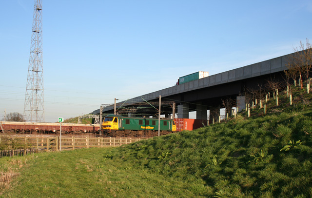
English: Rail, road and foot The A500 dual carriageway bridge over the railway just to the south of Crewe station, with a freight train emerging. Since the construction of the new dual carriageway, the public footpath from Gresty Road in Crewe to Basford has been diverted to go under the railway bridge rather than over the A500 embankment around 200m west. The tower (left) carries lights to illuminate the adjacent Basford Hall Sorting Sidings |
| Date | |
| Source | From geograph.org.uk |
| Author | Espresso Addict |
| Attribution (required by the license) | Espresso Addict / Rail, road and foot / |
| Camera location | | View this and other nearby images on: OpenStreetMap |
|---|
_heading:90.00&language=en)
| Object location | | View this and other nearby images on: OpenStreetMap |
|---|
_heading:90.00&language=en)
Licensing
[edit]

|
This image was taken from the Geograph project collection. See this photograph's page on the Geograph website for the photographer's contact details. The copyright on this image is owned by Espresso Addict and is licensed for reuse under the Creative Commons Attribution-ShareAlike 2.0 license.
|
This file is licensed under the Creative Commons Attribution-Share Alike 2.0 Generic license.
Attribution: Espresso Addict
- You are free:
- to share – to copy, distribute and transmit the work
- to remix – to adapt the work
- Under the following conditions:
- attribution – You must give appropriate credit, provide a link to the license, and indicate if changes were made. You may do so in any reasonable manner, but not in any way that suggests the licensor endorses you or your use.
- share alike – If you remix, transform, or build upon the material, you must distribute your contributions under the same or compatible license as the original.
- Remove redundant categories and try to put this image in the most specific category/categories
- Remove this template
- The location categories are based on information from this geonames tool and this OpenStreetMap tool combined with a database. You can also have a look at this tool from mysociety.
- The topic category from Geograph was Railway bridge (find similar images bridge at Geograph)
File history
Click on a date/time to view the file as it appeared at that time.
| Date/Time | Thumbnail | Dimensions | User | Comment | |
|---|---|---|---|---|---|
| current | 14:51, 3 February 2011 | | 640 × 406 (128 KB) | GeographBot (talk | contribs) | == {{int:filedesc}} == {{Information |description={{en|1=Rail, road and foot The A500 dual carriageway bridge over the railway just to the south of Crewe station, with a freight train emerging. Since the construction of the new dual carriageway, the publi |
You cannot overwrite this file.
File usage on Commons
There are no pages that use this file.
File usage on other wikis
The following other wikis use this file:
- Usage on ceb.wikipedia.org
- Usage on en.wikipedia.org
- Usage on www.wikidata.org