File:Raetischer Limes Rotenbachtal-Ansicht von Süden.jpg
Jump to navigation
Jump to search
Size of this preview: 800 × 533 pixels. Other resolutions: 320 × 213 pixels | 640 × 427 pixels | 1,024 × 683 pixels | 1,280 × 853 pixels | 2,560 × 1,707 pixels | 4,272 × 2,848 pixels.
Original file (4,272 × 2,848 pixels, file size: 6.57 MB, MIME type: image/jpeg)
Captions
Captions
Add a one-line explanation of what this file represents
Summary
[edit]
| Description |
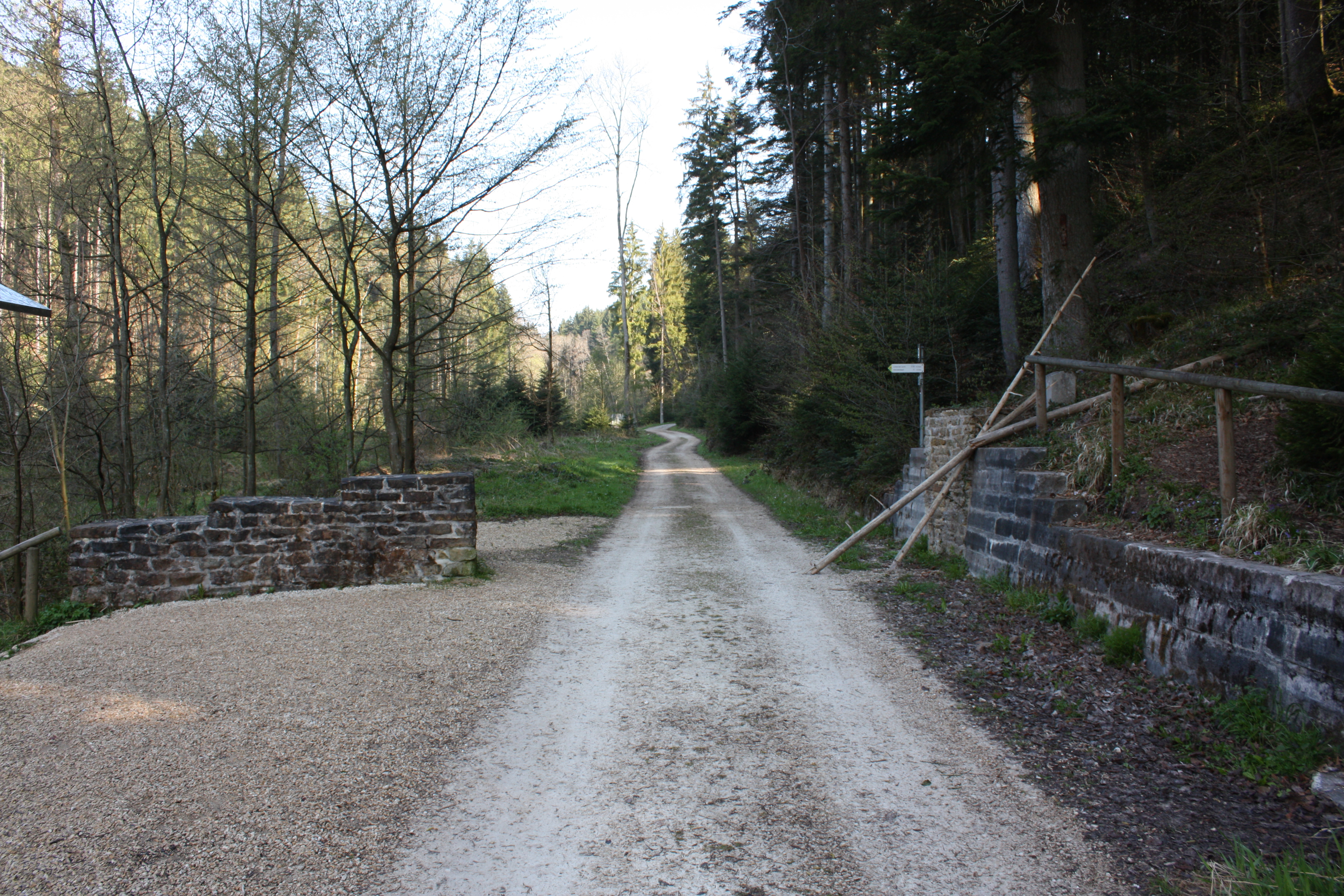
Deutsch: Ein rekonstruiertes Stück des Raetischen Limes im Rotenbachtal (Schwäbisch Gmünd), etwa 900 Meter vom Taleingang und vom Kleinkastell Freimühle entfernt. Ca. 90 m westlich von dieser Stelle endet der Obergermanische und beginnt der Raetische Limes. Ansicht von Süden.
In den feuchten Sedimenten des Rotenbachs erhielten sich mehrere Eichenholzpfähle (1977 und 1983 untersucht), die im Winter 163/164 n. Chr. gefällt wurden. |
| Date | |
| Source | Own work |
| Author | Vexillum |
Licensing
[edit]
I, the copyright holder of this work, hereby publish it under the following licenses:

|
Permission is granted to copy, distribute and/or modify this document under the terms of the GNU Free Documentation License, Version 1.2 or any later version published by the Free Software Foundation; with no Invariant Sections, no Front-Cover Texts, and no Back-Cover Texts. A copy of the license is included in the section entitled GNU Free Documentation License. |
This file is licensed under the Creative Commons Attribution 3.0 Unported license.
- You are free:
- to share – to copy, distribute and transmit the work
- to remix – to adapt the work
- Under the following conditions:
- attribution – You must give appropriate credit, provide a link to the license, and indicate if changes were made. You may do so in any reasonable manner, but not in any way that suggests the licensor endorses you or your use.
You may select the license of your choice.
File history
Click on a date/time to view the file as it appeared at that time.
| Date/Time | Thumbnail | Dimensions | User | Comment | |
|---|---|---|---|---|---|
| current | 12:02, 1 May 2011 | | 4,272 × 2,848 (6.57 MB) | Vexillum (talk | contribs) | {{Information |Description ={{de|1=Ein rekonstruiertes Stück des Raetischen Limes im Rotenbachtal (Schwäbisch Gmünd), etwa 900 Meter vom Taleingang und vom Kleinkastell Freimühle entfernt. Ca. 90 m westlich von dieser Stelle endet der Obergermanisc |
You cannot overwrite this file.
File usage on Commons
The following page uses this file:
File usage on other wikis
The following other wikis use this file:
- Usage on de.wikipedia.org