File:Radków (gmina w województwie dolnośląskim) location map.png

Original file (2,232 × 1,768 pixels, file size: 1.25 MB, MIME type: image/png)
Captions
Captions
Summary
[edit]_location_map.png&action=edit§ion=1)
| Description |
English: Location map. |
| Date | |
| Source | Own work |
| Author | Smat |
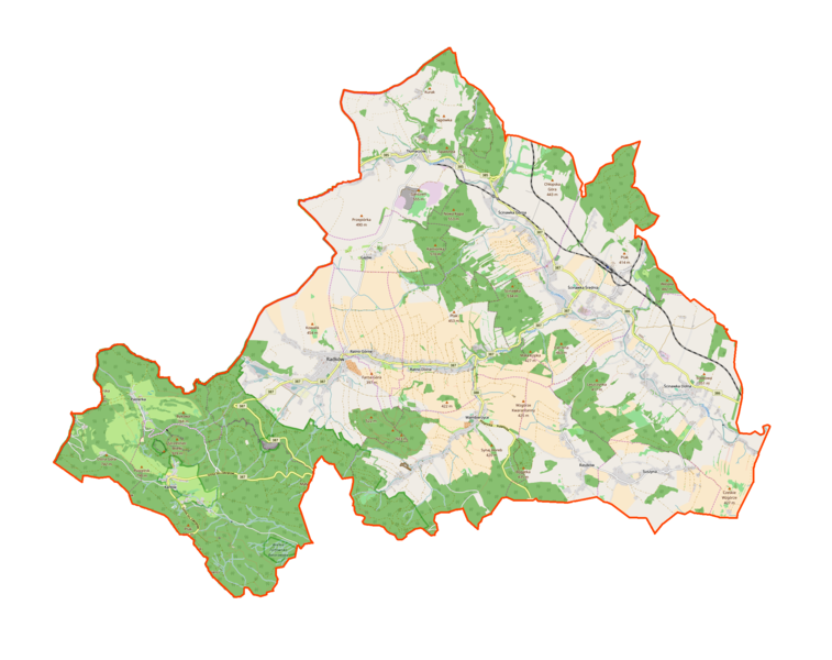
| Description |
Polski: Mapa gminy Radków, Polska
English: Map of Radków (gmina w województwie dolnośląskim), Poland |
|||||||||
| Date | ||||||||||
| Source | You may find a page on the OpenStreetMap wiki page for Radków (gmina w województwie dolnośląskim) | |||||||||
| Creator |
OpenStreetMap contributors OpenStreetMap contributors |
|||||||||
| Permission (Reusing this file) |
OpenStreetMap data is available under the Open Database License (details). Map tiles are licensed under the Creative Commons Attribution-ShareAlike 2.0 license (CC-BY-SA 2.0).
This file is licensed under the Creative Commons Attribution-Share Alike 2.0 Generic license.
|
|||||||||
| Geotemporal data | ||||||||||
| Bounding box |
|
|||||||||
| Georeferencing | If inappropriate please set warp_status = skip to hide. | |||||||||
Licensing
[edit]_location_map.png&action=edit§ion=2)
| This work contains information from OpenStreetMap, which is made available under the Open Database License (ODbL).
The ODbL does not require any particular license for maps produced from ODbL data. Prior to 1 August 2020, map tiles produced by the OpenStreetMap Foundation were licensed under the CC-BY-SA-2.0 license. Maps produced by other people may be subject to other licences. |
File history
Click on a date/time to view the file as it appeared at that time.
| Date/Time | Thumbnail | Dimensions | User | Comment | |
|---|---|---|---|---|---|
| current | 09:39, 11 December 2016 | | 2,232 × 1,768 (1.25 MB) | Smat (talk | contribs) | User created page with UploadWizard |
You cannot overwrite this file.
File usage on Commons
There are no pages that use this file.
File usage on other wikis
The following other wikis use this file:
- Usage on de.wikipedia.org
- Usage on pl.wikipedia.org
- Wambierzyce
- Radków (gmina w województwie dolnośląskim)
- Fort Karola
- Radków
- Zamek w Ratnie Dolnym
- Pasterka (wieś)
- Gajów
- Karłów
- Ratno Dolne
- Ratno Górne
- Suszyna (województwo dolnośląskie)
- Ścinawka Dolna
- Ścinawka Górna
- Ścinawka Średnia
- Tłumaczów
- Raszków (województwo dolnośląskie)
- Obszar ochrony ścisłej Wrota Pośny
- Ostra Góra (Pasterka)
- Zalew Radkowski
- Potok Czerwonogórski
- Posna
- Parafia św. Doroty w Radkowie
- Parafia św. Jakuba w Ścinawce Dolnej
- Parafia św. Marii Magdaleny w Ścinawce Średniej
- Parafia Nawiedzenia Najświętszej Maryi Panny w Wambierzycach
- Sanktuarium Wambierzyckiej Królowej Rodzin
- Ścinawka Średnia (stacja kolejowa)
- Zamek Kapitanowo w Ścinawce Średniej
- Dom Pomocy Społecznej dla Dzieci w Ścinawce Dolnej
- Radków (stacja kolejowa)
- Gorzuchówek
- Parafia Ewangelicko-Metodystyczna w Ścinawce Średniej
- Karłówek
- TSR Radków „Góra Guzowata”
- Bieganówek
- Błogocice (Ścinawka Górna)
- Janików (Tłumaczów)
- Księżno (Ścinawka Średnia)
- Leśna (Radków)
- Mrówieniec
- Nowy Świat (Ratno Dolne)
- Sarny (Ścinawka Górna)
- Tłumaczówek
- Rudawa (Tłumaczów)
- Skibin (Radków)
- Wygwizdów (Ścinawka Dolna)
- Jelenia Głowa (Wambierzyce)
- Boguszowice (Suszyna)
- Górne Wambierzyce
View more global usage of this file.
_location_map.png)
_location_map.png&oldid=607600919)