File:Radar map of southern Norway ESA211680.jpg
Jump to navigation
Jump to search
Size of this preview: 606 × 599 pixels. Other resolutions: 243 × 240 pixels | 485 × 480 pixels | 985 × 974 pixels.
Original file (985 × 974 pixels, file size: 825 KB, MIME type: image/jpeg)
Captions
Captions
Add a one-line explanation of what this file represents
Summary
[edit]
| Description |
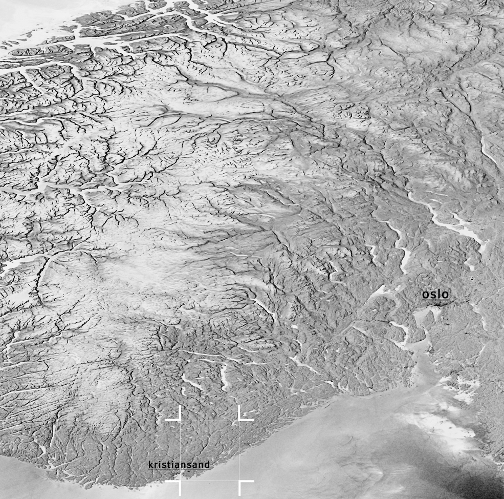
English: This image, recorded by the Advanced Synthetic Aperture Radar (ASAR) sensor on board Envisat, on 15 May 2008 shows the mountainous terrain of southern Norway. Due to the imaging technology of the radar instrument, mountains and valleys can be clearly depicted. |
| Date | |
| Source | http://www.esa.int/spaceinimages/Images/2008/06/Radar_map_of_southern_Norway |
| Author | European Space Agency |
| Permission (Reusing this file) |
ESA,CC BY-SA 3.0 IGO |
| Title | Radar map of southern Norway |
| Mission | Envisat |
| Activity | Observing the Earth |
Licensing
[edit]
This file is licensed under the Creative Commons Attribution-ShareAlike 3.0 IGO license.
Attribution: ESA
- You are free:
- to share – to copy, distribute and transmit the work
- to remix – to adapt the work
- Under the following conditions:
- attribution – You must give appropriate credit, provide a link to the license, and indicate if changes were made. You may do so in any reasonable manner, but not in any way that suggests the licensor endorses you or your use.
- share alike – If you remix, transform, or build upon the material, you must distribute your contributions under the same or compatible license as the original.
File history
Click on a date/time to view the file as it appeared at that time.
| Date/Time | Thumbnail | Dimensions | User | Comment | |
|---|---|---|---|---|---|
| current | 17:08, 24 May 2017 | | 985 × 974 (825 KB) | Fæ (talk | contribs) | European Space Agency, Id 211680, http://www.esa.int/spaceinimages/Images/2008/06/Radar_map_of_southern_Norway, User:Fæ/Project_list/ESA |
You cannot overwrite this file.
File usage on Commons
The following 2 pages use this file: