File:RU RYA Pitelinsky outline.svg

Original file (SVG file, nominally 455 × 471 pixels, file size: 286 KB)
Captions
Captions
Summary
[edit]
| Description |
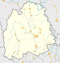
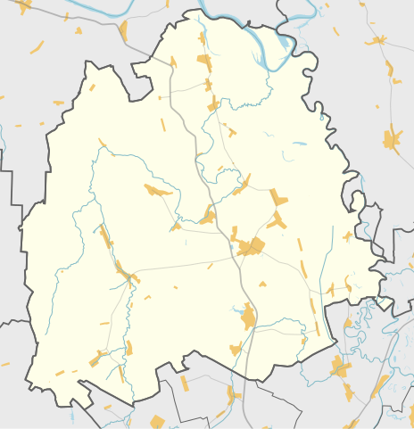
Русский: Карта, Пителинский район Рязанской области. |
| Date | |
| Source | Own work |
| Author | Nzeemin |
Licensing
[edit]
| Description |
This map was created from OpenStreetMap project data, collected by the community. This map may be incomplete, and may contain errors. Don't rely solely on it for navigation. |
|||
| Date | (see file history) | |||
| Source | openstreetmap.org | |||
| Creator |
OpenStreetMap contributors |
|||
| Permission (Reusing this file) |
OpenStreetMap data is available under the Open Database License (details). Map tiles are licensed under the Creative Commons Attribution-ShareAlike 2.0 license (CC-BY-SA 2.0).
This file is licensed under the Creative Commons Attribution-Share Alike 2.0 Generic license.
|
|||
| Georeferencing | If inappropriate please set warp_status = skip to hide. |
Details
[edit]
Maperitive commands:
set-geo-bounds 41.4375,54.416667,42.0625,54.791667
set-print-bounds-geo
zoom 10
export-svg compatibility=inkscape
File history
Click on a date/time to view the file as it appeared at that time.
| Date/Time | Thumbnail | Dimensions | User | Comment | |
|---|---|---|---|---|---|
| current | 17:05, 3 November 2014 | | 455 × 471 (286 KB) | Nzeemin (talk | contribs) | User created page with UploadWizard |
You cannot overwrite this file.
File usage on Commons
The following page uses this file:
File usage on other wikis
The following other wikis use this file:
- Usage on ce.wikipedia.org
- Usage on hy.wikipedia.org
- Usage on myv.wikipedia.org
- Usage on ru.wikipedia.org
- Пителинский район
- Пителино
- Пеньки (Рязанская область)
- Темирево
- Петас (река)
- Шаблон:ПозКарта Россия Рязанская область Пителинский район
- Участник:Nzeemin/Карты/Районы
- Веряево
- Ермо-Николаевка
- Потапьево
- Нестерово (Рязанская область)
- Высокие Поляны
- Краснопартизанский (Рязанская область)
- Полесье (Рязанская область)
- Савро-Мамышево
- Жуковка (Рязанская область)
- Кононовка (Рязанская область)
- Лукино (Пителинский район)
- Кошибеевка
- Пятницкий Яр
- Терентеево (Рязанская область)
- Пет (Пителинский район)
- Станищи
- Фалеевка (Рязанская область)
- Синюхино
- Андреевка (Пителинский район)
- Каменка (Пителинский район)
- Беседки (Рязанская область)
- Городок (Пителинский район)
- Знаменка (Пителинский район)
- Марьевка (Пителинский район)
- Новая Деревня (Пителинский район)
- Потапьевская Хохловка
- Малые Мочилы
- Соколово (Рязанская область)
- Обухово (Рязанская область)
- Юрьево (Рязанская область)
- Самодуровка (Рязанская область)
- Подболотье (Рязанская область)
- Большие Прудищи
- Большие Мочилы
- Высокое (Пителинский район)
- Гридино (Рязанская область)
- Новый Ункор
- Свищево (Пителинский район)
- Танкачевский Ункор
- Церлевский Ункор
View more global usage of this file.