File:RU RYA Korablinsky outline.svg

Original file (SVG file, nominally 637 × 464 pixels, file size: 297 KB)
Captions
Captions
Summary
[edit]
| Description |
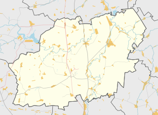
Русский: Карта, Кораблинский район Рязанской области. |
| Date | |
| Source | Own work using Maperitive tool on OpenStreetMap data, then Inkscape |
| Author | Nzeemin |
Licensing
[edit]
| Description |
This map was created from OpenStreetMap project data, collected by the community. This map may be incomplete, and may contain errors. Don't rely solely on it for navigation. |
|||
| Date | (see file history) | |||
| Source | openstreetmap.org | |||
| Creator |
OpenStreetMap contributors |
|||
| Permission (Reusing this file) |
OpenStreetMap data is available under the Open Database License (details). Map tiles are licensed under the Creative Commons Attribution-ShareAlike 2.0 license (CC-BY-SA 2.0).
This file is licensed under the Creative Commons Attribution-Share Alike 2.0 Generic license.
|
|||
| Georeferencing | If inappropriate please set warp_status = skip to hide. |
Details
[edit]
Maperitive commands:
set-geo-bounds 39.625,53.79167,40.5,54.16667
set-print-bounds-geo
zoom 10
export-svg compatibility=inkscape
File history
Click on a date/time to view the file as it appeared at that time.
| Date/Time | Thumbnail | Dimensions | User | Comment | |
|---|---|---|---|---|---|
| current | 21:06, 29 October 2014 | | 637 × 464 (297 KB) | Nzeemin (talk | contribs) | User created page with UploadWizard |
You cannot overwrite this file.
File usage on Commons
The following page uses this file:
File usage on other wikis
The following other wikis use this file:
- Usage on ce.wikipedia.org
- Usage on hy.wikipedia.org
- Usage on myv.wikipedia.org
- Usage on os.wikipedia.org
- Usage on ru.wikipedia.org
- Кораблино
- Кораблинский район
- Верхняя Ищередь
- Нижняя Ищередь
- Быковская Степь
- Семион (село)
- Аманово (Рязанская область)
- Ковалинка
- Бобровинки
- Пехлец
- Молвина Слобода
- Яблонево (Кораблинский район)
- Бестужево (Рязанская область)
- Юраково (Рязанская область)
- Серебряный (Рязанская область)
- Красные Выселки (Кораблинский район)
- Проницы (Рязанская область)
- Ерлино
- Марьинка (Рязанская область)
- Ибердский
- Великая Лука (Рязанская область)
- Волкова (Рязанская область)
- Моловка
- Залесно-Чулково
- Ключ (Рязанская область)
- Шаблон:ПозКарта Россия Рязанская область Кораблинский район
- Посёлок Газопровода
- Михино (Рязанская область)
- Владимировка (Кораблинский район)
- Копцево (Рязанская область)
- Никитино (Кораблинский район)
- Кипчаково (Рязанская область)
- Григорьевское (Рязанская область)
- Жаркое (деревня)
- Грачёвка (Кораблинский район)
- Новосёлово (Рязанская область)
- Серьзево
- Дроково (Рязанская область)
- Ерлино Выселки
- Щелево (Рязанская область)
- Чижово (Рязанская область)
- Крутое (Кораблинский район)
- Кумино (Рязанская область)
- Гальцово (Рязанская область)
- Ново-Александровские Выселки
- Прибытки (Кораблинский район)
View more global usage of this file.