File:REER-Final-Proclamation-Map-Overview-Map.jpg
Jump to navigation
Jump to search

Size of this preview: 460 × 600 pixels. Other resolutions: 184 × 240 pixels | 368 × 480 pixels | 589 × 768 pixels | 1,200 × 1,564 pixels.
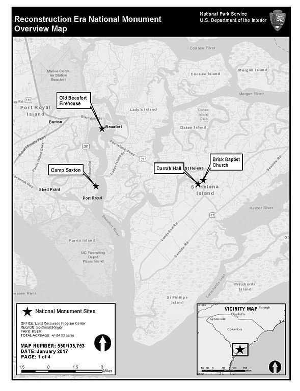
Original file (1,200 × 1,564 pixels, file size: 295 KB, MIME type: image/jpeg)
Captions
Captions
Add a one-line explanation of what this file represents
Summary
[edit]
| Description |
English: Map of Reconstruction Era National Monument, vicinity of Beaufort, South Carolina |
| Date | |
| Source | https://www.nps.gov/reer/planyourvisit/maps.htm |
| Author | United States National Park Service |
Licensing
[edit]
| This image or media file contains material based on a work of a National Park Service employee, created as part of that person's official duties. As a work of the U.S. federal government, such work is in the public domain in the United States. See the NPS website and NPS copyright policy for more information. |
File history
Click on a date/time to view the file as it appeared at that time.
| Date/Time | Thumbnail | Dimensions | User | Comment | |
|---|---|---|---|---|---|
| current | 16:45, 12 January 2018 | | 1,200 × 1,564 (295 KB) | Ser Amantio di Nicolao (talk | contribs) | User created page with UploadWizard |
You cannot overwrite this file.
File usage on Commons
The following page uses this file:
File usage on other wikis
The following other wikis use this file:
- Usage on de.wikipedia.org
- Usage on www.wikidata.org