File:R-27 regional road MNE 2020.svg
Jump to navigation
Jump to search

Size of this PNG preview of this SVG file: 496 × 600 pixels. Other resolutions: 198 × 240 pixels | 397 × 480 pixels | 635 × 768 pixels | 847 × 1,024 pixels | 1,694 × 2,048 pixels | 1,063 × 1,285 pixels.
Original file (SVG file, nominally 1,063 × 1,285 pixels, file size: 414 KB)
Captions
Captions
Add a one-line explanation of what this file represents
Summary
[edit]
| Description |
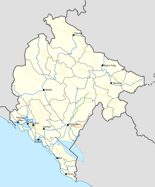
English: Regional road R-27 |
| Date | |
| Source |
English: Own work, based on:
|
| Author | Requiem mn |
Licensing
[edit]
I, the copyright holder of this work, hereby publish it under the following license:
This file is licensed under the Creative Commons Attribution-Share Alike 4.0 International license.
- You are free:
- to share – to copy, distribute and transmit the work
- to remix – to adapt the work
- Under the following conditions:
- attribution – You must give appropriate credit, provide a link to the license, and indicate if changes were made. You may do so in any reasonable manner, but not in any way that suggests the licensor endorses you or your use.
- share alike – If you remix, transform, or build upon the material, you must distribute your contributions under the same or compatible license as the original.
- ↑ Odluka o kategorizaciji državnih puteva (in Montenegrin). www.sluzbenilist.me. Official Gazette of Montenegro (25 November 2019). Retrieved on 5 March 2020.
File history
Click on a date/time to view the file as it appeared at that time.
| Date/Time | Thumbnail | Dimensions | User | Comment | |
|---|---|---|---|---|---|
| current | 19:49, 31 March 2023 | | 1,063 × 1,285 (414 KB) | Requiem mn (talk | contribs) | Updated to latest location map and changed motorway color to match the shield |
| 10:12, 22 March 2020 |  | 1,063 × 1,285 (390 KB) | Requiem mn (talk | contribs) | Uploaded own work with UploadWizard |
You cannot overwrite this file.
File usage on Commons
The following 6 pages use this file:
- User:Chumwa/OgreBot/Transport Maps/2020 March 21-31
- User:Chumwa/OgreBot/Transport Maps/2023 March 21-31
- User:Chumwa/OgreBot/Travel and communication maps/2020 March 21-31
- User:Chumwa/OgreBot/Travel and communication maps/2023 March 21-31
- User:J budissin/Uploads/BiH/2020 March 21-31
- Commons:Files used on the AARoads Wiki/91
File usage on other wikis
The following other wikis use this file:
- Usage on en.wikipedia.org