File:Różan (gmina) location map.png
Jump to navigation
Jump to search

Size of this preview: 549 × 600 pixels. Other resolutions: 220 × 240 pixels | 439 × 480 pixels | 703 × 768 pixels.
Original file (703 × 768 pixels, file size: 126 KB, MIME type: image/png)
Captions
Captions
Add a one-line explanation of what this file represents
| Description |
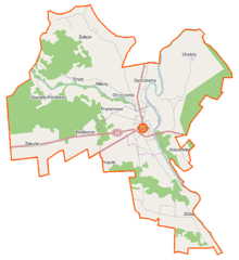
Polski: Mapa gminy Różan, Polska
English: Map of Gmina Różan, Poland |
|||||||||
| Date | ||||||||||
| Source | You may find a page on the OpenStreetMap wiki page for Różan (gmina) | |||||||||
| Creator |
OpenStreetMap contributors OpenStreetMap contributors |
|||||||||
| Permission (Reusing this file) |
OpenStreetMap data is available under the Open Database License (details). Map tiles are licensed under the Creative Commons Attribution-ShareAlike 2.0 license (CC-BY-SA 2.0).
This file is licensed under the Creative Commons Attribution-Share Alike 2.0 Generic license.
|
|||||||||
| Geotemporal data | ||||||||||
| Bounding box |
|
|||||||||
| Georeferencing | If inappropriate please set warp_status = skip to hide. | |||||||||
File history
Click on a date/time to view the file as it appeared at that time.
| Date/Time | Thumbnail | Dimensions | User | Comment | |
|---|---|---|---|---|---|
| current | 10:48, 12 September 2014 | | 703 × 768 (126 KB) | VanWiel (talk | contribs) | {{Information |Description= |Source= |Date= |Author= |Permission= |other_versions= }} |
| 11:42, 4 August 2014 |  | 703 × 768 (130 KB) | VanWiel (talk | contribs) | {{OpenStreetMap | name = Różan (gmina) | location = Różan (gmina) | description = {{pl|Mapa gminy Różan, Polska}} {{en|Map of Gmina Różan, Poland}} | top = 52.9513 | left = 21.2809 | right... |
You cannot overwrite this file.
File usage on Commons
There are no pages that use this file.
File usage on other wikis
The following other wikis use this file:
- Usage on fr.wikipedia.org
- Usage on nl.wikipedia.org
- Usage on pl.wikipedia.org
- Różan
- Różan (gmina)
- Chrzczonki
- Dyszobaba
- Dzbądz
- Kaszewiec (powiat makowski)
- Miłony
- Mroczki-Rębiszewo
- Prycanowo
- Szygi
- Załęże-Eliasze
- Załęże-Gartki
- Załęże-Sędzięta
- Załęże Wielkie
- Załuzie (wieś)
- Zawady-Ponikiew
- Chełsty (województwo mazowieckie)
- Podborze (powiat makowski)
- Dąbrówka (gmina Różan)
- Twierdza Różan
- Różan (stacja kolejowa)
- Krajowe Składowisko Odpadów Promieniotwórczych
- Cmentarz żydowski w Różanie
- Parafia św. Anny w Różanie
- Załuzie (osada leśna)
- Kościół św. Anny w Różanie
- Moduł:Mapa/dane/Różan
- Moduł:Mapa/dane/Różan (gmina)
- Paulinowo (powiat makowski)
- Usage on pl.wikibooks.org
_location_map.png&oldid=486283583)