File:Réseau Péribus map.svg
Jump to navigation
Jump to search

Size of this PNG preview of this SVG file: 800 × 587 pixels. Other resolutions: 320 × 235 pixels | 640 × 470 pixels | 1,024 × 752 pixels | 1,280 × 940 pixels | 2,560 × 1,879 pixels | 2,624 × 1,926 pixels.
Original file (SVG file, nominally 2,624 × 1,926 pixels, file size: 889 KB)
Captions
Captions
Add a one-line explanation of what this file represents
Summary
[edit]
| Description | |
| Date | |
| Source | Own work |
| Author | Hawk-Eye (talk) |
| Permission (Reusing this file) |
Attribution required: This illustration was created by Hawk-Eye. If you use this illustration outside the Wikimedia projects, please contact me, and credit this way: © Hawk-Eye This file is licensed under the Creative Commons Attribution-Share Alike 3.0 Unported license. Attribution: © Hawk-Eye
|
| Attribution (required by the license) | © Hawk-Eye / Wikimedia Commons / |
File history
Click on a date/time to view the file as it appeared at that time.
| Date/Time | Thumbnail | Dimensions | User | Comment | |
|---|---|---|---|---|---|
| current | 22:18, 7 April 2013 | | 2,624 × 1,926 (889 KB) | Hawk-Eye (talk | contribs) | encore |
| 22:16, 7 April 2013 |  | 2,624 × 1,926 (888 KB) | Hawk-Eye (talk | contribs) | text-color | |
| 22:12, 7 April 2013 |  | 2,624 × 1,926 (888 KB) | Hawk-Eye (talk | contribs) | fix | |
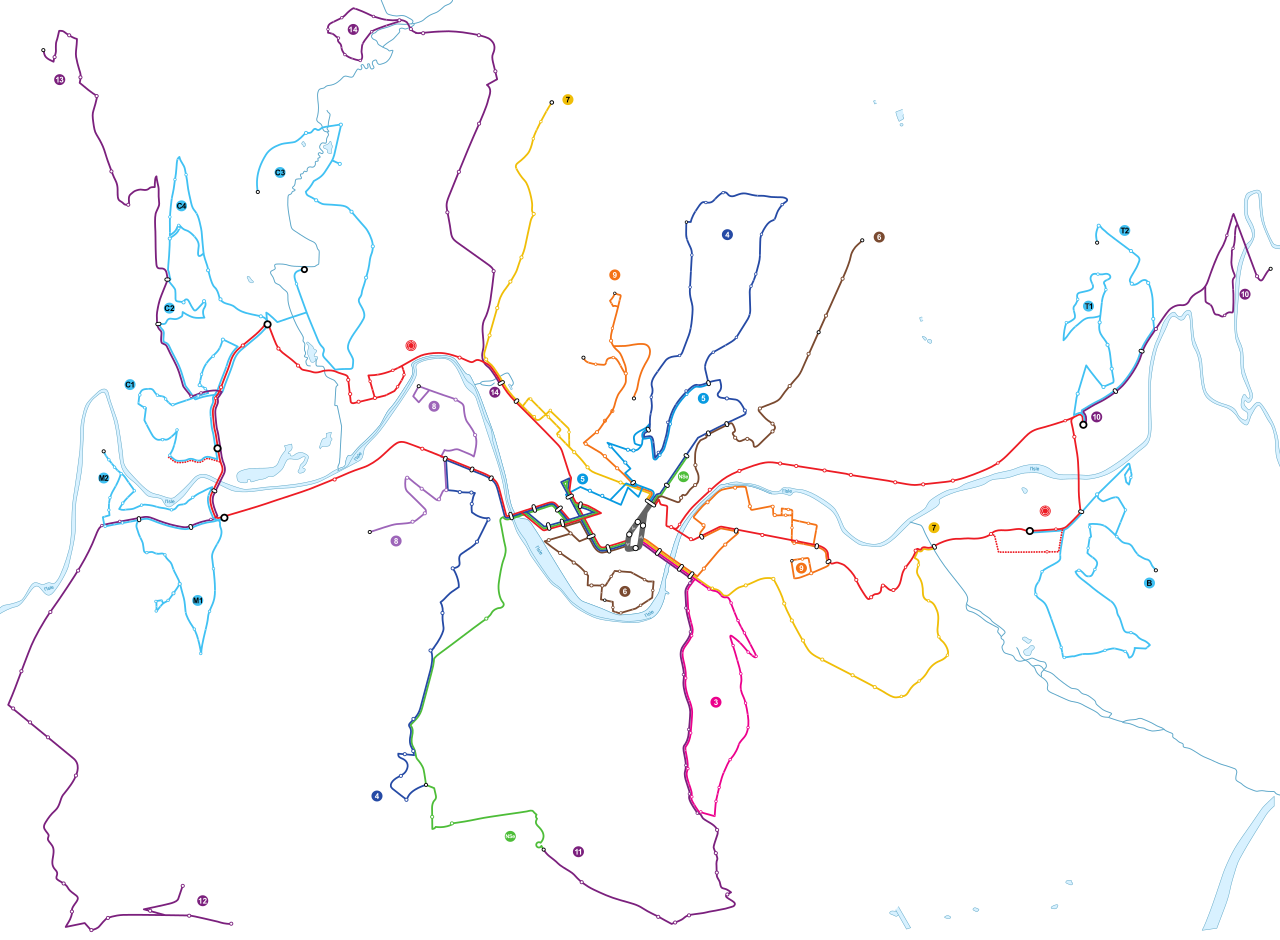
| 22:11, 7 April 2013 |  | 2,624 × 1,926 (834 KB) | Hawk-Eye (talk | contribs) | {{Information |Description ={{fr|1=Tracé géographique (à l'échelle) des lignes du réseau Péribus à Périgueux en 2013.}} |Source ={{own}} |Author =~~~ |Date =2013-04-08 |Permissi... |
You cannot overwrite this file.
File usage on Commons
The following 2 pages use this file:
File usage on other wikis
The following other wikis use this file:
- Usage on fr.wikipedia.org
- Usage on www.wikidata.org