File:Queen Mary Falls, Queen Mary Falls National Park, Queensland, Australia.JPG
Jump to navigation
Jump to search
Size of this preview: 600 × 600 pixels. Other resolutions: 240 × 240 pixels | 480 × 480 pixels | 768 × 768 pixels | 1,024 × 1,024 pixels | 2,048 × 2,048 pixels | 2,992 × 2,992 pixels.
Original file (2,992 × 2,992 pixels, file size: 3.48 MB, MIME type: image/jpeg)
Captions
Captions
Add a one-line explanation of what this file represents
Summary
[edit]
| Description |
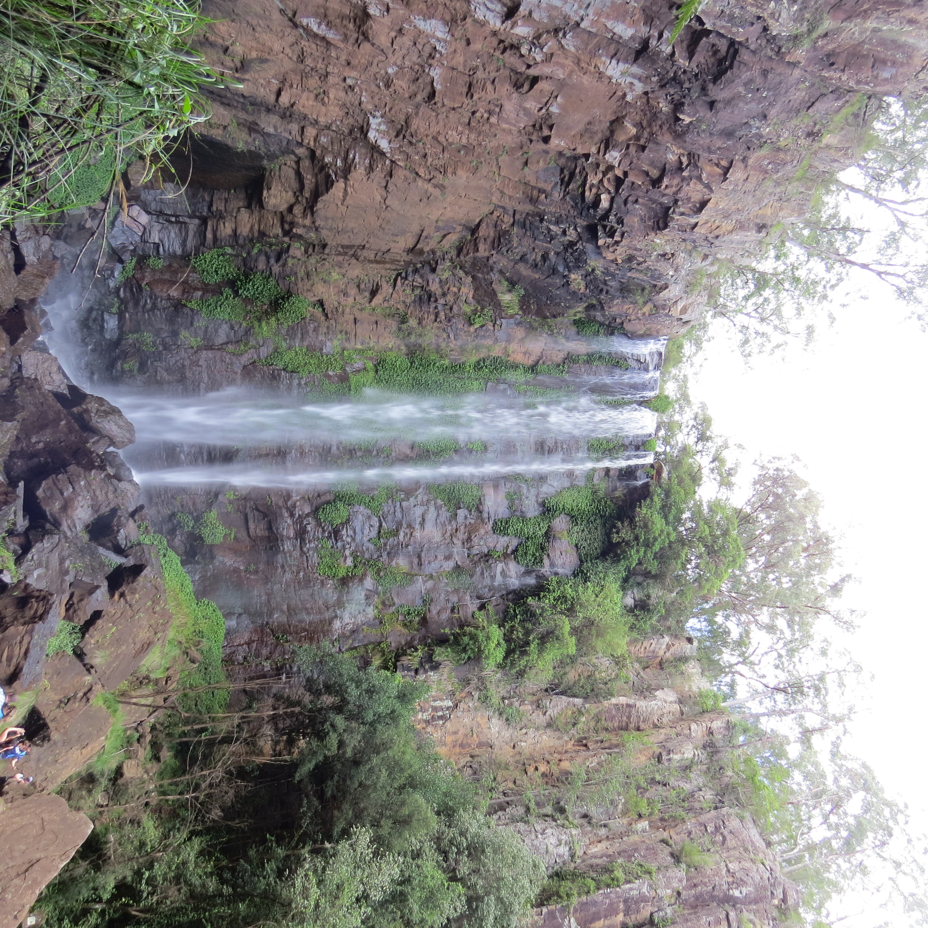
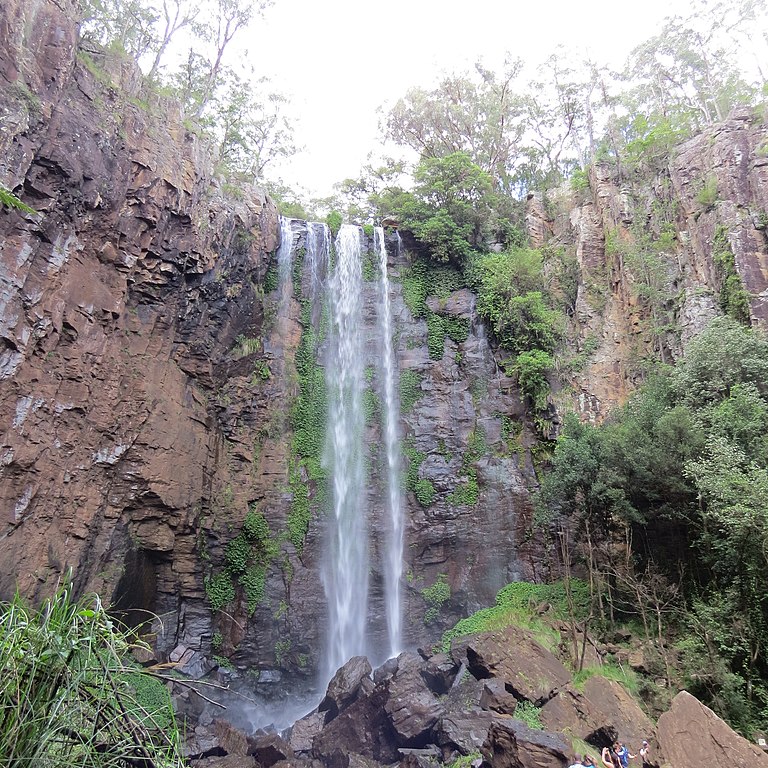
English: A view of the magnificent Queen Mary Falls, the start of the Condamine River: The Condamine River, part of the Balonne catchment that is part of the Murray-Darling Basin, drains the northern portion of the Darling Downs, an area of sub-coastal southern Queensland, Australia. The river rises on Mount Superbus, South East Queensland's highest peak, on the western slopes of the Great Dividing Range, approximately 100 kilometres (62 mi) from the east coast of Queensland, and then flows north west across the Darling Downs, then west.[2] (Credit: https://en.wikipedia.org/wiki/Condamine_River) |
| Date | |
| Source | Own work |
| Author | Izelle Barnard |
Licensing
[edit]
I, the copyright holder of this work, hereby publish it under the following license:
This file is licensed under the Creative Commons Attribution-Share Alike 4.0 International license.
- You are free:
- to share – to copy, distribute and transmit the work
- to remix – to adapt the work
- Under the following conditions:
- attribution – You must give appropriate credit, provide a link to the license, and indicate if changes were made. You may do so in any reasonable manner, but not in any way that suggests the licensor endorses you or your use.
- share alike – If you remix, transform, or build upon the material, you must distribute your contributions under the same or compatible license as the original.
This image was uploaded as part of Wiki Loves Earth 2016.
|
 |
File history
Click on a date/time to view the file as it appeared at that time.
| Date/Time | Thumbnail | Dimensions | User | Comment | |
|---|---|---|---|---|---|
| current | 02:51, 15 May 2016 | | 2,992 × 2,992 (3.48 MB) | IzelleB (talk | contribs) | User created page with UploadWizard |
You cannot overwrite this file.
File usage on Commons
There are no pages that use this file.