File:Quartier du Châtelet, 1750.jpg
Jump to navigation
Jump to search
Size of this preview: 463 × 600 pixels. Other resolutions: 185 × 240 pixels | 371 × 480 pixels | 593 × 768 pixels | 791 × 1,024 pixels | 1,631 × 2,112 pixels.
Original file (1,631 × 2,112 pixels, file size: 1.91 MB, MIME type: image/jpeg)
Captions
Captions
Add a one-line explanation of what this file represents
Summary
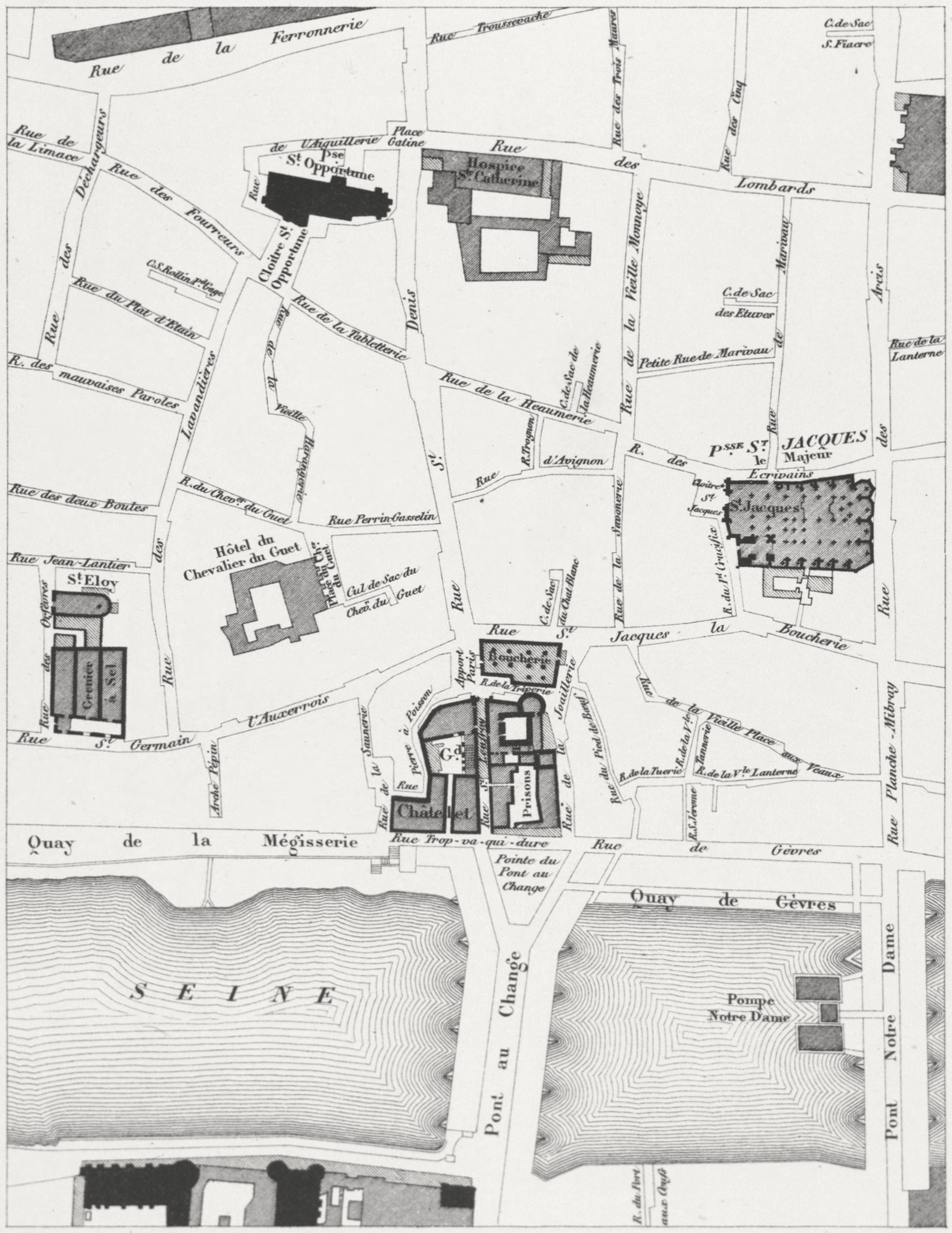
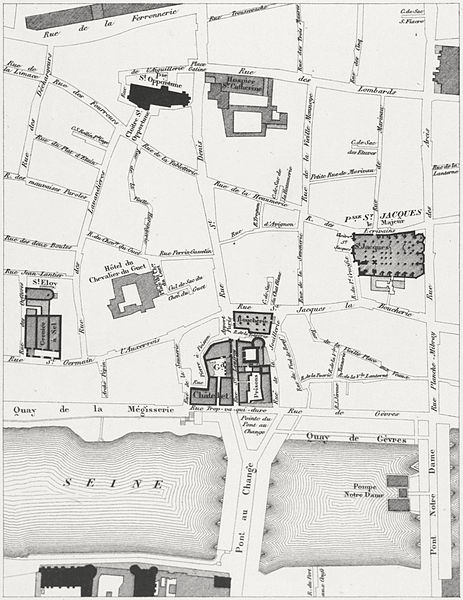
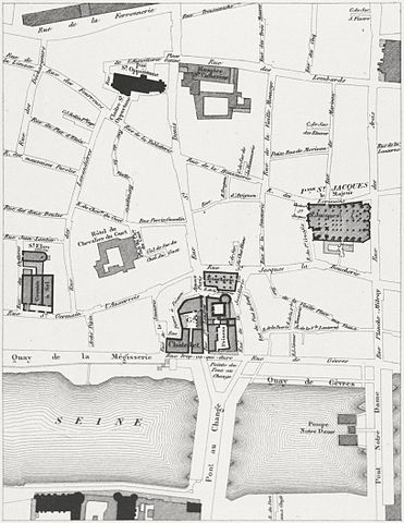
[edit]| Theodor Josef Hubert Hoffbauer: Quartier du Châtelet, 1750
( |
||||||||||||||||||||||||
|---|---|---|---|---|---|---|---|---|---|---|---|---|---|---|---|---|---|---|---|---|---|---|---|---|
| Artist |
|
|||||||||||||||||||||||
| Title |
Quartier du Châtelet, 1750 |
|||||||||||||||||||||||
| Description |
Aerial plans of the Quartier du Châtelet. There are two views: the one on the left shows the area in 1750; the one on the right shows the area in 1836. The overlay also shows the same area in 1876. |
|||||||||||||||||||||||
| Date | between 1875 and 1882 | |||||||||||||||||||||||
| Medium | lithograph | |||||||||||||||||||||||
| Collection |
|
|||||||||||||||||||||||
| Notes | Published in: Theodor Josef Hubert Hoffbauer. Paris à travers les âges. Paris: Firmin-Didot et cie, 1885. | |||||||||||||||||||||||
| Source/Photographer |
|
|||||||||||||||||||||||

Licensing
[edit]
|
This work is in the public domain in its country of origin and other countries and areas where the copyright term is the author's life plus 70 years or fewer. | |
| This file has been identified as being free of known restrictions under copyright law, including all related and neighboring rights. | |
File history
Click on a date/time to view the file as it appeared at that time.
| Date/Time | Thumbnail | Dimensions | User | Comment | |
|---|---|---|---|---|---|
| current | 17:18, 18 February 2013 | | 1,631 × 2,112 (1.91 MB) | Paris 16 (talk | contribs) |
You cannot overwrite this file.
File usage on Commons
The following 4 pages use this file:
File usage on other wikis
The following other wikis use this file:
- Usage on en.wikipedia.org
- Usage on fr.wikipedia.org
- Grand Châtelet
- Place du Châtelet
- Rue Pierre-à-Poisson
- Rue Trop-Va-Qui-Dure
- Rue de la Saunerie
- Grenier à sel de Paris
- Place du Chevalier-du-Guet
- Rue du Chevalier-du-Guet
- Rue Perrin-Gasselin
- Rue de la Vieille-Lanterne
- Rue du Pied-de-Bœuf
- Rue de l'Arche-Pépin
- Rue Saint-Leufroy
- Rue de la Triperie (ancienne, Paris)
- Place de l'Apport-Paris
- Usage on sv.wikipedia.org
- Usage on www.wikidata.org
Metadata
Categories:
- Lithographs of Paris
- Floor plans of Paris
- Paris à travers les âges
- Street maps of Paris 1er arrondissement
- Old maps of Paris 1er arrondissement
- Old maps of Paris 4e arrondissement
- Street maps of Paris 4e arrondissement
- Historical images of Place du Châtelet
- Historical images of Pont au Change
- Historical images of the Pont Notre-Dame
- Maps of Paris in the 1750s
- Hôtel du Chevalier-du-Guet
- Pompe Notre-Dame
- Grand Châtelet
- Rue Perrin-Gasselin (Paris)