File:Qeila west of Hebron.jpg
Original file (981 × 605 pixels, file size: 1,022 KB, MIME type: image/jpeg)
Captions
Captions
Summary
[edit]| Description |
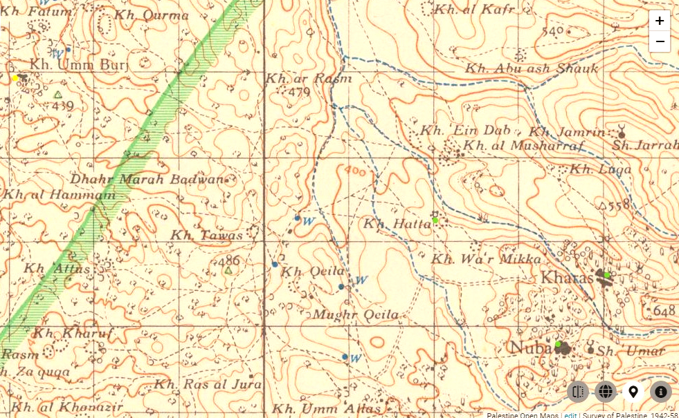
English: Biblical settlement of Keilah (Khirbet Qila), west of Hebron |
||||||
| Date | |||||||
| Source |
|
||||||
| Author |
The British Survey of Western Palestine - 1940s-1950s Copyright for the Survey of Palestine and PEF Survey maps:
|


Licensing
[edit]
- You are free:
- to share – to copy, distribute and transmit the work
- to remix – to adapt the work
- Under the following conditions:
- attribution – You must give appropriate credit, provide a link to the license, and indicate if changes were made. You may do so in any reasonable manner, but not in any way that suggests the licensor endorses you or your use.
- share alike – If you remix, transform, or build upon the material, you must distribute your contributions under the same or compatible license as the original.
File history
Click on a date/time to view the file as it appeared at that time.
| Date/Time | Thumbnail | Dimensions | User | Comment | |
|---|---|---|---|---|---|
| current | 12:09, 4 October 2020 | | 981 × 605 (1,022 KB) | Davidbena (talk | contribs) | Uploaded a work by The British Survey of Western Palestine - 1940s-1950s Copyright for the Survey of Palestine and PEF Survey maps: {{PD-UKGov}} {{PD-IsraelGov}} HMSO has declared that the expiry of Crown Copyrights applies worldwide. Applies to a photograph taken prior to 1 June 1957 - This work was created or ordered by the State of Israel, and is in the public domain because it satisfies one of the conditions stipulated in Israel's copyright statute from 2007 (translation) regarding the St... |
You cannot overwrite this file.
File usage on Commons
There are no pages that use this file.
File usage on other wikis
The following other wikis use this file: