File:Qatar CIA map PL.png
Jump to navigation
Jump to search

Size of this preview: 274 × 600 pixels. Other resolutions: 109 × 240 pixels | 324 × 709 pixels.
Original file (324 × 709 pixels, file size: 15 KB, MIME type: image/png)
Captions
Captions
Add a one-line explanation of what this file represents
| Description |
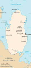
Polski: Mapa Kataru, CIA World Factbook, wersja polska |
|||
| Source | CIA World Factbook - after modifications transferred from Polish Wikipedia. | |||
| Author | Central Intelligence Agency | |||
| Permission (Reusing this file) |
|

Original upload log
[edit]
The original description page was here. All following user names refer to pl.wikipedia.
- 2004-08-23 22:28 Zero 326×713× (15089 bytes) Mapa [[Katar]]u, CIA World Factbook, wersja polska
File history
Click on a date/time to view the file as it appeared at that time.
| Date/Time | Thumbnail | Dimensions | User | Comment | |
|---|---|---|---|---|---|
| current | 20:08, 31 May 2022 | | 324 × 709 (15 KB) | Lojwe (talk | contribs) | Cropped 1 % horizontally, 1 % vertically using CropTool with precise mode. |
| 08:30, 22 December 2009 |  | 326 × 713 (15 KB) | File Upload Bot (Magnus Manske) (talk | contribs) | {{BotMoveToCommons|pl.wikipedia|year={{subst:CURRENTYEAR}}|month={{subst:CURRENTMONTHNAME}}|day={{subst:CURRENTDAY}}}} {{Information |Description={{pl|Mapa pl:Kataru, CIA World Factbook, wersja polska <big><font color="red">NIE PRZENOSIĆ!!!</font |
You cannot overwrite this file.
File usage on Commons
The following page uses this file:
File usage on other wikis
The following other wikis use this file:
- Usage on pl.wikipedia.org
- Usage on pl.wikivoyage.org