File:QFRohraustritt-BMVBSt.JPG
Jump to navigation
Jump to search

Size of this preview: 800 × 598 pixels. Other resolutions: 320 × 239 pixels | 640 × 478 pixels | 1,024 × 765 pixels | 1,296 × 968 pixels.
Original file (1,296 × 968 pixels, file size: 429 KB, MIME type: image/jpeg)
Captions
Captions
Add a one-line explanation of what this file represents
Summary
[edit]
| Description |
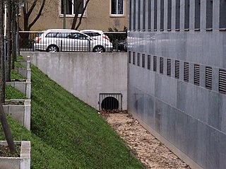
Deutsch: Die Panke wird auf ihrem Wege von der Quelle in Bernau/b. Berlin zur Mündung an vielen Stellen von Brücken oder Überfahrten überspannt. Rohraustrittsbrücke. Die Habersathstraße und die Zufahrtsstraße zum Heizkraftwerk der Charité durchläuft die geplante (Süd-)Panke unterirdisch im Rohr mit einer Länge von derzeit (Stand 2010) 400 Metern. Bei der geplanten Gestaltung der Pankeaue zwischen Chauseestraße (hinter dem Gebäudekomplex des Bundesnachrichtendienstes und dem Stadtquarier der Siedlungshäuser an der Scharnhorststraße würde sich diese Verrührung auf 105 Meter verkürzen. |
| Date | |
| Source | Own work |
| Author | Boonekamp |
| Camera location | | View this and other nearby images on: OpenStreetMap |
|---|
Licensing
[edit]
| I, the copyright holder of this work, release this work into the public domain. This applies worldwide. In some countries this may not be legally possible; if so: I grant anyone the right to use this work for any purpose, without any conditions, unless such conditions are required by law. |
File history
Click on a date/time to view the file as it appeared at that time.
| Date/Time | Thumbnail | Dimensions | User | Comment | |
|---|---|---|---|---|---|
| current | 20:33, 4 April 2010 | | 1,296 × 968 (429 KB) | Boonekamp (talk | contribs) | {{Information |Description={{de|1=Die Panke wird auf ihrem Wege von der Quelle in Bernau/b. Berlin zur Mündung an vielen Stellen von Brücken oder Überfahrten überspannt. Rohraustrittsbrücke. Die Habersathstraße und die Zufahrtsstraße zum Heizkraftw |
You cannot overwrite this file.
File usage on Commons
There are no pages that use this file.
File usage on other wikis
The following other wikis use this file:
- Usage on de.wikipedia.org