File:Pyzdry (gmina) location map.png
Jump to navigation
Jump to search
Size of this preview: 446 × 599 pixels. Other resolutions: 178 × 240 pixels | 593 × 797 pixels.
Original file (593 × 797 pixels, file size: 90 KB, MIME type: image/png)
Captions
Captions
Add a one-line explanation of what this file represents
| Description |
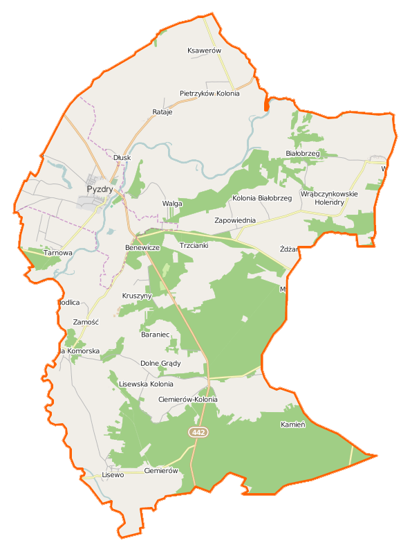
Polski: Mapa gminy Pyzdry, Polska
English: Map of Gmina Pyzdry, Poland |
|||||||||
| Date | ||||||||||
| Source | You may find a page on the OpenStreetMap wiki page for Pyzdry (gmina) | |||||||||
| Creator |
OpenStreetMap contributors OpenStreetMap contributors |
|||||||||
| Permission (Reusing this file) |
OpenStreetMap data is available under the Open Database License (details). Map tiles are licensed under the Creative Commons Attribution-ShareAlike 2.0 license (CC-BY-SA 2.0).
This file is licensed under the Creative Commons Attribution-Share Alike 2.0 Generic license.
|
|||||||||
| Geotemporal data | ||||||||||
| Bounding box |
|
|||||||||
| Georeferencing | If inappropriate please set warp_status = skip to hide. | |||||||||
File history
Click on a date/time to view the file as it appeared at that time.
| Date/Time | Thumbnail | Dimensions | User | Comment | |
|---|---|---|---|---|---|
| current | 11:59, 5 January 2015 | | 593 × 797 (90 KB) | VanWiel (talk | contribs) | {{OpenStreetMap | name = Pyzdry (gmina) | location = Pyzdry (gmina) | description = {{pl|Mapa gminy Pyzdry, Polska}} {{en|Map of Gmina Pyzdry, Poland}} | top = 52.2267 | bottom = 52.0588 | left... |
You cannot overwrite this file.
File usage on Commons
There are no pages that use this file.
File usage on other wikis
The following other wikis use this file:
- Usage on fr.wikipedia.org
- Usage on pl.wikipedia.org
- Pyzdry
- Pyzdry (gmina)
- Białobrzeg
- Ciemierów
- Ciemierów-Kolonia
- Dłusk
- Dolne Grądy
- Górne Grądy
- Pietrzyków-Kolonia
- Ruda Komorska
- Walga
- Wrąbczynek
- Wrąbczynkowskie Holendry
- Zapowiednia
- Lisewo (powiat wrzesiński)
- Trzcianki (województwo wielkopolskie)
- Ksawerów (powiat wrzesiński)
- Pietrzyków (powiat wrzesiński)
- Rataje (powiat wrzesiński)
- Tarnowa (powiat wrzesiński)
- Synagoga w Pyzdrach
- Zamość (powiat wrzesiński)
- Kruszyny (województwo wielkopolskie)
- Łupice (województwo wielkopolskie)
- Baraniec (województwo wielkopolskie)
- Zimochowiec
- Benewicze
- Lisiaki
- Tłoczyzna
- Białobrzeg Ratajski
- Glinianki (województwo wielkopolskie)
- Żdżary (Zapowiednia)
- Kamień (powiat wrzesiński)
- Kolonia Janowska
- Kolonia Lisewo
- Królewiny
- Modlica (województwo wielkopolskie)
- Olsz
- Cmentarz żydowski w Pyzdrach
- Parafia Narodzenia Najświętszej Maryi Panny w Pyzdrach
- Pyzdry (stacja kolejowa)
- Muzeum Ziemi Pyzdrskiej w Pyzdrach
- Kościół Ścięcia Głowy św. Jana Chrzciciela w Pyzdrach
- Zamek w Pyzdrach
- Kościół Narodzenia Najświętszej Maryi Panny w Pyzdrach
- Dom podcieniowy w Pyzdrach
- Dwór w Ratajach
- Chatka Ornitologa
- Wydma Ciemierowska
View more global usage of this file.
_location_map.png)
_location_map.png&oldid=519993619)