File:Pyrenees Mountains (MODIS 2016-01-05).jpg

Original file (2,676 × 2,480 pixels, file size: 1.12 MB, MIME type: image/jpeg)
Captions
Captions
Summary
[edit].jpg&action=edit§ion=1)
| Description |
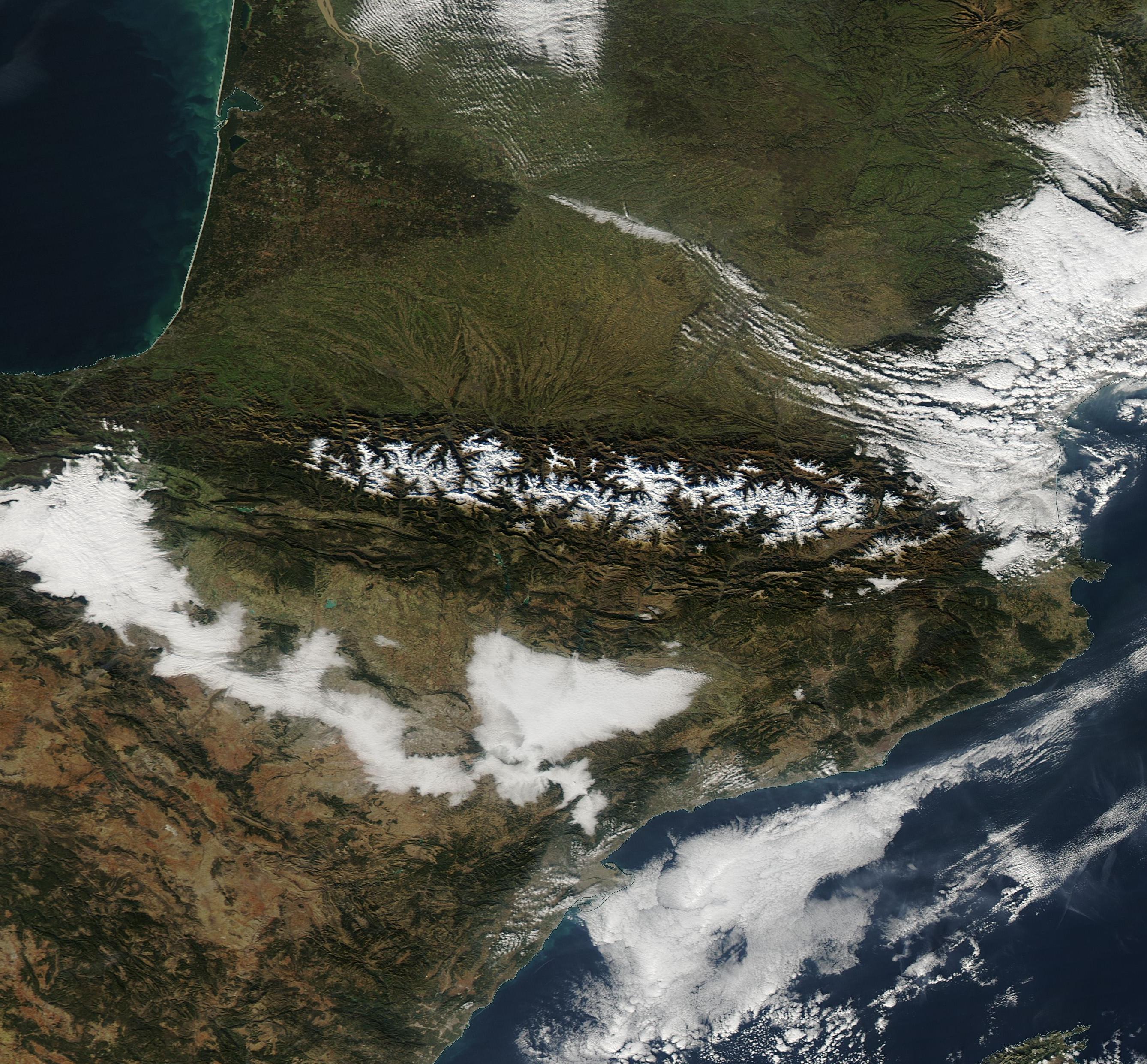
English: The snow-capped peaks of the Pyrenees Mountains ride ridge-tops which mark the border between France (north) and Spain (south), and also form a bridge between Central and Mediterranean Europe. The tiny country of Andorra sits between France and Spain in the high peaks of the Pyrenees.
Stretching between the warm Mediterranean Sea in the east and the Atlantic Ocean in the west, the rugged range covers about 500 square kilometers (193 square miles). The landscape is dramatic, with high summits rising over 3,000 meters (1,640 feet), rocky slopes, high plains and breathtaking canyons. The climate varies from west to east. The Atlantic Ocean's mild, humid air influences the western Pyrenees and the warmer Mediterranean bring heat and summer drought to the east. In between, the central section tends to be both cooler and drier. Although the region faces substantial pressure from human use, including grazing, farming, logging tourist and ski area development, substantial pockets of the area remain in a natural state and several parks have been created to protect at least portions of this biologically rich region. About 3,500 species of vascular plant species are found in the mountains, with 200 estimated to be endemic. Sixty-four species of mammal live here, along with about 120 breeding bird species as well as roughly the same number of migrant bird species. Several of the mammals and birds are endangered and habitat fragmentation is a significant concern for their survival. The Moderate Resolution Imaging Spectroradiometer (MODIS) aboard the Aqua satellite captured this true-color image of the Pyrenees Mountains on December 21, 2015. |
||
| Date | Taken on 21 December 2015 | ||
| Source |
Pyrenees Mountains (direct link)
|
||
| Author | Jeff Schmaltz, MODIS Land Rapid Response Team, NASA GSFC |
| This media is a product of the Aqua mission Credit and attribution belongs to the mission team, if not already specified in the "author" row |
Licensing
[edit].jpg&action=edit§ion=2)
| This file is in the public domain in the United States because it was solely created by NASA. NASA copyright policy states that "NASA material is not protected by copyright unless noted". (See Template:PD-USGov, NASA copyright policy page or JPL Image Use Policy.) | ||
 |
Warnings:
|
File history
Click on a date/time to view the file as it appeared at that time.
| Date/Time | Thumbnail | Dimensions | User | Comment | |
|---|---|---|---|---|---|
| current | 19:49, 15 February 2024 | | 2,676 × 2,480 (1.12 MB) | OptimusPrimeBot (talk | contribs) | #Spacemedia - Upload of http://modis.gsfc.nasa.gov/gallery/images/image01052016_250m.jpg via Commons:Spacemedia |
You cannot overwrite this file.
File usage on Commons
There are no pages that use this file.
.jpg&oldid=852076219)